Imola elevation
Imola (Emilia-Romagna, Bologna), Italy elevation is 47 meters and Imola elevation in feet is 154 ft above sea level [src 1]. Imola is a seat of a third-order administrative division (feature code) with elevation that is 275 meters (902 ft) smaller than average city elevation in Italy.
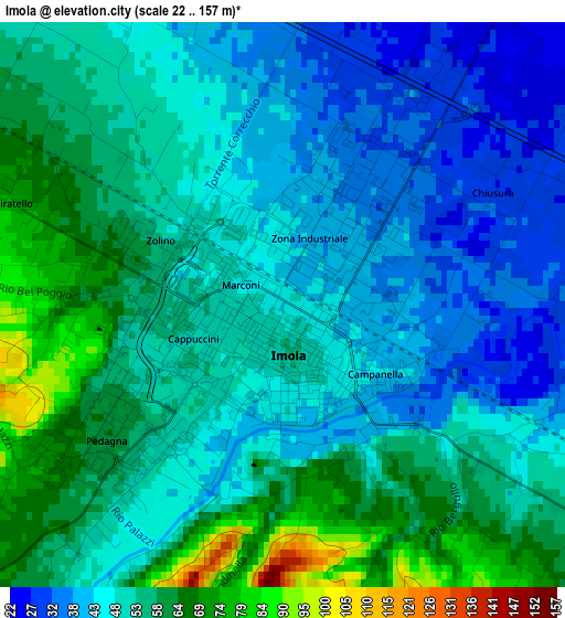
Below is the Elevation map of Imola, which displays elevation range with different colors. Scale of the first map is from 22 to 157 m (72 to 515 ft) with average elevation of 51.1 meters (=168 ft) [note 1]
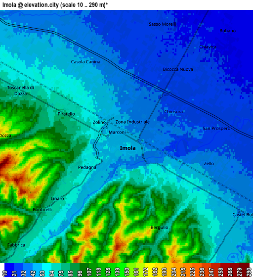
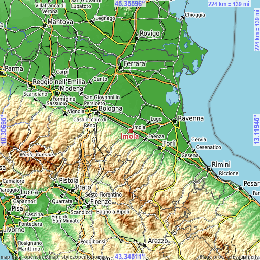
These maps also provides idea of topography and contour of this city, they are displayed at different zoom levels. More info about maps, scale and edge coordinates you can find below images.
| \ | Map #1 | Map #2 | Topo.Map |
| Scale [m] | 22..157 m | 10..290 m | × |
| Scale [ft] | 72..515 ft | 33..951 ft | × |
| Average | 51.1 m = 168 ft | 65.7 m = 216 ft | × |
| Width | 6.99 km = 4.3 mi | 13.97 km = 8.7 mi | 223.6 km = 138.9 mi |
| Height | 6.99 km = 4.3 mi | 13.97 km = 8.7 mi | 223.6 km = 138.9 mi |
| ↑Max Latitude | 44.390571° | 44.421966° | 45.35596° |
| Latitude at center | 44.35916° | 44.35916° | 44.35916° |
| ↓Min Latitude | 44.327732° | 44.296287° | 43.34511° |
| ← Min Longitude | 11.669255° | 11.625309° | 10.30695° |
| Longitude center | 11.7132° | 11.7132° | 11.7132° |
| →Max Longitude | 11.757145° | 11.801091° | 13.11945° |
Nearby cities:
Cities around Imola sort by population:
• Castel San Pietro Terme elevation 80 m
11.1 km,  293°
293°
• Castel Bolognese 46 m
8.1 km,  122°
122°
• Riolo Terme 93 m
9.3 km,  173°
173°
• Toscanella 68 m
6.4 km, 293°
• Solarolo 26 m
10.6 km,  90°
90°
• Castel Guelfo di Bologna 36 m
8.6 km,  339°
339°
• Mordano 20 m
8.6 km,  60°
60°
• Casalfiumanese 88 m
9.9 km,  225°
225°
• Bagnara di Romagna 22 m
9.7 km,  69°
69°
• Sesto Imolese 19 m
11.2 km,  6°
6°
• Bubano 18 m
8.2 km,  42°
42°
• Dozza 159 m
6.2 km,  272°
272°
Multilingual:
 En español:
Imola elevación 47 m.
 En France:
Imola élévation 47 m.


Sources and notes:
- [note 1] Map square and city borders are not equal. Map elevation data is calculated only from area inside that square.
- [src 1] Elevation data from geonames database provided with same terms of usage.
- [src 2] The elevation map of Imola is generated using elevation data from NASA's 3 arcsec (90m) resolution SRTM data.
- [src 3] Base (background) map © OpenStreetMap contributors tiles are generated by Geofabrik and OpenTopoMap.
Copyright & License:
This Imola Elevation Map is licensed under CC BY-SA. You may reuse any part from this page, if you give a proper credit by linking to this URL:
 More info on terms of use page.