Calamandrana elevation
Calamandrana (Piedmont, Provincia di Asti), Italy elevation is 153 meters and Calamandrana elevation in feet is 502 ft above sea level [src 1]. Calamandrana is a seat of a third-order administrative division (feature code) with elevation that is 169 meters (554 ft) smaller than average city elevation in Italy.
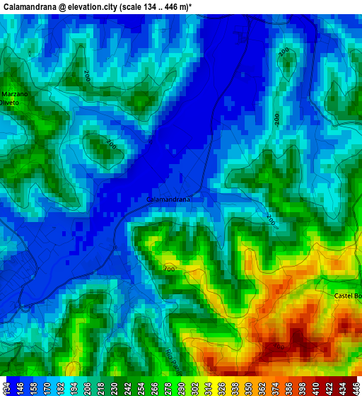
Below is the Elevation map of Calamandrana, which displays elevation range with different colors. Scale of the first map is from 134 to 446 m (440 to 1463 ft) with average elevation of 212.6 meters (=698 ft) [note 1]
These maps also provides idea of topography and contour of this city, they are displayed at different zoom levels. More info about maps, scale and edge coordinates you can find below images.
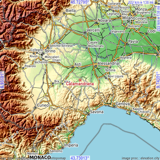
| \ | Map #1 | Topo.Map |
| Scale [m] | 134..446 m | × |
| Scale [ft] | 440..1463 ft | × |
| Average | 212.6 m = 698 ft | × |
| Width | 6.94 km = 4.3 mi | 222.1 km = 138 mi |
| Height | 6.94 km = 4.3 mi | 222.1 km = 138 mi |
| ↑Max Latitude | 44.768878° | 45.72795° |
| Latitude at center | 44.73767° | 44.73767° |
| ↓Min Latitude | 44.706446° | 43.73013° |
| ← Min Longitude | 8.293315° | 6.93101° |
| Longitude center | 8.33726° | 8.33726° |
| →Max Longitude | 8.381205° | 9.74351° |
Nearby cities:
Cities around Calamandrana sort by population:
• Canelli elevation 152 m
4 km,  241°
241°
• Nizza Monferrato 144 m
4.4 km,  21°
21°
• Fontanile 276 m
6.9 km,  75°
75°
• Castelnuovo Calcea 226 m
6.9 km,  322°
322°
• Cassinasco 400 m
6 km,  206°
206°
• Castel Rocchero 414 m
6.5 km,  109°
109°
• San Marzano Oliveto 289 m
3.8 km,  299°
299°
• Castel Boglione 267 m
3.8 km,  117°
117°
• Vaglio Serra 271 m
6.5 km,  1°
1°
• Rocchetta Palafea 398 m
3.4 km,  169°
169°
• Moasca 250 m
5.5 km, 301°
• Montabone 449 m
6 km,  135°
135°
Multilingual:
 En español:
Calamandrana elevación 153 m.
 En France:
Calamandrana élévation 153 m.
 Auf Deutsch:
Calamandrana höhe über dem Meeresspiegel ist 153 m.

Sources and notes:
- [note 1] Map square and city borders are not equal. Map elevation data is calculated only from area inside that square.
- [src 1] Elevation data from geonames database provided with same terms of usage.
- [src 2] The elevation map of Calamandrana is generated using elevation data from NASA's 3 arcsec (90m) resolution SRTM data.
- [src 3] Base (background) map © OpenStreetMap contributors tiles are generated by Geofabrik and OpenTopoMap.
Copyright & License:
This Calamandrana Elevation Map is licensed under CC BY-SA. You may reuse any part from this page, if you give a proper credit by linking to this URL:
 More info on terms of use page.