Canneto sull'Oglio elevation
Canneto sull'Oglio (Lombardy, Provincia di Mantova), Italy elevation is 31 meters and Canneto sull'Oglio elevation in feet is 102 ft above sea level [src 1]. Canneto sull'Oglio is a seat of a third-order administrative division (feature code) with elevation that is 291 meters (955 ft) smaller than average city elevation in Italy.
Below is the Elevation map of Canneto sull'Oglio, which displays elevation range with different colors. Scale of the first map is from 19 to 42 m (62 to 138 ft) with average elevation of 28.4 meters (=93 ft) [note 1]
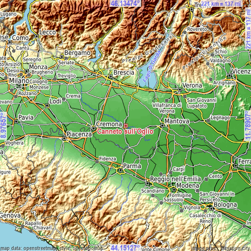
These maps also provides idea of topography and contour of this city, they are displayed at different zoom levels. More info about maps, scale and edge coordinates you can find below images.
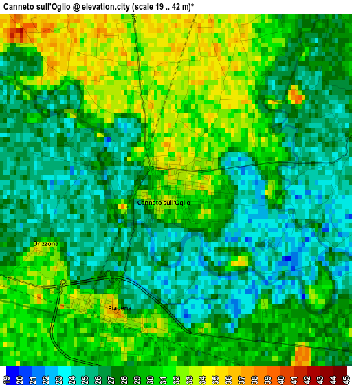
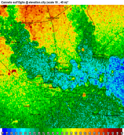
| \ | Map #1 | Map #2 | Topo.Map |
| Scale [m] | 19..42 m | 18..45 m | × |
| Scale [ft] | 62..138 ft | 59..148 ft | × |
| Average | 28.4 m = 93 ft | 29.5 m = 97 ft | × |
| Width | 6.89 km = 4.3 mi | 13.78 km = 8.6 mi | 220.5 km = 137 mi |
| Height | 6.89 km = 4.3 mi | 13.78 km = 8.6 mi | 220.5 km = 137 mi |
| ↑Max Latitude | 45.182613° | 45.21358° | 46.13474° |
| Latitude at center | 45.15163° | 45.15163° | 45.15163° |
| ↓Min Latitude | 45.12063° | 45.089613° | 44.15127° |
| ← Min Longitude | 10.338875° | 10.294929° | 8.97657° |
| Longitude center | 10.38282° | 10.38282° | 10.38282° |
| →Max Longitude | 10.426765° | 10.470711° | 11.78907° |
Nearby cities:
Cities around Canneto sull'Oglio sort by population:
• Asola elevation 37 m
8 km,  16°
16°
• Piadena 32 m
2.7 km,  199°
199°
• Acquanegra sul Chiese 29 m
4.2 km,  70°
70°
• San Giovanni in Croce 27 m
8.7 km,  185°
185°
• Calvatone 28 m
5.3 km,  121°
121°
• Isola Dovarese 33 m
6.3 km,  292°
292°
• Casalromano 37 m
5.3 km,  346°
346°
• Torre de' Picenardi 39 m
7.5 km,  262°
262°
• Solarolo Rainerio 31 m
8.1 km, 194°
• Drizzona 31 m
2.8 km,  247°
247°
• Tornata 29 m
6.5 km,  144°
144°
• Voltido 34 m
5.9 km,  221°
221°
Multilingual:
 En español:
Canneto sull'Oglio elevación 31 m.
 En France:
Canneto sull'Oglio élévation 31 m.
 Auf Deutsch:
Canneto sull'Oglio höhe über dem Meeresspiegel ist 31 m.

Sources and notes:
- [note 1] Map square and city borders are not equal. Map elevation data is calculated only from area inside that square.
- [src 1] Elevation data from geonames database provided with same terms of usage.
- [src 2] The elevation map of Canneto sull'Oglio is generated using elevation data from NASA's 3 arcsec (90m) resolution SRTM data.
- [src 3] Base (background) map © OpenStreetMap contributors tiles are generated by Geofabrik and OpenTopoMap.
Copyright & License:
This Canneto sull'Oglio Elevation Map is licensed under CC BY-SA. You may reuse any part from this page, if you give a proper credit by linking to this URL:
 More info on terms of use page.