Solarolo Rainerio elevation
Solarolo Rainerio (Lombardy, Provincia di Cremona), Italy elevation is 31 meters and Solarolo Rainerio elevation in feet is 102 ft above sea level [src 1]. Solarolo Rainerio is a seat of a third-order administrative division (feature code) with elevation that is 291 meters (955 ft) smaller than average city elevation in Italy.
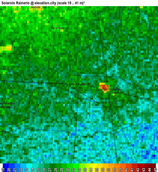
Below is the Elevation map of Solarolo Rainerio, which displays elevation range with different colors. Scale of the first map is from 19 to 41 m (62 to 135 ft) with average elevation of 26.4 meters (=87 ft) [note 1]
These maps also provides idea of topography and contour of this city, they are displayed at different zoom levels. More info about maps, scale and edge coordinates you can find below images.
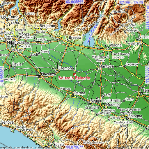
| \ | Map #1 | Topo.Map |
| Scale [m] | 19..41 m | × |
| Scale [ft] | 62..135 ft | × |
| Average | 26.4 m = 87 ft | × |
| Width | 6.9 km = 4.3 mi | 220.8 km = 137.2 mi |
| Height | 6.9 km = 4.3 mi | 220.8 km = 137.2 mi |
| ↑Max Latitude | 45.112281° | 46.06559° |
| Latitude at center | 45.08126° | 45.08126° |
| ↓Min Latitude | 45.050222° | 44.07967° |
| ← Min Longitude | 10.313165° | 8.95086° |
| Longitude center | 10.35711° | 10.35711° |
| →Max Longitude | 10.401055° | 11.76336° |
Nearby cities:
Cities around Solarolo Rainerio sort by population:
• Piadena elevation 32 m
5.4 km,  11°
11°
• Gussola 27 m
7.8 km,  184°
184°
• Rivarolo Mantovano 26 m
6.4 km,  98°
98°
• San Giovanni in Croce 27 m
1.5 km,  122°
122°
• Scandolara Ravara 31 m
5.3 km,  234°
234°
• Cingia de' Botti 30 m
6.4 km,  273°
273°
• Casteldidone 28 m
4 km,  107°
107°
• Drizzona 31 m
6.8 km,  355°
355°
• San Martino del Lago 28 m
3.4 km,  253°
253°
• Tornata 29 m
6.3 km,  66°
66°
• Ca' d'Andrea 34 m
7.6 km,  304°
304°
• Voltido 34 m
3.9 km,  330°
330°
Multilingual:
 En español:
Solarolo Rainerio elevación 31 m.
 En France:
Solarolo Rainerio élévation 31 m.
 Auf Deutsch:
Solarolo Rainerio höhe über dem Meeresspiegel ist 31 m.

Sources and notes:
- [note 1] Map square and city borders are not equal. Map elevation data is calculated only from area inside that square.
- [src 1] Elevation data from geonames database provided with same terms of usage.
- [src 2] The elevation map of Solarolo Rainerio is generated using elevation data from NASA's 3 arcsec (90m) resolution SRTM data.
- [src 3] Base (background) map © OpenStreetMap contributors tiles are generated by Geofabrik and OpenTopoMap.
Copyright & License:
This Solarolo Rainerio Elevation Map is licensed under CC BY-SA. You may reuse any part from this page, if you give a proper credit by linking to this URL:
 More info on terms of use page.