Carlantino elevation
Carlantino (Apulia, Provincia di Foggia), Italy elevation is 546 meters and Carlantino elevation in feet is 1791 ft above sea level [src 1]. Carlantino is a seat of a third-order administrative division (feature code) with elevation that is 224 meters (735 ft) bigger than average city elevation in Italy.
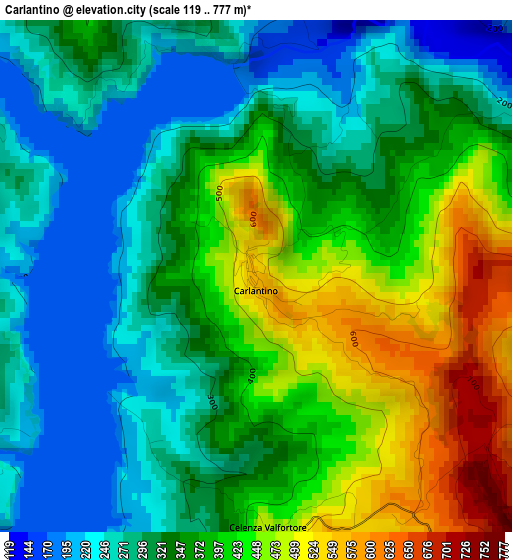
Below is the Elevation map of Carlantino, which displays elevation range with different colors. Scale of the first map is from 119 to 777 m (390 to 2549 ft) with average elevation of 352.6 meters (=1157 ft) [note 1]
These maps also provides idea of topography and contour of this city, they are displayed at different zoom levels. More info about maps, scale and edge coordinates you can find below images.
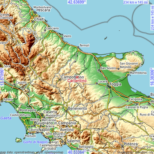
| \ | Map #1 | Topo.Map |
| Scale [m] | 119..777 m | × |
| Scale [ft] | 390..2549 ft | × |
| Average | 352.6 m = 1157 ft | × |
| Width | 7.31 km = 4.5 mi | 233.9 km = 145.3 mi |
| Height | 7.31 km = 4.5 mi | 233.9 km = 145.3 mi |
| ↑Max Latitude | 41.626737° | 42.63699° |
| Latitude at center | 41.59388° | 41.59388° |
| ↓Min Latitude | 41.561006° | 40.53364° |
| ← Min Longitude | 14.932865° | 13.57056° |
| Longitude center | 14.97681° | 14.97681° |
| →Max Longitude | 15.020755° | 16.38306° |
Nearby cities:
Cities around Carlantino sort by population:
• Colletorto elevation 535 m
7.6 km,  354°
354°
• Celenza Valfortore 463 m
3.7 km,  177°
177°
• Casalvecchio di Puglia 471 m
11.1 km,  89°
89°
• Sant'Elia a Pianisi 661 m
8.9 km,  289°
289°
• Castelnuovo della Daunia 542 m
11.8 km,  96°
96°
• Casalnuovo Monterotaro 416 m
11 km,  74°
74°
• Pietracatella 679 m
8.8 km,  260°
260°
• Gambatesa 477 m
10.9 km,  209°
209°
• San Marco la Catola 656 m
8.1 km,  162°
162°
• San Giuliano di Puglia 472 m
10.5 km, 353°
• Macchia Valfortore 485 m
5.4 km,  271°
271°
• Volturara Appula 521 m
12.6 km,  150°
150°
Multilingual:
 En español:
Carlantino elevación 546 m.
 En France:
Carlantino élévation 546 m.
 Auf Deutsch:
Carlantino höhe über dem Meeresspiegel ist 546 m.

Sources and notes:
- [note 1] Map square and city borders are not equal. Map elevation data is calculated only from area inside that square.
- [src 1] Elevation data from geonames database provided with same terms of usage.
- [src 2] The elevation map of Carlantino is generated using elevation data from NASA's 3 arcsec (90m) resolution SRTM data.
- [src 3] Base (background) map © OpenStreetMap contributors tiles are generated by Geofabrik and OpenTopoMap.
Copyright & License:
This Carlantino Elevation Map is licensed under CC BY-SA. You may reuse any part from this page, if you give a proper credit by linking to this URL:
 More info on terms of use page.