Gambatesa elevation
Gambatesa (Molise, Provincia di Campobasso), Italy elevation is 477 meters and Gambatesa elevation in feet is 1565 ft above sea level [src 1]. Gambatesa is a seat of a third-order administrative division (feature code) with elevation that is 155 meters (509 ft) bigger than average city elevation in Italy.
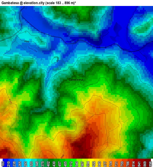
Below is the Elevation map of Gambatesa, which displays elevation range with different colors. Scale of the first map is from 183 to 896 m (600 to 2940 ft) with average elevation of 435.6 meters (=1429 ft) [note 1]
These maps also provides idea of topography and contour of this city, they are displayed at different zoom levels. More info about maps, scale and edge coordinates you can find below images.
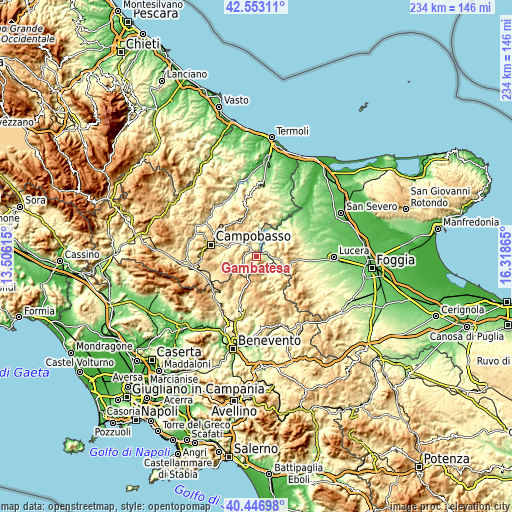
| \ | Map #1 | Topo.Map |
| Scale [m] | 183..896 m | × |
| Scale [ft] | 600..2940 ft | × |
| Average | 435.6 m = 1429 ft | × |
| Width | 7.32 km = 4.5 mi | 234.2 km = 145.5 mi |
| Height | 7.32 km = 4.5 mi | 234.2 km = 145.5 mi |
| ↑Max Latitude | 41.54151° | 42.55311° |
| Latitude at center | 41.50861° | 41.50861° |
| ↓Min Latitude | 41.475693° | 40.44698° |
| ← Min Longitude | 14.868455° | 13.50615° |
| Longitude center | 14.9124° | 14.9124° |
| →Max Longitude | 14.956345° | 16.31865° |
Nearby cities:
Cities around Gambatesa sort by population:
• San Bartolomeo in Galdo elevation 607 m
13.5 km,  139°
139°
• Riccia 704 m
7.3 km,  247°
247°
• Celenza Valfortore 463 m
8 km,  43°
43°
• Sant'Elia a Pianisi 661 m
12.8 km,  346°
346°
• Jelsi 608 m
9.6 km,  275°
275°
• Pietracatella 679 m
8.7 km,  337°
337°
• San Marco la Catola 656 m
8 km,  76°
76°
• Carlantino 546 m
10.9 km,  29°
29°
• Castelvetere in Val Fortore 689 m
7.7 km,  161°
161°
• Tufara 443 m
4.1 km, 136°
• Macchia Valfortore 485 m
9.6 km,  359°
359°
• Volturara Appula 521 m
11.7 km,  96°
96°
Multilingual:
 En español:
Gambatesa elevación 477 m.
 En France:
Gambatesa élévation 477 m.
 Auf Deutsch:
Gambatesa höhe über dem Meeresspiegel ist 477 m.

Sources and notes:
- [note 1] Map square and city borders are not equal. Map elevation data is calculated only from area inside that square.
- [src 1] Elevation data from geonames database provided with same terms of usage.
- [src 2] The elevation map of Gambatesa is generated using elevation data from NASA's 3 arcsec (90m) resolution SRTM data.
- [src 3] Base (background) map © OpenStreetMap contributors tiles are generated by Geofabrik and OpenTopoMap.
Copyright & License:
This Gambatesa Elevation Map is licensed under CC BY-SA. You may reuse any part from this page, if you give a proper credit by linking to this URL:
 More info on terms of use page.