Casalbuono elevation
Casalbuono (Campania, Provincia di Salerno), Italy elevation is 574 meters and Casalbuono elevation in feet is 1883 ft above sea level [src 1]. Casalbuono is a seat of a third-order administrative division (feature code) with elevation that is 252 meters (827 ft) bigger than average city elevation in Italy.
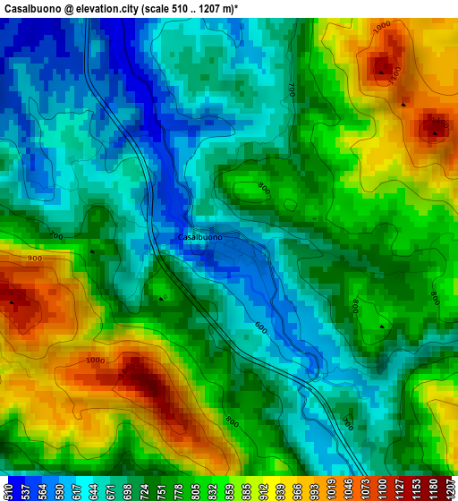
Below is the Elevation map of Casalbuono, which displays elevation range with different colors. Scale of the first map is from 510 to 1207 m (1673 to 3960 ft) with average elevation of 764.4 meters (=2508 ft) [note 1]
These maps also provides idea of topography and contour of this city, they are displayed at different zoom levels. More info about maps, scale and edge coordinates you can find below images.
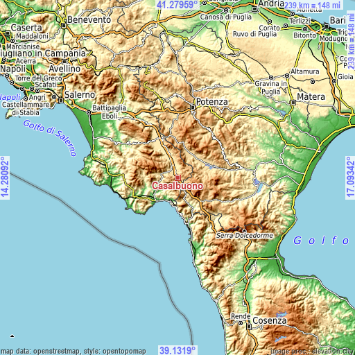
| \ | Map #1 | Topo.Map |
| Scale [m] | 510..1207 m | × |
| Scale [ft] | 1673..3960 ft | × |
| Average | 764.4 m = 2508 ft | × |
| Width | 7.46 km = 4.6 mi | 238.8 km = 148.4 mi |
| Height | 7.46 km = 4.6 mi | 238.8 km = 148.4 mi |
| ↑Max Latitude | 40.2478° | 41.27959° |
| Latitude at center | 40.21425° | 40.21425° |
| ↓Min Latitude | 40.180683° | 39.1319° |
| ← Min Longitude | 15.643225° | 14.28092° |
| Longitude center | 15.68717° | 15.68717° |
| →Max Longitude | 15.731115° | 17.09342° |
Nearby cities:
Cities around Casalbuono sort by population:
• Lagonegro elevation 707 m
11.5 km,  146°
146°
• Moliterno 880 m
15.5 km,  77°
77°
• Padula 604 m
14.1 km,  349°
349°
• Tramutola 657 m
14.4 km,  36°
36°
• Sanza 536 m
11.8 km,  286°
286°
• Buonabitacolo 500 m
8.2 km,  317°
317°
• Caselle in Pittari 415 m
13.1 km,  249°
249°
• Montesano sulla Marcellana 838 m
7 km,  11°
11°
• Casaletto Spartano 407 m
9 km,  218°
218°
• Torraca 434 m
12.3 km,  200°
200°
• Tortorella 580 m
10.5 km, 220°
• Morigerati 290 m
13.9 km,  233°
233°
Multilingual:
 En español:
Casalbuono elevación 574 m.
 En France:
Casalbuono élévation 574 m.
 Auf Deutsch:
Casalbuono höhe über dem Meeresspiegel ist 574 m.

Sources and notes:
- [note 1] Map square and city borders are not equal. Map elevation data is calculated only from area inside that square.
- [src 1] Elevation data from geonames database provided with same terms of usage.
- [src 2] The elevation map of Casalbuono is generated using elevation data from NASA's 3 arcsec (90m) resolution SRTM data.
- [src 3] Base (background) map © OpenStreetMap contributors tiles are generated by Geofabrik and OpenTopoMap.
Copyright & License:
This Casalbuono Elevation Map is licensed under CC BY-SA. You may reuse any part from this page, if you give a proper credit by linking to this URL:
 More info on terms of use page.