Lagonegro elevation
Lagonegro (Basilicate, Provincia di Potenza), Italy elevation is 707 meters and Lagonegro elevation in feet is 2320 ft above sea level [src 1]. Lagonegro is a seat of a third-order administrative division (feature code) with elevation that is 385 meters (1263 ft) bigger than average city elevation in Italy.
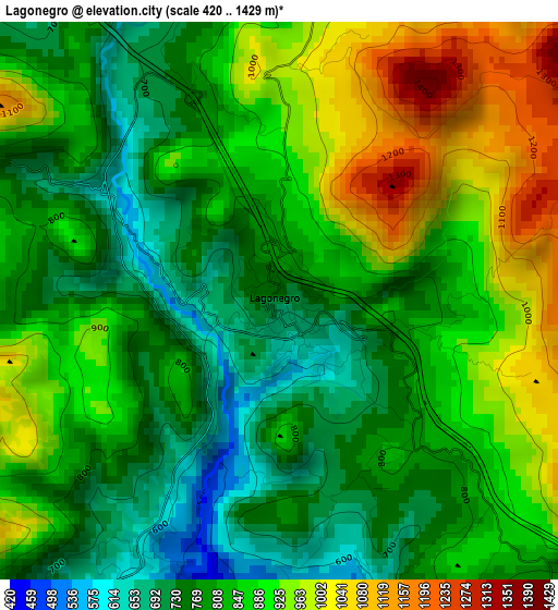
Below is the Elevation map of Lagonegro, which displays elevation range with different colors. Scale of the first map is from 420 to 1429 m (1378 to 4688 ft) with average elevation of 846.2 meters (=2776 ft) [note 1]
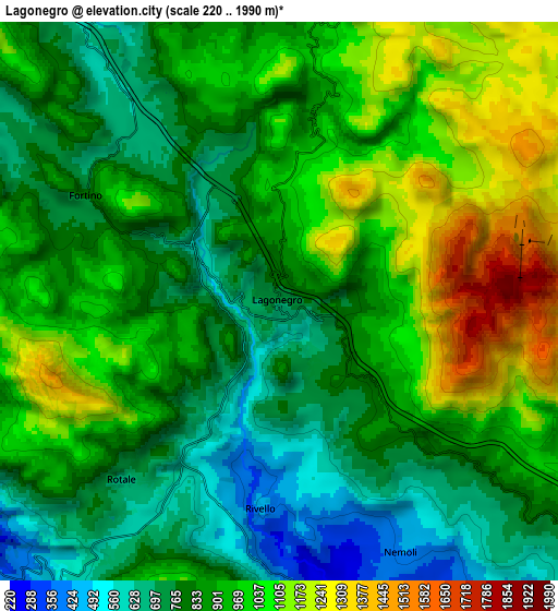
These maps also provides idea of topography and contour of this city, they are displayed at different zoom levels. More info about maps, scale and edge coordinates you can find below images.
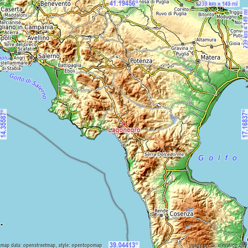
| \ | Map #1 | Map #2 | Topo.Map |
| Scale [m] | 420..1429 m | 220..1990 m | × |
| Scale [ft] | 1378..4688 ft | 722..6529 ft | × |
| Average | 846.2 m = 2776 ft | 907.2 m = 2976 ft | × |
| Width | 7.47 km = 4.6 mi | 14.94 km = 9.3 mi | 239.1 km = 148.6 mi |
| Height | 7.47 km = 4.6 mi | 14.94 km = 9.3 mi | 239.1 km = 148.6 mi |
| ↑Max Latitude | 40.161443° | 40.195019° | 41.19456° |
| Latitude at center | 40.12785° | 40.12785° | 40.12785° |
| ↓Min Latitude | 40.094241° | 40.060615° | 39.04413° |
| ← Min Longitude | 15.718175° | 15.674229° | 14.35587° |
| Longitude center | 15.76212° | 15.76212° | 15.76212° |
| →Max Longitude | 15.806065° | 15.850011° | 17.16837° |
Nearby cities:
Cities around Lagonegro sort by population:
• Sapri elevation 9 m
12.5 km,  241°
241°
• Lauria 481 m
11.1 km,  144°
144°
• Maratea 179 m
14.8 km,  195°
195°
• Trecchina 503 m
11.4 km,  174°
174°
• Casalbuono 574 m
11.5 km,  326°
326°
• Villammare 25 m
15.4 km,  248°
248°
• Vibonati 106 m
15.5 km,  258°
258°
• Rivello 416 m
5.5 km,  183°
183°
• Casaletto Spartano 407 m
12.3 km,  282°
282°
• Torraca 434 m
10.9 km, 260°
• Nemoli 422 m
7.4 km,  154°
154°
• Tortorella 580 m
13.3 km, 276°
Multilingual:
 En español:
Lagonegro elevación 707 m.
 En France:
Lagonegro élévation 707 m.
 Auf Deutsch:
Lagonegro höhe über dem Meeresspiegel ist 707 m.

Sources and notes:
- [note 1] Map square and city borders are not equal. Map elevation data is calculated only from area inside that square.
- [src 1] Elevation data from geonames database provided with same terms of usage.
- [src 2] The elevation map of Lagonegro is generated using elevation data from NASA's 3 arcsec (90m) resolution SRTM data.
- [src 3] Base (background) map © OpenStreetMap contributors tiles are generated by Geofabrik and OpenTopoMap.
Copyright & License:
This Lagonegro Elevation Map is licensed under CC BY-SA. You may reuse any part from this page, if you give a proper credit by linking to this URL:
 More info on terms of use page.