Castiglione Olona elevation
Castiglione Olona (Lombardy, Provincia di Varese), Italy elevation is 317 meters and Castiglione Olona elevation in feet is 1040 ft above sea level [src 1]. Castiglione Olona is a seat of a third-order administrative division (feature code) with elevation that is 5 meters (16 ft) smaller than average city elevation in Italy.
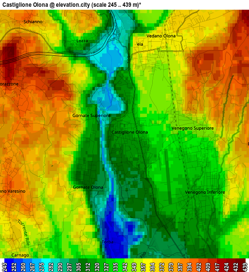
Below is the Elevation map of Castiglione Olona, which displays elevation range with different colors. Scale of the first map is from 245 to 439 m (804 to 1440 ft) with average elevation of 347.6 meters (=1140 ft) [note 1]
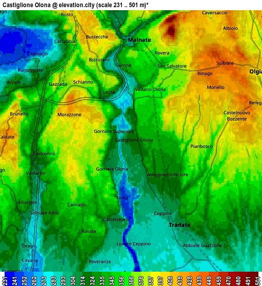
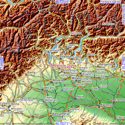
These maps also provides idea of topography and contour of this city, they are displayed at different zoom levels. More info about maps, scale and edge coordinates you can find below images.
| \ | Map #1 | Map #2 | Topo.Map |
| Scale [m] | 245..439 m | 231..501 m | × |
| Scale [ft] | 804..1440 ft | 758..1644 ft | × |
| Average | 347.6 m = 1140 ft | 346 m = 1135 ft | × |
| Width | 6.82 km = 4.2 mi | 13.64 km = 8.5 mi | 218.2 km = 135.6 mi |
| Height | 6.82 km = 4.2 mi | 13.64 km = 8.5 mi | 218.2 km = 135.6 mi |
| ↑Max Latitude | 45.783215° | 45.813853° | 46.72516° |
| Latitude at center | 45.75256° | 45.75256° | 45.75256° |
| ↓Min Latitude | 45.721888° | 45.6912° | 44.76271° |
| ← Min Longitude | 8.828835° | 8.784889° | 7.46653° |
| Longitude center | 8.87278° | 8.87278° | 8.87278° |
| →Max Longitude | 8.916725° | 8.960671° | 10.27903° |
Nearby cities:
Cities around Castiglione Olona sort by population:
• Malnate elevation 360 m
4.6 km,  7°
7°
• Vedano Olona 359 m
2.8 km,  24°
24°
• Venegono Superiore 343 m
1.9 km,  90°
90°
• Venegono Inferiore 323 m
2.6 km,  136°
136°
• Carnago 354 m
4.5 km,  221°
221°
• Caronno Varesino 389 m
3.7 km,  239°
239°
• Gazzada Schianno 382 m
4.3 km,  315°
315°
• Morazzone 397 m
3.7 km,  290°
290°
• Castronno 357 m
4.6 km,  263°
263°
• Gornate Olona 307 m
1.6 km, 219°
• Castelseprio 309 m
4.4 km,  191°
191°
• Lozza 337 m
2.8 km,  335°
335°
Multilingual:
 En español:
Castiglione Olona elevación 317 m.
 En France:
Castiglione Olona élévation 317 m.
 Auf Deutsch:
Castiglione Olona höhe über dem Meeresspiegel ist 317 m.

Sources and notes:
- [note 1] Map square and city borders are not equal. Map elevation data is calculated only from area inside that square.
- [src 1] Elevation data from geonames database provided with same terms of usage.
- [src 2] The elevation map of Castiglione Olona is generated using elevation data from NASA's 3 arcsec (90m) resolution SRTM data.
- [src 3] Base (background) map © OpenStreetMap contributors tiles are generated by Geofabrik and OpenTopoMap.
Copyright & License:
This Castiglione Olona Elevation Map is licensed under CC BY-SA. You may reuse any part from this page, if you give a proper credit by linking to this URL:
 More info on terms of use page.