Castignano elevation
Castignano (The Marches, Provincia di Ascoli Piceno), Italy elevation is 442 meters and Castignano elevation in feet is 1450 ft above sea level [src 1]. Castignano is a seat of a third-order administrative division (feature code) with elevation that is 120 meters (394 ft) bigger than average city elevation in Italy.
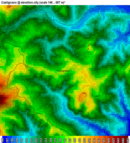
Below is the Elevation map of Castignano, which displays elevation range with different colors. Scale of the first map is from 146 to 687 m (479 to 2254 ft) with average elevation of 337.3 meters (=1107 ft) [note 1]
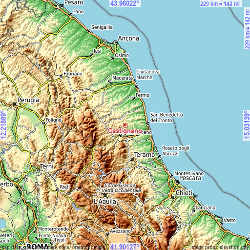
These maps also provides idea of topography and contour of this city, they are displayed at different zoom levels. More info about maps, scale and edge coordinates you can find below images.
| \ | Map #1 | Topo.Map |
| Scale [m] | 146..687 m | × |
| Scale [ft] | 479..2254 ft | × |
| Average | 337.3 m = 1107 ft | × |
| Width | 7.15 km = 4.4 mi | 228.9 km = 142.2 mi |
| Height | 7.15 km = 4.4 mi | 228.9 km = 142.2 mi |
| ↑Max Latitude | 42.971513° | 43.96022° |
| Latitude at center | 42.93935° | 42.93935° |
| ↓Min Latitude | 42.90717° | 41.90127° |
| ← Min Longitude | 13.581195° | 12.21889° |
| Longitude center | 13.62514° | 13.62514° |
| →Max Longitude | 13.669085° | 15.03139° |
Nearby cities:
Cities around Castignano sort by population:
• Ascoli Piceno elevation 160 m
10.4 km,  203°
203°
• Piattoni-Villa Sant'Antonio 148 m
10.7 km,  139°
139°
• Castel di Lama 81 m
11.3 km, 137°
• Offida 275 m
5.9 km,  94°
94°
• Appignano del Tronto 184 m
5.5 km,  146°
146°
• Castorano 265 m
9.7 km,  118°
118°
• Montalto delle Marche 505 m
5.8 km,  346°
346°
• Monte Rinaldo 457 m
10.5 km,  340°
340°
• Rotella 390 m
5.7 km,  287°
287°
• Cossignano 359 m
7.2 km,  47°
47°
• Ortezzano 306 m
10.3 km, 350°
• Montedinove 528 m
4.7 km,  322°
322°
Multilingual:
 En español:
Castignano elevación 442 m.
 En France:
Castignano élévation 442 m.
 Auf Deutsch:
Castignano höhe über dem Meeresspiegel ist 442 m.

Sources and notes:
- [note 1] Map square and city borders are not equal. Map elevation data is calculated only from area inside that square.
- [src 1] Elevation data from geonames database provided with same terms of usage.
- [src 2] The elevation map of Castignano is generated using elevation data from NASA's 3 arcsec (90m) resolution SRTM data.
- [src 3] Base (background) map © OpenStreetMap contributors tiles are generated by Geofabrik and OpenTopoMap.
Copyright & License:
This Castignano Elevation Map is licensed under CC BY-SA. You may reuse any part from this page, if you give a proper credit by linking to this URL:
 More info on terms of use page.