Rotella elevation
Rotella (The Marches, Provincia di Ascoli Piceno), Italy elevation is 390 meters and Rotella elevation in feet is 1280 ft above sea level [src 1]. Rotella is a seat of a third-order administrative division (feature code) with elevation that is 68 meters (223 ft) bigger than average city elevation in Italy.
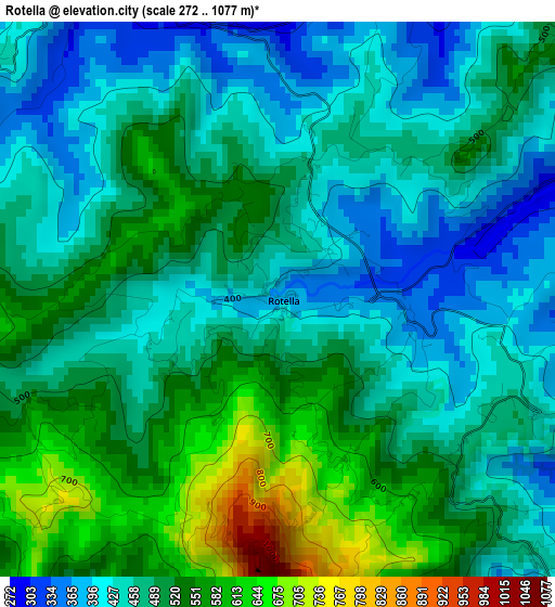
Below is the Elevation map of Rotella, which displays elevation range with different colors. Scale of the first map is from 272 to 1077 m (892 to 3533 ft) with average elevation of 487.1 meters (=1598 ft) [note 1]
These maps also provides idea of topography and contour of this city, they are displayed at different zoom levels. More info about maps, scale and edge coordinates you can find below images.
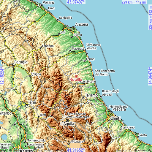
| \ | Map #1 | Topo.Map |
| Scale [m] | 272..1077 m | × |
| Scale [ft] | 892..3533 ft | × |
| Average | 487.1 m = 1598 ft | × |
| Width | 7.15 km = 4.4 mi | 228.9 km = 142.2 mi |
| Height | 7.15 km = 4.4 mi | 228.9 km = 142.2 mi |
| ↑Max Latitude | 42.986505° | 43.97497° |
| Latitude at center | 42.95435° | 42.95435° |
| ↓Min Latitude | 42.922178° | 41.91652° |
| ← Min Longitude | 13.514545° | 12.15224° |
| Longitude center | 13.55849° | 13.55849° |
| →Max Longitude | 13.602435° | 14.96474° |
Nearby cities:
Cities around Rotella sort by population:
• Castignano elevation 442 m
5.7 km,  107°
107°
• Venarotta 426 m
9.7 km,  214°
214°
• Appignano del Tronto 184 m
10.5 km,  126°
126°
• Force 662 m
5.8 km,  277°
277°
• Montalto delle Marche 505 m
5.6 km,  45°
45°
• San Vittoria in Matenano 600 m
8.9 km,  325°
325°
• Montefalcone Appennino 766 m
9.2 km,  295°
295°
• Monte Rinaldo 457 m
8.4 km,  13°
13°
• Ortezzano 306 m
9.3 km,  24°
24°
• Montedinove 528 m
3.3 km, 51°
• Montelparo 543 m
7.2 km,  346°
346°
• Palmiano 534 m
10.1 km,  232°
232°
Multilingual:
 En español:
Rotella elevación 390 m.
 En France:
Rotella élévation 390 m.


Sources and notes:
- [note 1] Map square and city borders are not equal. Map elevation data is calculated only from area inside that square.
- [src 1] Elevation data from geonames database provided with same terms of usage.
- [src 2] The elevation map of Rotella is generated using elevation data from NASA's 3 arcsec (90m) resolution SRTM data.
- [src 3] Base (background) map © OpenStreetMap contributors tiles are generated by Geofabrik and OpenTopoMap.
Copyright & License:
This Rotella Elevation Map is licensed under CC BY-SA. You may reuse any part from this page, if you give a proper credit by linking to this URL:
 More info on terms of use page.