Cavour elevation
Cavour (Piedmont, Torino), Italy elevation is 307 meters and Cavour elevation in feet is 1007 ft above sea level [src 1]. Cavour is a seat of a third-order administrative division (feature code) with elevation that is 15 meters (49 ft) smaller than average city elevation in Italy.
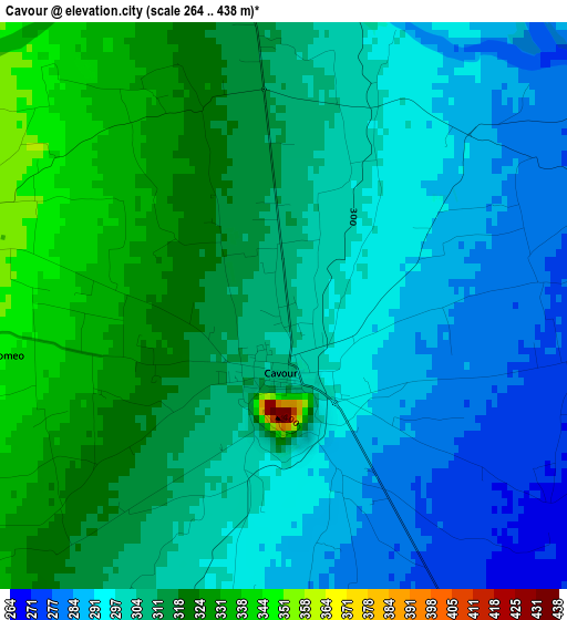
Below is the Elevation map of Cavour, which displays elevation range with different colors. Scale of the first map is from 264 to 438 m (866 to 1437 ft) with average elevation of 306 meters (=1004 ft) [note 1]
These maps also provides idea of topography and contour of this city, they are displayed at different zoom levels. More info about maps, scale and edge coordinates you can find below images.
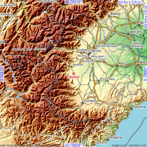
| \ | Map #1 | Topo.Map |
| Scale [m] | 264..438 m | × |
| Scale [ft] | 866..1437 ft | × |
| Average | 306 m = 1004 ft | × |
| Width | 6.94 km = 4.3 mi | 221.9 km = 137.9 mi |
| Height | 6.94 km = 4.3 mi | 221.9 km = 137.9 mi |
| ↑Max Latitude | 44.824038° | 45.78219° |
| Latitude at center | 44.79286° | 44.79286° |
| ↓Min Latitude | 44.761665° | 43.78628° |
| ← Min Longitude | 7.330435° | 5.96813° |
| Longitude center | 7.37438° | 7.37438° |
| →Max Longitude | 7.418325° | 8.78063° |
Nearby cities:
Cities around Cavour sort by population:
• Airali elevation 472 m
10 km,  285°
285°
• Barge 374 m
8.3 km,  209°
209°
• Bagnolo Piemonte 373 m
6 km,  232°
232°
• Bricherasio 389 m
6.6 km,  300°
300°
• Bibiana 415 m
6.8 km,  275°
275°
• Cardè 261 m
9.8 km,  123°
123°
• Buriasco 300 m
9.3 km,  18°
18°
• Osasco 346 m
6.8 km,  338°
338°
• Campiglione 365 m
4.1 km, 285°
• Macello 306 m
6.7 km, 16°
• Lusernetta 502 m
10.1 km, 276°
• Garzigliana 315 m
4.9 km,  0°
0°
Multilingual:
 En español:
Cavour elevación 307 m.
 En France:
Cavour élévation 307 m.


Sources and notes:
- [note 1] Map square and city borders are not equal. Map elevation data is calculated only from area inside that square.
- [src 1] Elevation data from geonames database provided with same terms of usage.
- [src 2] The elevation map of Cavour is generated using elevation data from NASA's 3 arcsec (90m) resolution SRTM data.
- [src 3] Base (background) map © OpenStreetMap contributors tiles are generated by Geofabrik and OpenTopoMap.
Copyright & License:
This Cavour Elevation Map is licensed under CC BY-SA. You may reuse any part from this page, if you give a proper credit by linking to this URL:
 More info on terms of use page.