Cerreto d'Esi elevation
Cerreto d'Esi (The Marches, Provincia di Ancona), Italy elevation is 288 meters and Cerreto d'Esi elevation in feet is 945 ft above sea level [src 1]. Cerreto d'Esi is a seat of a third-order administrative division (feature code) with elevation that is 34 meters (112 ft) smaller than average city elevation in Italy.
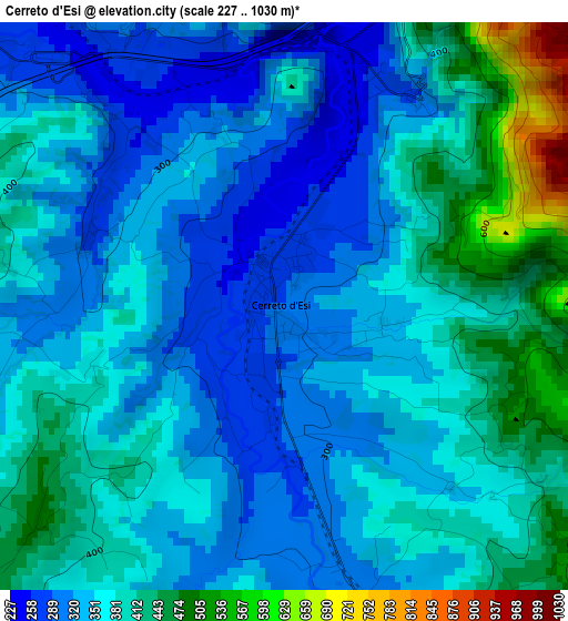
Below is the Elevation map of Cerreto d'Esi, which displays elevation range with different colors. Scale of the first map is from 227 to 1030 m (745 to 3379 ft) with average elevation of 366.5 meters (=1202 ft) [note 1]
These maps also provides idea of topography and contour of this city, they are displayed at different zoom levels. More info about maps, scale and edge coordinates you can find below images.
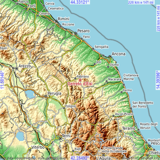
| \ | Map #1 | Topo.Map |
| Scale [m] | 227..1030 m | × |
| Scale [ft] | 745..3379 ft | × |
| Average | 366.5 m = 1202 ft | × |
| Width | 7.11 km = 4.4 mi | 227.5 km = 141.4 mi |
| Height | 7.11 km = 4.4 mi | 227.5 km = 141.4 mi |
| ↑Max Latitude | 43.348645° | 44.33121° |
| Latitude at center | 43.31668° | 43.31668° |
| ↓Min Latitude | 43.284698° | 42.28492° |
| ← Min Longitude | 12.943765° | 11.58146° |
| Longitude center | 12.98771° | 12.98771° |
| →Max Longitude | 13.031655° | 14.39396° |
Nearby cities:
Cities around Cerreto d'Esi sort by population:
• Fabriano elevation 315 m
7.3 km,  290°
290°
• Matelica 339 m
6.7 km,  166°
166°
• Castelraimondo 308 m
13.2 km,  155°
155°
• Sassoferrato 284 m
16.6 km,  320°
320°
• Serra San Quirico 185 m
14.7 km,  11°
11°
• Esanatoglia 446 m
7.8 km,  203°
203°
• Apiro 517 m
14.3 km,  53°
53°
• Pioraco 470 m
15.1 km,  183°
183°
• Massa 464 m
15 km, 197°
• Gagliole 479 m
10.9 km,  143°
143°
• Poggio San Vicino 475 m
9.8 km, 49°
• Genga 303 m
13.3 km,  341°
341°
Multilingual:
 En español:
Cerreto d'Esi elevación 288 m.
 En France:
Cerreto d'Esi élévation 288 m.
 Auf Deutsch:
Cerreto d'Esi höhe über dem Meeresspiegel ist 288 m.

Sources and notes:
- [note 1] Map square and city borders are not equal. Map elevation data is calculated only from area inside that square.
- [src 1] Elevation data from geonames database provided with same terms of usage.
- [src 2] The elevation map of Cerreto d'Esi is generated using elevation data from NASA's 3 arcsec (90m) resolution SRTM data.
- [src 3] Base (background) map © OpenStreetMap contributors tiles are generated by Geofabrik and OpenTopoMap.
Copyright & License:
This Cerreto d'Esi Elevation Map is licensed under CC BY-SA. You may reuse any part from this page, if you give a proper credit by linking to this URL:
 More info on terms of use page.