Cetona elevation
Cetona (Tuscany, Provincia di Siena), Italy elevation is 329 meters and Cetona elevation in feet is 1079 ft above sea level [src 1]. Cetona is a seat of a third-order administrative division (feature code) with elevation that is 7 meters (23 ft) bigger than average city elevation in Italy.
Below is the Elevation map of Cetona, which displays elevation range with different colors. Scale of the first map is from 248 to 1052 m (814 to 3451 ft) with average elevation of 424.8 meters (=1394 ft) [note 1]
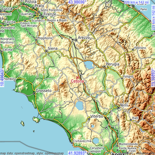
These maps also provides idea of topography and contour of this city, they are displayed at different zoom levels. More info about maps, scale and edge coordinates you can find below images.
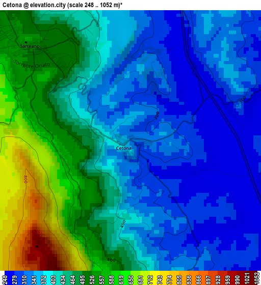
| \ | Map #1 | Topo.Map |
| Scale [m] | 248..1052 m | × |
| Scale [ft] | 814..3451 ft | × |
| Average | 424.8 m = 1394 ft | × |
| Width | 7.15 km = 4.4 mi | 228.8 km = 142.2 mi |
| Height | 7.15 km = 4.4 mi | 228.8 km = 142.2 mi |
| ↑Max Latitude | 42.998699° | 43.98696° |
| Latitude at center | 42.96655° | 42.96655° |
| ↓Min Latitude | 42.934385° | 41.92893° |
| ← Min Longitude | 11.858735° | 10.49643° |
| Longitude center | 11.90268° | 11.90268° |
| →Max Longitude | 11.946625° | 13.30893° |
Nearby cities:
Cities around Cetona sort by population:
• Chianciano Terme elevation 515 m
11.2 km,  318°
318°
• Chiusi Scalo 266 m
5.3 km,  51°
51°
• Sarteano 531 m
4.2 km,  312°
312°
• Città della Pieve 484 m
8.5 km,  95°
95°
• Chiusi 344 m
6.4 km,  34°
34°
• Sant'Albino 485 m
14 km,  326°
326°
• Fabro 262 m
13.9 km,  138°
138°
• Piegaro 353 m
14.8 km,  90°
90°
• Radicofani 775 m
13.4 km,  234°
234°
• Monteleone d'Orvieto 493 m
13.2 km,  112°
112°
• San Casciano dei Bagni 565 m
10.9 km,  191°
191°
• Paciano 364 m
14.8 km,  65°
65°
Multilingual:
 En español:
Cetona elevación 329 m.
 En France:
Cetona élévation 329 m.


Sources and notes:
- [note 1] Map square and city borders are not equal. Map elevation data is calculated only from area inside that square.
- [src 1] Elevation data from geonames database provided with same terms of usage.
- [src 2] The elevation map of Cetona is generated using elevation data from NASA's 3 arcsec (90m) resolution SRTM data.
- [src 3] Base (background) map © OpenStreetMap contributors tiles are generated by Geofabrik and OpenTopoMap.
Copyright & License:
This Cetona Elevation Map is licensed under CC BY-SA. You may reuse any part from this page, if you give a proper credit by linking to this URL:
 More info on terms of use page.