Contigliano elevation
Contigliano (Latium, Provincia di Rieti), Italy elevation is 413 meters and Contigliano elevation in feet is 1355 ft above sea level [src 1]. Contigliano is a seat of a third-order administrative division (feature code) with elevation that is 91 meters (299 ft) bigger than average city elevation in Italy.
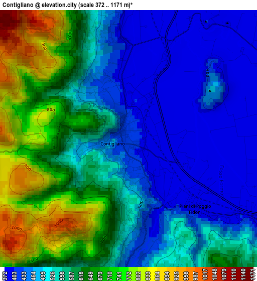
Below is the Elevation map of Contigliano, which displays elevation range with different colors. Scale of the first map is from 372 to 1171 m (1220 to 3842 ft) with average elevation of 561.1 meters (=1841 ft) [note 1]
These maps also provides idea of topography and contour of this city, they are displayed at different zoom levels. More info about maps, scale and edge coordinates you can find below images.
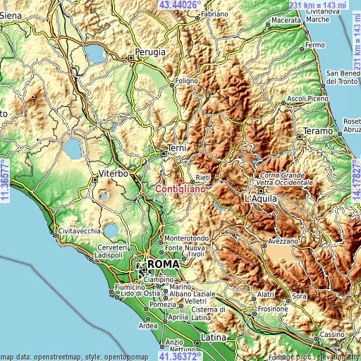
| \ | Map #1 | Topo.Map |
| Scale [m] | 372..1171 m | × |
| Scale [ft] | 1220..3842 ft | × |
| Average | 561.1 m = 1841 ft | × |
| Width | 7.22 km = 4.5 mi | 230.9 km = 143.5 mi |
| Height | 7.22 km = 4.5 mi | 230.9 km = 143.5 mi |
| ↑Max Latitude | 42.443018° | 43.44026° |
| Latitude at center | 42.41058° | 42.41058° |
| ↓Min Latitude | 42.378125° | 41.36372° |
| ← Min Longitude | 12.728075° | 11.36577° |
| Longitude center | 12.77202° | 12.77202° |
| →Max Longitude | 12.815965° | 14.17827° |
Nearby cities:
Cities around Contigliano sort by population:
• Rieti elevation 395 m
7 km,  95°
95°
• Santa Rufina 465 m
12 km,  90°
90°
• Limiti di Greccio 400 m
4.8 km,  357°
357°
• Casperia 390 m
11.6 km,  226°
226°
• Colli sul Velino 460 m
9.8 km,  4°
4°
• Cantalice 728 m
12.4 km,  61°
61°
• Roccantica 443 m
11.9 km,  212°
212°
• Cottanello 502 m
7.1 km,  267°
267°
• Configni 487 m
10.6 km,  278°
278°
• Vacone 392 m
10.9 km,  252°
252°
• Monte San Giovanni in Sabina 676 m
9.3 km,  176°
176°
• Montasola 575 m
8 km, 249°
Multilingual:
 En español:
Contigliano elevación 413 m.
 En France:
Contigliano élévation 413 m.
 Auf Deutsch:
Contigliano höhe über dem Meeresspiegel ist 413 m.

Sources and notes:
- [note 1] Map square and city borders are not equal. Map elevation data is calculated only from area inside that square.
- [src 1] Elevation data from geonames database provided with same terms of usage.
- [src 2] The elevation map of Contigliano is generated using elevation data from NASA's 3 arcsec (90m) resolution SRTM data.
- [src 3] Base (background) map © OpenStreetMap contributors tiles are generated by Geofabrik and OpenTopoMap.
Copyright & License:
This Contigliano Elevation Map is licensed under CC BY-SA. You may reuse any part from this page, if you give a proper credit by linking to this URL:
 More info on terms of use page.