Fontaniva elevation
Fontaniva (Veneto, Provincia di Padova), Italy elevation is 43 meters and Fontaniva elevation in feet is 141 ft above sea level [src 1]. Fontaniva is a seat of a third-order administrative division (feature code) with elevation that is 279 meters (915 ft) smaller than average city elevation in Italy.
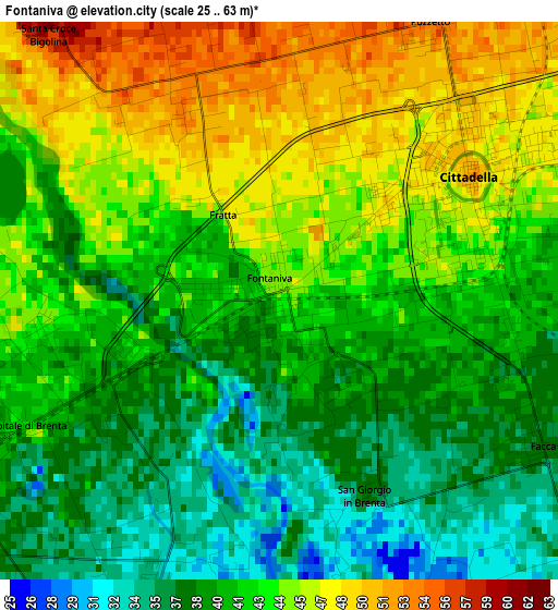
Below is the Elevation map of Fontaniva, which displays elevation range with different colors. Scale of the first map is from 25 to 63 m (82 to 207 ft) with average elevation of 41.9 meters (=137 ft) [note 1]
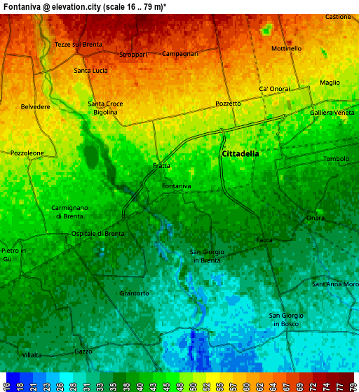
These maps also provides idea of topography and contour of this city, they are displayed at different zoom levels. More info about maps, scale and edge coordinates you can find below images.
| \ | Map #1 | Map #2 | Topo.Map |
| Scale [m] | 25..63 m | 16..79 m | × |
| Scale [ft] | 82..207 ft | 52..259 ft | × |
| Average | 41.9 m = 137 ft | 44.3 m = 145 ft | × |
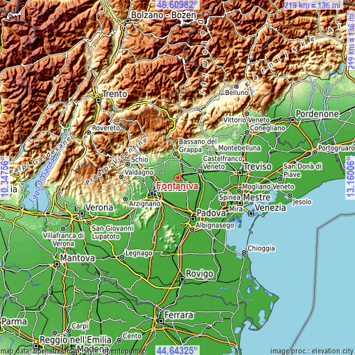
| Width | 6.83 km = 4.2 mi | 13.67 km = 8.5 mi | 218.7 km = 135.9 mi |
| Height | 6.83 km = 4.2 mi | 13.67 km = 8.5 mi | 218.7 km = 135.9 mi |
| ↑Max Latitude | 45.665879° | 45.696582° | 46.60982° |
| Latitude at center | 45.63516° | 45.63516° | 45.63516° |
| ↓Min Latitude | 45.604424° | 45.573671° | 44.64325° |
| ← Min Longitude | 11.709865° | 11.665919° | 10.34756° |
| Longitude center | 11.75381° | 11.75381° | 11.75381° |
| →Max Longitude | 11.797755° | 11.841701° | 13.16006° |
Nearby cities:
Cities around Fontaniva sort by population:
• Cittadella elevation 47 m
2.6 km,  64°
64°
• Rosà 76 m
7.5 km,  4°
4°
• Tombolo 40 m
5.5 km,  85°
85°
• Belvedere 69 m
6.3 km,  12°
12°
• Galliera Veneta 53 m
6.4 km, 55°
• Carmignano di Brenta 42 m
3.9 km,  254°
254°
• Tezze 72 m
7.1 km,  329°
329°
• Grantorto 34 m
4 km,  205°
205°
• San Pietro in Gu 42 m
6.9 km,  244°
244°
• San Giorgio in Bosco 31 m
6.6 km,  141°
141°
• Pozzoleone 52 m
6.6 km,  284°
284°
• Gazzo 34 m
6.9 km, 211°
Multilingual:
 En español:
Fontaniva elevación 43 m.
 En France:
Fontaniva élévation 43 m.
 Auf Deutsch:
Fontaniva höhe über dem Meeresspiegel ist 43 m.

Sources and notes:
- [note 1] Map square and city borders are not equal. Map elevation data is calculated only from area inside that square.
- [src 1] Elevation data from geonames database provided with same terms of usage.
- [src 2] The elevation map of Fontaniva is generated using elevation data from NASA's 3 arcsec (90m) resolution SRTM data.
- [src 3] Base (background) map © OpenStreetMap contributors tiles are generated by Geofabrik and OpenTopoMap.
Copyright & License:
This Fontaniva Elevation Map is licensed under CC BY-SA. You may reuse any part from this page, if you give a proper credit by linking to this URL:
 More info on terms of use page.