Tombolo elevation
Tombolo (Veneto, Provincia di Padova), Italy elevation is 40 meters and Tombolo elevation in feet is 131 ft above sea level [src 1]. Tombolo is a seat of a third-order administrative division (feature code) with elevation that is 282 meters (925 ft) smaller than average city elevation in Italy.
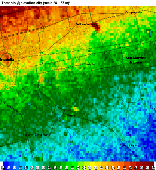
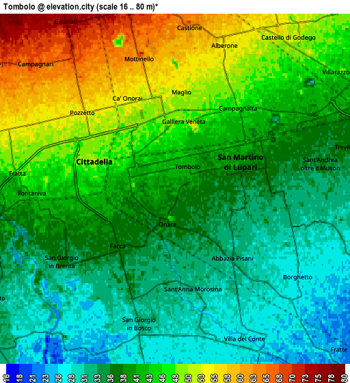
Below is the Elevation map of Tombolo, which displays elevation range with different colors. Scale of the first map is from 28 to 57 m (92 to 187 ft) with average elevation of 39.7 meters (=130 ft) [note 1]
These maps also provides idea of topography and contour of this city, they are displayed at different zoom levels. More info about maps, scale and edge coordinates you can find below images.
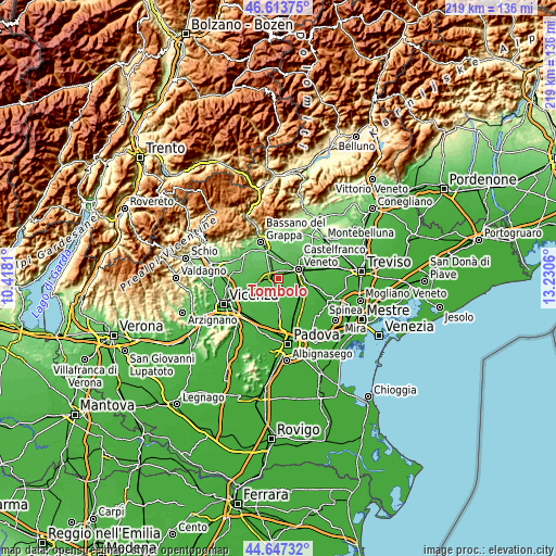
| \ | Map #1 | Map #2 | Topo.Map |
| Scale [m] | 28..57 m | 16..80 m | × |
| Scale [ft] | 92..187 ft | 52..262 ft | × |
| Average | 39.7 m = 130 ft | 40.9 m = 134 ft | × |
| Width | 6.83 km = 4.2 mi | 13.67 km = 8.5 mi | 218.6 km = 135.8 mi |
| Height | 6.83 km = 4.2 mi | 13.67 km = 8.5 mi | 218.6 km = 135.8 mi |
| ↑Max Latitude | 45.669877° | 45.700577° | 46.61375° |
| Latitude at center | 45.63916° | 45.63916° | 45.63916° |
| ↓Min Latitude | 45.608426° | 45.577675° | 44.64732° |
| ← Min Longitude | 11.780405° | 11.736459° | 10.4181° |
| Longitude center | 11.82435° | 11.82435° | 11.82435° |
| →Max Longitude | 11.868295° | 11.912241° | 13.2306° |
Nearby cities:
Cities around Tombolo sort by population:
• Cittadella elevation 47 m
3.2 km,  282°
282°
• San Martino di Lupari 40 m
3.1 km,  64°
64°
• Rossano Veneto 74 m
7.3 km,  347°
347°
• Belvedere 69 m
7 km,  324°
324°
• Galliera Veneta 53 m
3.2 km,  356°
356°
• Fontaniva 43 m
5.5 km,  265°
265°
• Castello di Godego 57 m
7.4 km,  35°
35°
• Villa del Conte 28 m
6.6 km,  155°
155°
• San Giorgio in Bosco 31 m
5.8 km,  193°
193°
• Loreggiola 27 m
8.1 km,  114°
114°
• Abbazia Pisani 32 m
3.8 km,  141°
141°
• Sant'Andrea 36 m
5.7 km,  81°
81°
Multilingual:
 En español:
Tombolo elevación 40 m.
 En France:
Tombolo élévation 40 m.


Sources and notes:
- [note 1] Map square and city borders are not equal. Map elevation data is calculated only from area inside that square.
- [src 1] Elevation data from geonames database provided with same terms of usage.
- [src 2] The elevation map of Tombolo is generated using elevation data from NASA's 3 arcsec (90m) resolution SRTM data.
- [src 3] Base (background) map © OpenStreetMap contributors tiles are generated by Geofabrik and OpenTopoMap.
Copyright & License:
This Tombolo Elevation Map is licensed under CC BY-SA. You may reuse any part from this page, if you give a proper credit by linking to this URL:
 More info on terms of use page.