Gavirate elevation
Gavirate (Lombardy, Provincia di Varese), Italy elevation is 242 meters and Gavirate elevation in feet is 794 ft above sea level [src 1]. Gavirate is a seat of a third-order administrative division (feature code) with elevation that is 80 meters (262 ft) smaller than average city elevation in Italy.
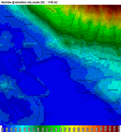
Below is the Elevation map of Gavirate, which displays elevation range with different colors. Scale of the first map is from 222 to 1145 m (728 to 3757 ft) with average elevation of 364.2 meters (=1195 ft) [note 1]
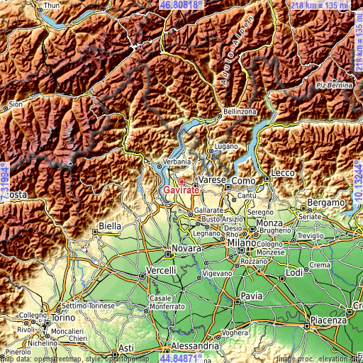
These maps also provides idea of topography and contour of this city, they are displayed at different zoom levels. More info about maps, scale and edge coordinates you can find below images.
| \ | Map #1 | Map #2 | Topo.Map |
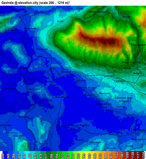
| Scale [m] | 222..1145 m | 206..1216 m | × |
| Scale [ft] | 728..3757 ft | 676..3990 ft | × |
| Average | 364.2 m = 1195 ft | 380.7 m = 1249 ft | × |
| Width | 6.81 km = 4.2 mi | 13.62 km = 8.5 mi | 217.9 km = 135.4 mi |
| Height | 6.81 km = 4.2 mi | 13.62 km = 8.5 mi | 217.9 km = 135.4 mi |
| ↑Max Latitude | 45.867678° | 45.89827° | 46.80818° |
| Latitude at center | 45.83707° | 45.83707° | 45.83707° |
| ↓Min Latitude | 45.806445° | 45.775803° | 44.84871° |
| ← Min Longitude | 8.682245° | 8.638299° | 7.31994° |
| Longitude center | 8.72619° | 8.72619° | 8.72619° |
| →Max Longitude | 8.770135° | 8.814081° | 10.13244° |
Nearby cities:
Cities around Gavirate sort by population:
• Besozzo elevation 281 m
4.9 km,  285°
285°
• Cocquio 279 m
4.1 km,  314°
314°
• Casciago 396 m
4.5 km,  96°
96°
• Biandronno 267 m
3 km,  206°
206°
• Comerio 390 m
1.3 km,  66°
66°
• Barasso 409 m
2.4 km,  80°
80°
• Bardello 251 m
2.3 km,  266°
266°
• Luvinate 422 m
3.6 km,  85°
85°
• Malgesso 255 m
4.1 km,  255°
255°
• Bregano 320 m
3.2 km,  247°
247°
• Cazzago Brabbia 247 m
4.6 km,  171°
171°
• Orino 447 m
5 km,  350°
350°
Multilingual:
 En español:
Gavirate elevación 242 m.
 En France:
Gavirate élévation 242 m.
 Auf Deutsch:
Gavirate höhe über dem Meeresspiegel ist 242 m.

Sources and notes:
- [note 1] Map square and city borders are not equal. Map elevation data is calculated only from area inside that square.
- [src 1] Elevation data from geonames database provided with same terms of usage.
- [src 2] The elevation map of Gavirate is generated using elevation data from NASA's 3 arcsec (90m) resolution SRTM data.
- [src 3] Base (background) map © OpenStreetMap contributors tiles are generated by Geofabrik and OpenTopoMap.
Copyright & License:
This Gavirate Elevation Map is licensed under CC BY-SA. You may reuse any part from this page, if you give a proper credit by linking to this URL:
 More info on terms of use page.