Giungano elevation
Giungano (Campania, Provincia di Salerno), Italy elevation is 232 meters and Giungano elevation in feet is 761 ft above sea level [src 1]. Giungano is a seat of a third-order administrative division (feature code) with elevation that is 90 meters (295 ft) smaller than average city elevation in Italy.
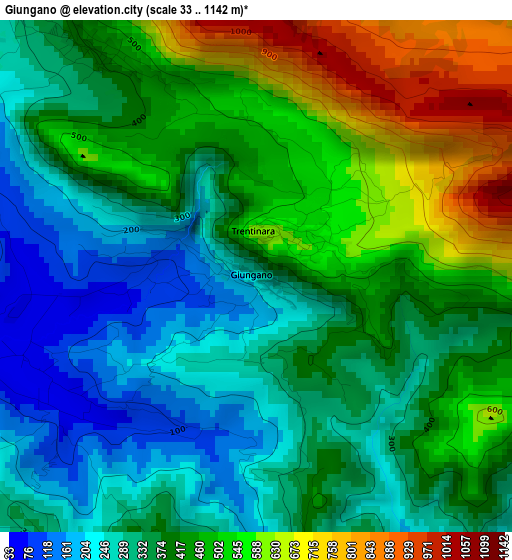
Below is the Elevation map of Giungano, which displays elevation range with different colors. Scale of the first map is from 33 to 1142 m (108 to 3747 ft) with average elevation of 407.2 meters (=1336 ft) [note 1]
These maps also provides idea of topography and contour of this city, they are displayed at different zoom levels. More info about maps, scale and edge coordinates you can find below images.
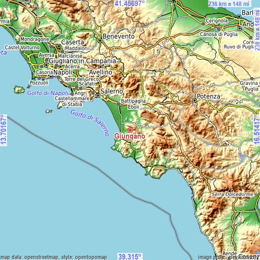
| \ | Map #1 | Topo.Map |
| Scale [m] | 33..1142 m | × |
| Scale [ft] | 108..3747 ft | × |
| Average | 407.2 m = 1336 ft | × |
| Width | 7.44 km = 4.6 mi | 238.2 km = 148 mi |
| Height | 7.44 km = 4.6 mi | 238.2 km = 148 mi |
| ↑Max Latitude | 40.42796° | 41.45697° |
| Latitude at center | 40.3945° | 40.3945° |
| ↓Min Latitude | 40.361023° | 39.315° |
| ← Min Longitude | 15.063975° | 13.70167° |
| Longitude center | 15.10792° | 15.10792° |
| →Max Longitude | 15.151865° | 16.51417° |
Nearby cities:
Cities around Giungano sort by population:
• Licinella-Torre di Paestum elevation 9 m
9.4 km,  278°
278°
• Roccadaspide 390 m
7.7 km,  65°
65°
• Castel San Lorenzo 332 m
10.3 km, 74°
• Capaccio 407 m
4.1 km,  324°
324°
• Ogliastro Cilento 324 m
7.1 km,  227°
227°
• Trentinara 567 m
0.9 km,  46°
46°
• Albanella 223 m
9.5 km,  3°
3°
• Rettifilo-Vannullo 31 m
9.3 km,  312°
312°
• Prignano Cilento 420 m
7.6 km,  206°
206°
• Cicerale 492 m
5.9 km,  161°
161°
• Torchiara 345 m
9.3 km, 209°
• Monteforte Cilento 584 m
8.1 km,  114°
114°
Multilingual:
 En español:
Giungano elevación 232 m.
 En France:
Giungano élévation 232 m.
 Auf Deutsch:
Giungano höhe über dem Meeresspiegel ist 232 m.

Sources and notes:
- [note 1] Map square and city borders are not equal. Map elevation data is calculated only from area inside that square.
- [src 1] Elevation data from geonames database provided with same terms of usage.
- [src 2] The elevation map of Giungano is generated using elevation data from NASA's 3 arcsec (90m) resolution SRTM data.
- [src 3] Base (background) map © OpenStreetMap contributors tiles are generated by Geofabrik and OpenTopoMap.
Copyright & License:
This Giungano Elevation Map is licensed under CC BY-SA. You may reuse any part from this page, if you give a proper credit by linking to this URL:
 More info on terms of use page.