Lamporo elevation
Lamporo (Piedmont, Provincia di Vercelli), Italy elevation is 167 meters and Lamporo elevation in feet is 548 ft above sea level [src 1]. Lamporo is a seat of a third-order administrative division (feature code) with elevation that is 155 meters (509 ft) smaller than average city elevation in Italy.
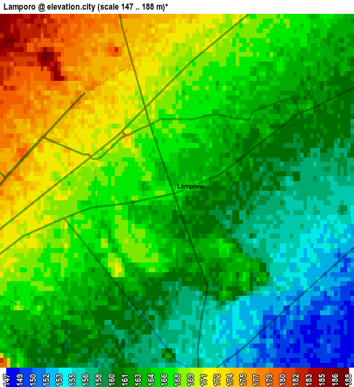
Below is the Elevation map of Lamporo, which displays elevation range with different colors. Scale of the first map is from 147 to 188 m (482 to 617 ft) with average elevation of 164.4 meters (=539 ft) [note 1]
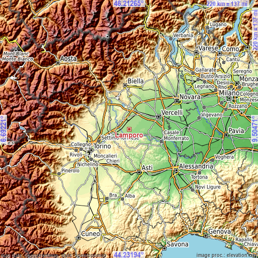
These maps also provides idea of topography and contour of this city, they are displayed at different zoom levels. More info about maps, scale and edge coordinates you can find below images.
| \ | Map #1 | Topo.Map |
| Scale [m] | 147..188 m | × |
| Scale [ft] | 482..617 ft | × |
| Average | 164.4 m = 539 ft | × |
| Width | 6.88 km = 4.3 mi | 220.2 km = 136.8 mi |
| Height | 6.88 km = 4.3 mi | 220.2 km = 136.8 mi |
| ↑Max Latitude | 45.26186° | 46.21265° |
| Latitude at center | 45.23092° | 45.23092° |
| ↓Min Latitude | 45.199963° | 44.23194° |
| ← Min Longitude | 8.054515° | 6.69221° |
| Longitude center | 8.09846° | 8.09846° |
| →Max Longitude | 8.142405° | 9.50471° |
Nearby cities:
Cities around Lamporo sort by population:
• Crescentino elevation 162 m
3.6 km,  195°
195°
• Livorno Ferraris 191 m
6 km,  344°
344°
• Saluggia 194 m
6.6 km,  275°
275°
• Torrazza Piemonte 187 m
9.7 km,  259°
259°
• Cavagnolo 194 m
9.6 km, 203°
• Pomaretto 217 m
9.7 km, 204°
• Bianzè 185 m
8.7 km,  12°
12°
• Verrua Savoia 288 m
8.3 km,  183°
183°
• Fontanetto Po 145 m
8.4 km,  119°
119°
• Brusasco 172 m
8.9 km, 199°
• Valentino 284 m
8.4 km, 182°
• Moncestino 286 m
9.8 km,  149°
149°
Multilingual:
 En español:
Lamporo elevación 167 m.
 En France:
Lamporo élévation 167 m.


Sources and notes:
- [note 1] Map square and city borders are not equal. Map elevation data is calculated only from area inside that square.
- [src 1] Elevation data from geonames database provided with same terms of usage.
- [src 2] The elevation map of Lamporo is generated using elevation data from NASA's 3 arcsec (90m) resolution SRTM data.
- [src 3] Base (background) map © OpenStreetMap contributors tiles are generated by Geofabrik and OpenTopoMap.
Copyright & License:
This Lamporo Elevation Map is licensed under CC BY-SA. You may reuse any part from this page, if you give a proper credit by linking to this URL:
 More info on terms of use page.