Verrua Savoia elevation
Verrua Savoia (Piedmont, Torino), Italy elevation is 288 meters and Verrua Savoia elevation in feet is 945 ft above sea level [src 1]. Verrua Savoia is a seat of a third-order administrative division (feature code) with elevation that is 34 meters (112 ft) smaller than average city elevation in Italy.
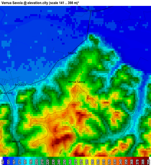
Below is the Elevation map of Verrua Savoia, which displays elevation range with different colors. Scale of the first map is from 141 to 398 m (463 to 1306 ft) with average elevation of 212.3 meters (=697 ft) [note 1]
These maps also provides idea of topography and contour of this city, they are displayed at different zoom levels. More info about maps, scale and edge coordinates you can find below images.
| \ | Map #1 | Topo.Map |
| Scale [m] | 141..398 m | × |
| Scale [ft] | 463..1306 ft | × |
| Average | 212.3 m = 697 ft | × |
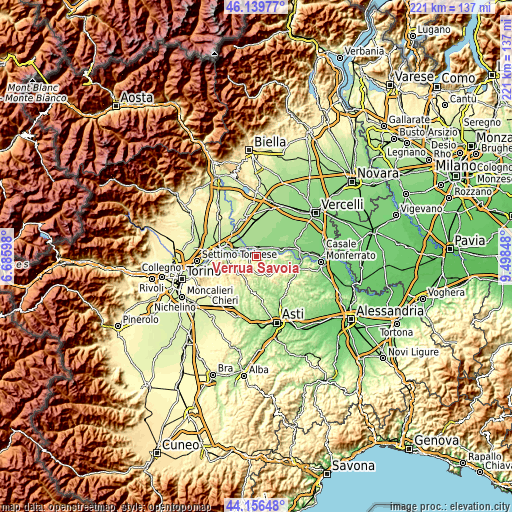
| Width | 6.89 km = 4.3 mi | 220.5 km = 137 mi |
| Height | 6.89 km = 4.3 mi | 220.5 km = 137 mi |
| ↑Max Latitude | 45.18773° | 46.13977° |
| Latitude at center | 45.15675° | 45.15675° |
| ↓Min Latitude | 45.125753° | 44.15648° |
| ← Min Longitude | 8.048285° | 6.68598° |
| Longitude center | 8.09223° | 8.09223° |
| →Max Longitude | 8.136175° | 9.49848° |
Nearby cities:
Cities around Verrua Savoia sort by population:
• Crescentino elevation 162 m
4.8 km,  354°
354°
• Cavagnolo 194 m
3.4 km,  260°
260°
• Pomaretto 217 m
3.6 km, 261°
• Brusasco 172 m
2.5 km,  265°
265°
• Lauriano 168 m
7.7 km, 272°
• Monteu da Po 217 m
6.2 km, 263°
• Brozolo 364 m
4.7 km,  199°
199°
• Valentino 284 m
0.2 km,  134°
134°
• Robella 400 m
6.2 km,  172°
172°
• Moransengo 399 m
7 km,  228°
228°
• Moncestino 286 m
5.4 km,  92°
92°
• Villamiroglio 305 m
6.7 km,  111°
111°
Multilingual:
 En español:
Verrua Savoia elevación 288 m.
 En France:
Verrua Savoia élévation 288 m.
 Auf Deutsch:
Verrua Savoia höhe über dem Meeresspiegel ist 288 m.

Sources and notes:
- [note 1] Map square and city borders are not equal. Map elevation data is calculated only from area inside that square.
- [src 1] Elevation data from geonames database provided with same terms of usage.
- [src 2] The elevation map of Verrua Savoia is generated using elevation data from NASA's 3 arcsec (90m) resolution SRTM data.
- [src 3] Base (background) map © OpenStreetMap contributors tiles are generated by Geofabrik and OpenTopoMap.
Copyright & License:
This Verrua Savoia Elevation Map is licensed under CC BY-SA. You may reuse any part from this page, if you give a proper credit by linking to this URL:
 More info on terms of use page.