Laveno elevation
Laveno (Lombardy, Provincia di Varese), Italy elevation is 201 meters and Laveno elevation in feet is 659 ft above sea level [src 1]. Laveno is a seat of a third-order administrative division (feature code) with elevation that is 121 meters (397 ft) smaller than average city elevation in Italy.
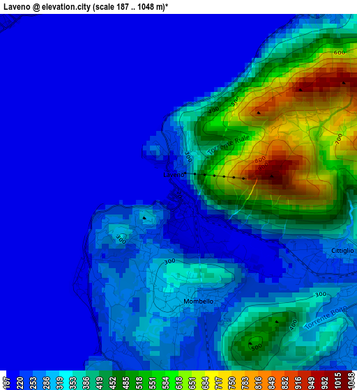
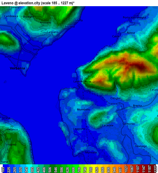
Below is the Elevation map of Laveno, which displays elevation range with different colors. Scale of the first map is from 187 to 1048 m (614 to 3438 ft) with average elevation of 320.8 meters (=1052 ft) [note 1]
These maps also provides idea of topography and contour of this city, they are displayed at different zoom levels. More info about maps, scale and edge coordinates you can find below images.
| \ | Map #1 | Map #2 | Topo.Map |
| Scale [m] | 187..1048 m | 185..1227 m | × |
| Scale [ft] | 614..3438 ft | 607..4026 ft | × |
| Average | 320.8 m = 1052 ft | 327.2 m = 1073 ft | × |
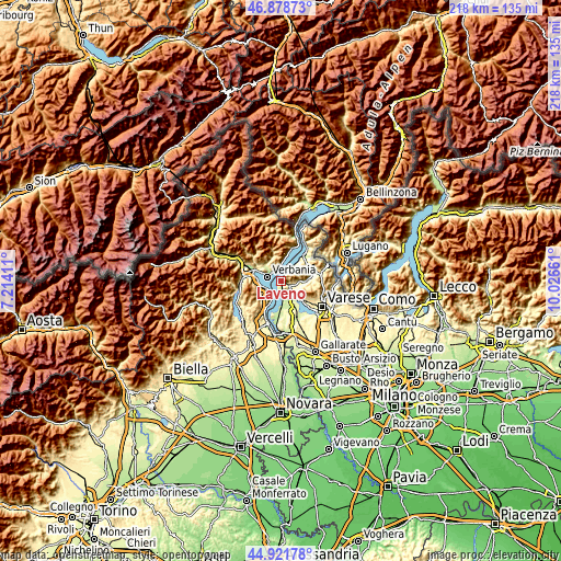
| Width | 6.8 km = 4.2 mi | 13.6 km = 8.5 mi | 217.6 km = 135.2 mi |
| Height | 6.8 km = 4.2 mi | 13.6 km = 8.5 mi | 217.6 km = 135.2 mi |
| ↑Max Latitude | 45.939449° | 45.970001° | 46.87873° |
| Latitude at center | 45.90888° | 45.90888° | 45.90888° |
| ↓Min Latitude | 45.878294° | 45.847692° | 44.92178° |
| ← Min Longitude | 8.576415° | 8.532469° | 7.21411° |
| Longitude center | 8.62036° | 8.62036° | 8.62036° |
| →Max Longitude | 8.664305° | 8.708251° | 10.02661° |
Nearby cities:
Cities around Laveno sort by population:
• Verbania elevation 205 m
5.5 km,  284°
284°
• Pallanza-Intra-Suna 215 m
5 km,  310°
310°
• Cittiglio 247 m
3.8 km,  112°
112°
• Leggiuno 243 m
3.7 km,  179°
179°
• Gemonio 309 m
5.4 km,  128°
128°
• Caravate 255 m
4.3 km,  142°
142°
• Ghiffa 335 m
5.1 km,  345°
345°
• Arizzano 503 m
6.1 km,  331°
331°
• Castelveccana 225 m
5.6 km,  39°
39°
• Monvalle 234 m
5.7 km,  171°
171°
• Brenta 283 m
5.2 km, 108°
• Sangiano 233 m
3.9 km, 165°
Multilingual:
 En español:
Laveno elevación 201 m.
 En France:
Laveno-Mombello élévation 201 m.
 Auf Deutsch:
Laveno-Mombello höhe über dem Meeresspiegel ist 201 m.

Sources and notes:
- [note 1] Map square and city borders are not equal. Map elevation data is calculated only from area inside that square.
- [src 1] Elevation data from geonames database provided with same terms of usage.
- [src 2] The elevation map of Laveno is generated using elevation data from NASA's 3 arcsec (90m) resolution SRTM data.
- [src 3] Base (background) map © OpenStreetMap contributors tiles are generated by Geofabrik and OpenTopoMap.
Copyright & License:
This Laveno Elevation Map is licensed under CC BY-SA. You may reuse any part from this page, if you give a proper credit by linking to this URL:
 More info on terms of use page.