Pallanza-Intra-Suna elevation
Pallanza-Intra-Suna (Piedmont, Provincia Verbano-Cusio-Ossola), Italy elevation is 215 meters and Pallanza-Intra-Suna elevation in feet is 705 ft above sea level [src 1]. Pallanza-Intra-Suna is a seat of a third-order administrative division (feature code) with elevation that is 107 meters (351 ft) smaller than average city elevation in Italy.
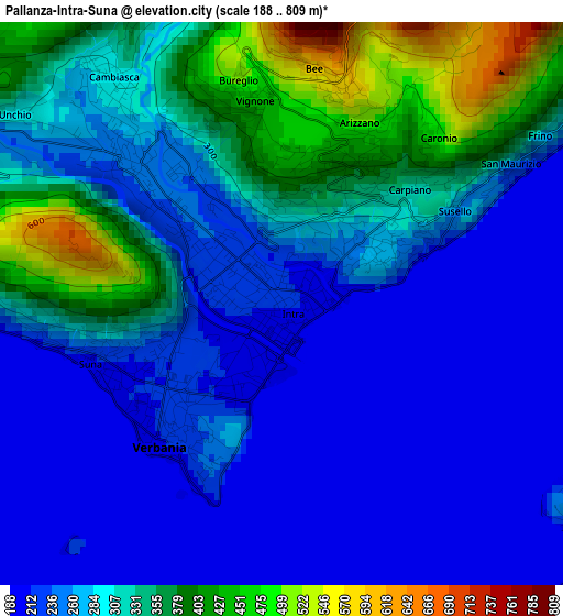
Below is the Elevation map of Pallanza-Intra-Suna, which displays elevation range with different colors. Scale of the first map is from 188 to 809 m (617 to 2654 ft) with average elevation of 286.4 meters (=940 ft) [note 1]
These maps also provides idea of topography and contour of this city, they are displayed at different zoom levels. More info about maps, scale and edge coordinates you can find below images.
| \ | Map #1 | Map #2 | Topo.Map |
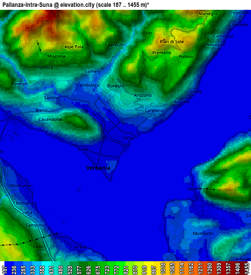
| Scale [m] | 188..809 m | 187..1455 m | × |
| Scale [ft] | 617..2654 ft | 614..4774 ft | × |
| Average | 286.4 m = 940 ft | 397 m = 1302 ft | × |
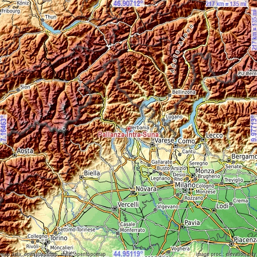
| Width | 6.8 km = 4.2 mi | 13.59 km = 8.4 mi | 217.5 km = 135.1 mi |
| Height | 6.8 km = 4.2 mi | 13.59 km = 8.4 mi | 217.5 km = 135.1 mi |
| ↑Max Latitude | 45.968333° | 45.998869° | 46.90712° |
| Latitude at center | 45.93778° | 45.93778° | 45.93778° |
| ↓Min Latitude | 45.90721° | 45.876624° | 44.95119° |
| ← Min Longitude | 8.526935° | 8.482989° | 7.16463° |
| Longitude center | 8.57088° | 8.57088° | 8.57088° |
| →Max Longitude | 8.614825° | 8.658771° | 9.97713° |
Nearby cities:
Cities around Pallanza-Intra-Suna sort by population:
• Verbania elevation 205 m
2.3 km,  218°
218°
• Laveno 201 m
5 km,  130°
130°
• Ghiffa 335 m
3.1 km,  56°
56°
• Arizzano 503 m
2.4 km,  23°
23°
• San Bernardino Verbano 303 m
4.5 km,  297°
297°
• Cambiasca 304 m
3.4 km,  323°
323°
• Vignone 476 m
2.7 km,  347°
347°
• Bee 597 m
2.9 km,  7°
7°
• Cossogno 390 m
5.6 km, 301°
• Premeno 839 m
4.9 km, 23°
• Santino 299 m
4.5 km, 296°
• Caprezzo 554 m
5 km, 352°
Multilingual:
 En español:
Pallanza-Intra-Suna elevación 215 m.
 En France:
Pallanza-Intra-Suna élévation 215 m.
 Auf Deutsch:
Pallanza-Intra-Suna höhe über dem Meeresspiegel ist 215 m.
 На русском:
Pallanza-Intra-Suna высота над уровнем моря 215 м
Sources and notes:
- [note 1] Map square and city borders are not equal. Map elevation data is calculated only from area inside that square.
- [src 1] Elevation data from geonames database provided with same terms of usage.
- [src 2] The elevation map of Pallanza-Intra-Suna is generated using elevation data from NASA's 3 arcsec (90m) resolution SRTM data.
- [src 3] Base (background) map © OpenStreetMap contributors tiles are generated by Geofabrik and OpenTopoMap.
Copyright & License:
This Pallanza-Intra-Suna Elevation Map is licensed under CC BY-SA. You may reuse any part from this page, if you give a proper credit by linking to this URL:
 More info on terms of use page.