Montemilone elevation
Montemilone (Basilicate, Provincia di Potenza), Italy elevation is 350 meters and Montemilone elevation in feet is 1148 ft above sea level [src 1]. Montemilone is a seat of a third-order administrative division (feature code) with elevation that is 28 meters (92 ft) bigger than average city elevation in Italy.
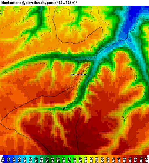
Below is the Elevation map of Montemilone, which displays elevation range with different colors. Scale of the first map is from 169 to 392 m (554 to 1286 ft) with average elevation of 317.4 meters (=1041 ft) [note 1]
These maps also provides idea of topography and contour of this city, they are displayed at different zoom levels. More info about maps, scale and edge coordinates you can find below images.
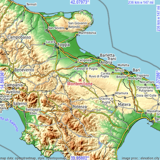
| \ | Map #1 | Topo.Map |
| Scale [m] | 169..392 m | × |
| Scale [ft] | 554..1286 ft | × |
| Average | 317.4 m = 1041 ft | × |
| Width | 7.37 km = 4.6 mi | 235.9 km = 146.6 mi |
| Height | 7.37 km = 4.6 mi | 235.9 km = 146.6 mi |
| ↑Max Latitude | 41.060564° | 42.07973° |
| Latitude at center | 41.02742° | 41.02742° |
| ↓Min Latitude | 40.99426° | 39.95802° |
| ← Min Longitude | 15.922665° | 14.56036° |
| Longitude center | 15.96661° | 15.96661° |
| →Max Longitude | 16.010555° | 17.37286° |
Nearby cities:
Cities around Montemilone sort by population:
• Canosa di Puglia elevation 131 m
23 km,  21°
21°
• Lavello 319 m
15.1 km,  278°
278°
• Venosa 418 m
14.8 km,  240°
240°
• Minervino Murge 374 m
11.2 km,  56°
56°
• Spinazzola 422 m
12.6 km,  124°
124°
• Genzano di Lucania 595 m
20.9 km,  164°
164°
• Palazzo San Gervasio 472 m
10.7 km,  173°
173°
• Forenza 832 m
20.8 km,  206°
206°
• Maschito 594 m
17.5 km,  221°
221°
• Ripacandida 572 m
23.9 km, 237°
• Banzi 566 m
18.9 km, 168°
• Ginestra 572 m
22.2 km, 241°
Multilingual:
 En español:
Montemilone elevación 350 m.
 En France:
Montemilone élévation 350 m.
 Auf Deutsch:
Montemilone höhe über dem Meeresspiegel ist 350 m.

Sources and notes:
- [note 1] Map square and city borders are not equal. Map elevation data is calculated only from area inside that square.
- [src 1] Elevation data from geonames database provided with same terms of usage.
- [src 2] The elevation map of Montemilone is generated using elevation data from NASA's 3 arcsec (90m) resolution SRTM data.
- [src 3] Base (background) map © OpenStreetMap contributors tiles are generated by Geofabrik and OpenTopoMap.
Copyright & License:
This Montemilone Elevation Map is licensed under CC BY-SA. You may reuse any part from this page, if you give a proper credit by linking to this URL:
 More info on terms of use page.