Narni elevation
Narni (Umbria, Provincia di Terni), Italy elevation is 146 meters and Narni elevation in feet is 479 ft above sea level [src 1]. Narni is a seat of a third-order administrative division (feature code) with elevation that is 176 meters (577 ft) smaller than average city elevation in Italy.
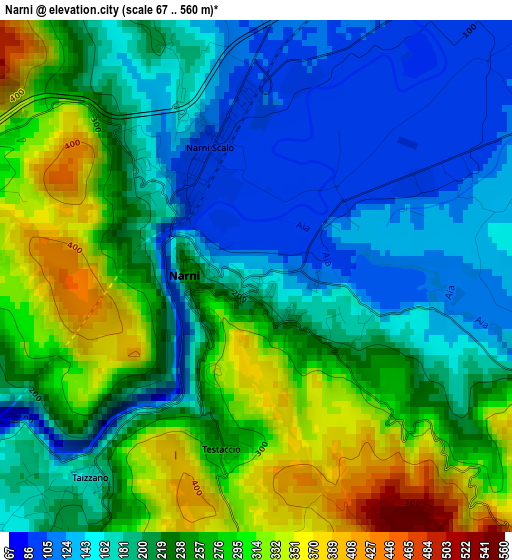
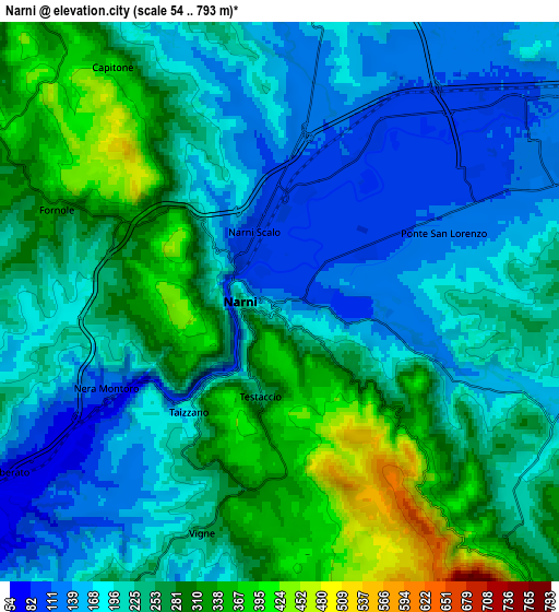
Below is the Elevation map of Narni, which displays elevation range with different colors. Scale of the first map is from 67 to 560 m (220 to 1837 ft) with average elevation of 224.6 meters (=737 ft) [note 1]
These maps also provides idea of topography and contour of this city, they are displayed at different zoom levels. More info about maps, scale and edge coordinates you can find below images.
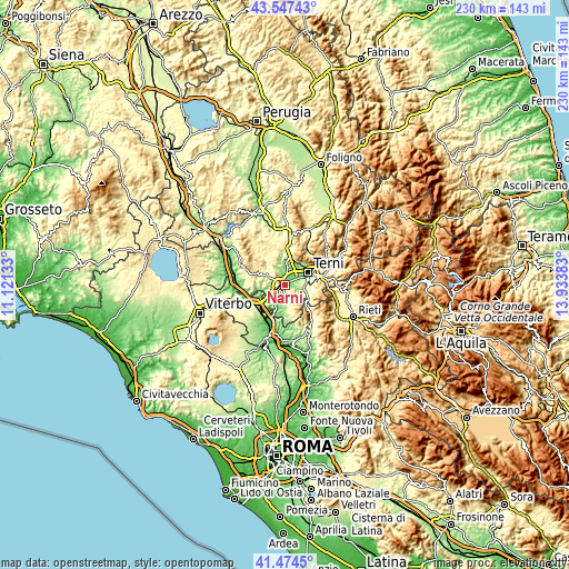
| \ | Map #1 | Map #2 | Topo.Map |
| Scale [m] | 67..560 m | 54..793 m | × |
| Scale [ft] | 220..1837 ft | 177..2602 ft | × |
| Average | 224.6 m = 737 ft | 232.5 m = 763 ft | × |
| Width | 7.2 km = 4.5 mi | 14.41 km = 9 mi | 230.5 km = 143.2 mi |
| Height | 7.2 km = 4.5 mi | 14.41 km = 9 mi | 230.5 km = 143.2 mi |
| ↑Max Latitude | 42.551941° | 42.584306° | 43.54743° |
| Latitude at center | 42.51956° | 42.51956° | 42.51956° |
| ↓Min Latitude | 42.487162° | 42.454747° | 41.4745° |
| ← Min Longitude | 12.483635° | 12.439689° | 11.12133° |
| Longitude center | 12.52758° | 12.52758° | 12.52758° |
| →Max Longitude | 12.571525° | 12.615471° | 13.93383° |
Nearby cities:
Cities around Narni sort by population:
• Terni elevation 127 m
10.7 km,  62°
62°
• Amelia 328 m
9.5 km,  292°
292°
• Narni Scalo 100 m
2.1 km,  334°
334°
• Orte 132 m
13.3 km,  240°
240°
• San Gemini 348 m
10.6 km,  7°
7°
• Orte Scalo 57 m
13.6 km,  226°
226°
• Stroncone 324 m
9.9 km,  94°
94°
• Fornole 332 m
6.4 km, 293°
• Otricoli 191 m
11.7 km,  200°
200°
• Calvi dell'Umbria 399 m
13.2 km,  165°
165°
• Configni 487 m
14.2 km,  137°
137°
• Roman catholic diocese of Terni 163 m
10.5 km, 64°
Multilingual:
 En español:
Narni elevación 146 m.
 En France:
Narni élévation 146 m.


Sources and notes:
- [note 1] Map square and city borders are not equal. Map elevation data is calculated only from area inside that square.
- [src 1] Elevation data from geonames database provided with same terms of usage.
- [src 2] The elevation map of Narni is generated using elevation data from NASA's 3 arcsec (90m) resolution SRTM data.
- [src 3] Base (background) map © OpenStreetMap contributors tiles are generated by Geofabrik and OpenTopoMap.
Copyright & License:
This Narni Elevation Map is licensed under CC BY-SA. You may reuse any part from this page, if you give a proper credit by linking to this URL:
 More info on terms of use page.