Orte elevation
Orte (Latium, Provincia di Viterbo), Italy elevation is 132 meters and Orte elevation in feet is 433 ft above sea level [src 1]. Orte is a seat of a third-order administrative division (feature code) with elevation that is 190 meters (623 ft) smaller than average city elevation in Italy.
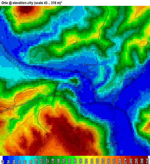
Below is the Elevation map of Orte, which displays elevation range with different colors. Scale of the first map is from 43 to 316 m (141 to 1037 ft) with average elevation of 139.3 meters (=457 ft) [note 1]
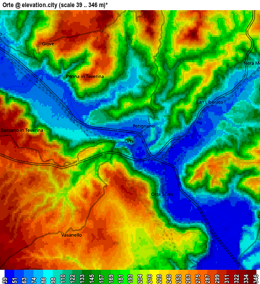
These maps also provides idea of topography and contour of this city, they are displayed at different zoom levels. More info about maps, scale and edge coordinates you can find below images.
| \ | Map #1 | Map #2 | Topo.Map |
| Scale [m] | 43..316 m | 39..346 m | × |
| Scale [ft] | 141..1037 ft | 128..1135 ft | × |
| Average | 139.3 m = 457 ft | 178.4 m = 585 ft | × |
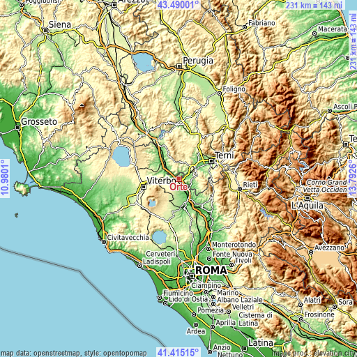
| Width | 7.21 km = 4.5 mi | 14.42 km = 9 mi | 230.7 km = 143.4 mi |
| Height | 7.21 km = 4.5 mi | 14.42 km = 9 mi | 230.7 km = 143.4 mi |
| ↑Max Latitude | 42.493582° | 42.525976° | 43.49001° |
| Latitude at center | 42.46117° | 42.46117° | 42.46117° |
| ↓Min Latitude | 42.428742° | 42.396296° | 41.41515° |
| ← Min Longitude | 12.342405° | 12.298459° | 10.9801° |
| Longitude center | 12.38635° | 12.38635° | 12.38635° |
| →Max Longitude | 12.430295° | 12.474241° | 13.7926° |
Nearby cities:
Cities around Orte sort by population:
• Amelia elevation 328 m
10.5 km,  15°
15°
• Vignanello 383 m
12.7 km,  224°
224°
• Vasanello 266 m
6 km,  211°
211°
• Orte Scalo 57 m
3.4 km,  148°
148°
• Attigliano 88 m
9.6 km,  308°
308°
• Bomarzo 295 m
11.4 km,  282°
282°
• Gallese 149 m
9.8 km,  175°
175°
• Fornole 332 m
10.7 km,  32°
32°
• Giove 296 m
7.1 km,  319°
319°
• Bassano in Teverina 315 m
6.5 km,  273°
273°
• Otricoli 191 m
8.7 km,  121°
121°
• Penna in Teverina 302 m
4.3 km,  327°
327°
Multilingual:
 En español:
Orte elevación 132 m.
 En France:
Orte élévation 132 m.


Sources and notes:
- [note 1] Map square and city borders are not equal. Map elevation data is calculated only from area inside that square.
- [src 1] Elevation data from geonames database provided with same terms of usage.
- [src 2] The elevation map of Orte is generated using elevation data from NASA's 3 arcsec (90m) resolution SRTM data.
- [src 3] Base (background) map © OpenStreetMap contributors tiles are generated by Geofabrik and OpenTopoMap.
Copyright & License:
This Orte Elevation Map is licensed under CC BY-SA. You may reuse any part from this page, if you give a proper credit by linking to this URL:
 More info on terms of use page.