Vasanello elevation
Vasanello (Latium, Provincia di Viterbo), Italy elevation is 266 meters and Vasanello elevation in feet is 873 ft above sea level [src 1]. Vasanello is a seat of a third-order administrative division (feature code) with elevation that is 56 meters (184 ft) smaller than average city elevation in Italy.
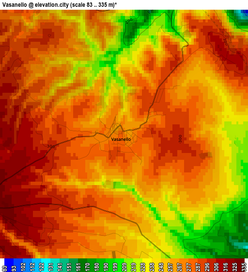
Below is the Elevation map of Vasanello, which displays elevation range with different colors. Scale of the first map is from 83 to 335 m (272 to 1099 ft) with average elevation of 265.3 meters (=870 ft) [note 1]
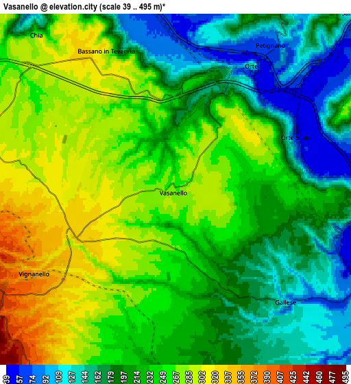
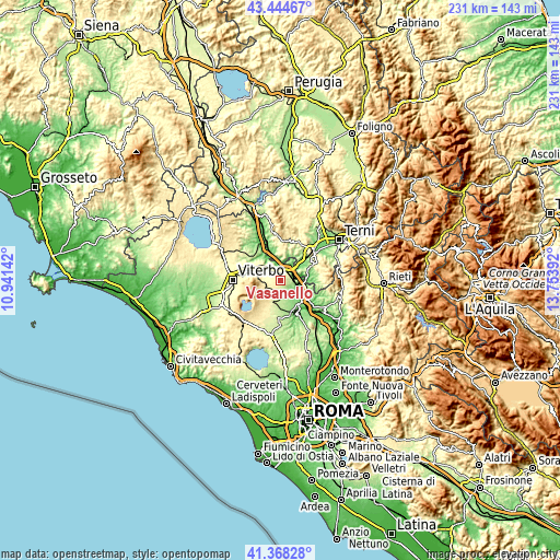
These maps also provides idea of topography and contour of this city, they are displayed at different zoom levels. More info about maps, scale and edge coordinates you can find below images.
| \ | Map #1 | Map #2 | Topo.Map |
| Scale [m] | 83..335 m | 39..495 m | × |
| Scale [ft] | 272..1099 ft | 128..1624 ft | × |
| Average | 265.3 m = 870 ft | 225.9 m = 741 ft | × |
| Width | 7.21 km = 4.5 mi | 14.43 km = 9 mi | 230.9 km = 143.5 mi |
| Height | 7.21 km = 4.5 mi | 14.43 km = 9 mi | 230.9 km = 143.5 mi |
| ↑Max Latitude | 42.447505° | 42.479924° | 43.44467° |
| Latitude at center | 42.41507° | 42.41507° | 42.41507° |
| ↓Min Latitude | 42.382618° | 42.350149° | 41.36828° |
| ← Min Longitude | 12.303725° | 12.259779° | 10.94142° |
| Longitude center | 12.34767° | 12.34767° | 12.34767° |
| →Max Longitude | 12.391615° | 12.435561° | 13.75392° |
Nearby cities:
Cities around Vasanello sort by population:
• Soriano nel Cimino elevation 472 m
9.3 km,  272°
272°
• Fabrica di Roma 273 m
9.8 km,  204°
204°
• Vignanello 383 m
7 km,  234°
234°
• Orte 132 m
6 km,  31°
31°
• Orte Scalo 57 m
5.4 km,  66°
66°
• Canepina 538 m
10.2 km,  249°
249°
• Corchiano 204 m
7.8 km,  174°
174°
• Vallerano 414 m
7.9 km,  243°
243°
• Gallese 149 m
6.1 km,  138°
138°
• Giove 296 m
10.6 km,  352°
352°
• Bassano in Teverina 315 m
6.4 km,  329°
329°
• Penna in Teverina 302 m
8.8 km,  5°
5°
Multilingual:
 En español:
Vasanello elevación 266 m.
 En France:
Vasanello élévation 266 m.
 Auf Deutsch:
Vasanello höhe über dem Meeresspiegel ist 266 m.

Sources and notes:
- [note 1] Map square and city borders are not equal. Map elevation data is calculated only from area inside that square.
- [src 1] Elevation data from geonames database provided with same terms of usage.
- [src 2] The elevation map of Vasanello is generated using elevation data from NASA's 3 arcsec (90m) resolution SRTM data.
- [src 3] Base (background) map © OpenStreetMap contributors tiles are generated by Geofabrik and OpenTopoMap.
Copyright & License:
This Vasanello Elevation Map is licensed under CC BY-SA. You may reuse any part from this page, if you give a proper credit by linking to this URL:
 More info on terms of use page.