Novello elevation
Novello (Piedmont, Provincia di Cuneo), Italy elevation is 438 meters and Novello elevation in feet is 1437 ft above sea level [src 1]. Novello is a seat of a third-order administrative division (feature code) with elevation that is 116 meters (381 ft) bigger than average city elevation in Italy.
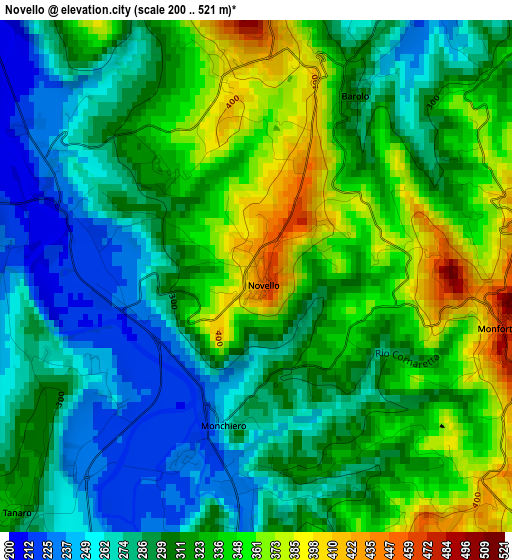
Below is the Elevation map of Novello, which displays elevation range with different colors. Scale of the first map is from 200 to 521 m (656 to 1709 ft) with average elevation of 310.9 meters (=1020 ft) [note 1]
These maps also provides idea of topography and contour of this city, they are displayed at different zoom levels. More info about maps, scale and edge coordinates you can find below images.
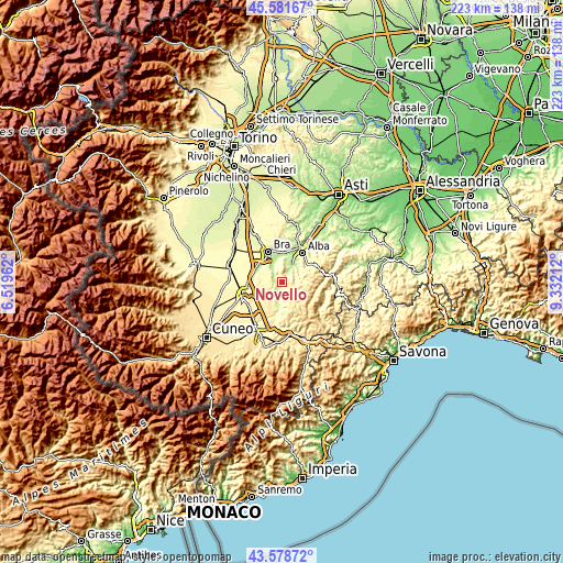
| \ | Map #1 | Topo.Map |
| Scale [m] | 200..521 m | × |
| Scale [ft] | 656..1709 ft | × |
| Average | 310.9 m = 1020 ft | × |
| Width | 6.96 km = 4.3 mi | 222.7 km = 138.4 mi |
| Height | 6.96 km = 4.3 mi | 222.7 km = 138.4 mi |
| ↑Max Latitude | 44.620108° | 45.58167° |
| Latitude at center | 44.58882° | 44.58882° |
| ↓Min Latitude | 44.557515° | 43.57872° |
| ← Min Longitude | 7.881925° | 6.51962° |
| Longitude center | 7.92587° | 7.92587° |
| →Max Longitude | 7.969815° | 9.33212° |
Nearby cities:
Cities around Novello sort by population:
• Dogliani elevation 289 m
6.4 km,  166°
166°
• Cherasco 289 m
8.1 km,  318°
318°
• Narzole 328 m
4.7 km,  277°
277°
• Monforte d'Alba 471 m
3.4 km,  101°
101°
• La Morra 480 m
5.5 km,  4°
4°
• Barolo 298 m
2.8 km,  28°
28°
• Lequio Tanaro 329 m
4.7 km,  227°
227°
• Monchiero Borgonuovo 259 m
2.1 km,  192°
192°
• Castiglione Falletto 337 m
5.4 km,  46°
46°
• Serralunga d'Alba 385 m
6.3 km,  67°
67°
• Sinio 327 m
7.6 km,  80°
80°
• Roddino 594 m
7.6 km, 102°
Multilingual:
 En español:
Novello elevación 438 m.
 En France:
Novello élévation 438 m.


Sources and notes:
- [note 1] Map square and city borders are not equal. Map elevation data is calculated only from area inside that square.
- [src 1] Elevation data from geonames database provided with same terms of usage.
- [src 2] The elevation map of Novello is generated using elevation data from NASA's 3 arcsec (90m) resolution SRTM data.
- [src 3] Base (background) map © OpenStreetMap contributors tiles are generated by Geofabrik and OpenTopoMap.
Copyright & License:
This Novello Elevation Map is licensed under CC BY-SA. You may reuse any part from this page, if you give a proper credit by linking to this URL:
 More info on terms of use page.