Perugia elevation
Perugia (Umbria, Provincia di Perugia), Italy elevation is 482 meters and Perugia elevation in feet is 1581 ft above sea level [src 1]. Perugia is a seat of a first-order administrative division (feature code) with elevation that is 160 meters (525 ft) bigger than average city elevation in Italy.
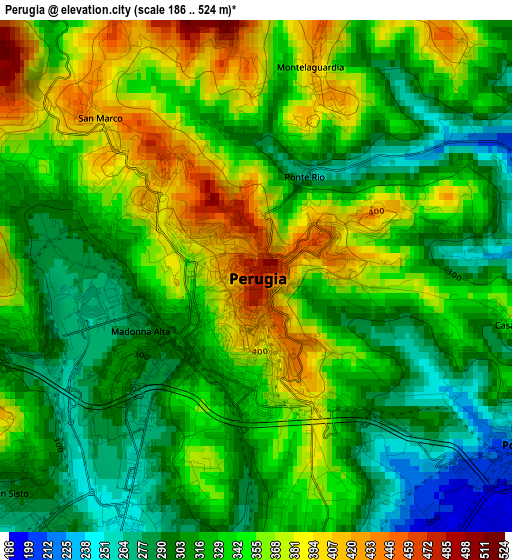
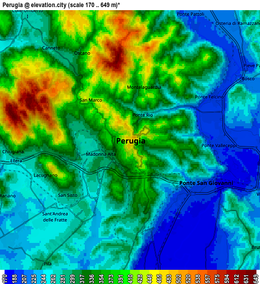
Below is the Elevation map of Perugia, which displays elevation range with different colors. Scale of the first map is from 186 to 524 m (610 to 1719 ft) with average elevation of 333 meters (=1093 ft) [note 1]
These maps also provides idea of topography and contour of this city, they are displayed at different zoom levels. More info about maps, scale and edge coordinates you can find below images.
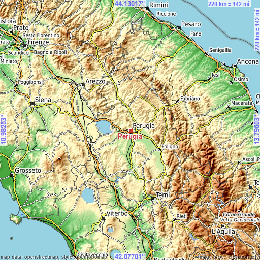
| \ | Map #1 | Map #2 | Topo.Map |
| Scale [m] | 186..524 m | 170..649 m | × |
| Scale [ft] | 610..1719 ft | 558..2129 ft | × |
| Average | 333 m = 1093 ft | 307.7 m = 1010 ft | × |
| Width | 7.13 km = 4.4 mi | 14.27 km = 8.9 mi | 228.3 km = 141.9 mi |
| Height | 7.13 km = 4.4 mi | 14.27 km = 8.9 mi | 228.3 km = 141.9 mi |
| ↑Max Latitude | 43.144272° | 43.176328° | 44.13017° |
| Latitude at center | 43.1122° | 43.1122° | 43.1122° |
| ↓Min Latitude | 43.080111° | 43.048005° | 42.07701° |
| ← Min Longitude | 12.344835° | 12.300889° | 10.98253° |
| Longitude center | 12.38878° | 12.38878° | 12.38878° |
| →Max Longitude | 12.432725° | 12.476671° | 13.79503° |
Nearby cities:
Cities around Perugia sort by population:
• Chiugiana-La Commenda elevation 247 m
6.7 km,  256°
256°
• Ponte Felcino 203 m
5.3 km,  67°
67°
• Colombella 273 m
8.8 km,  59°
59°
• San Martino in Campo 176 m
8.5 km,  172°
172°
• Ponte Pattoli 210 m
8 km,  23°
23°
• Pila 290 m
8.2 km,  216°
216°
• Via Lippia 216 m
8 km,  111°
111°
• Casa del Diavolo 237 m
9.7 km,  30°
30°
• Oscano 293 m
6.6 km,  321°
321°
• Lacugnano 322 m
5 km,  247°
247°
• Corciano 395 m
8.5 km,  282°
282°
• bishopric of Perugia 395 m
0 km, 26°
Multilingual:
 En español:
Perugia elevación 482 m.
 En France:
Pérouse élévation 482 m.


Sources and notes:
- [note 1] Map square and city borders are not equal. Map elevation data is calculated only from area inside that square.
- [src 1] Elevation data from geonames database provided with same terms of usage.
- [src 2] The elevation map of Perugia is generated using elevation data from NASA's 3 arcsec (90m) resolution SRTM data.
- [src 3] Base (background) map © OpenStreetMap contributors tiles are generated by Geofabrik and OpenTopoMap.
Copyright & License:
This Perugia Elevation Map is licensed under CC BY-SA. You may reuse any part from this page, if you give a proper credit by linking to this URL:
 More info on terms of use page.