Poggiodomo elevation
Poggiodomo (Umbria, Provincia di Perugia), Italy elevation is 985 meters and Poggiodomo elevation in feet is 3232 ft above sea level [src 1]. Poggiodomo is a seat of a third-order administrative division (feature code) with elevation that is 663 meters (2175 ft) bigger than average city elevation in Italy.
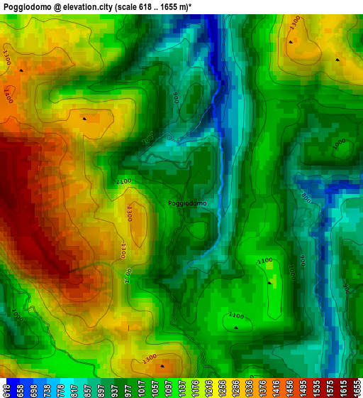
Below is the Elevation map of Poggiodomo, which displays elevation range with different colors. Scale of the first map is from 618 to 1655 m (2028 to 5430 ft) with average elevation of 1088.7 meters (=3572 ft) [note 1]
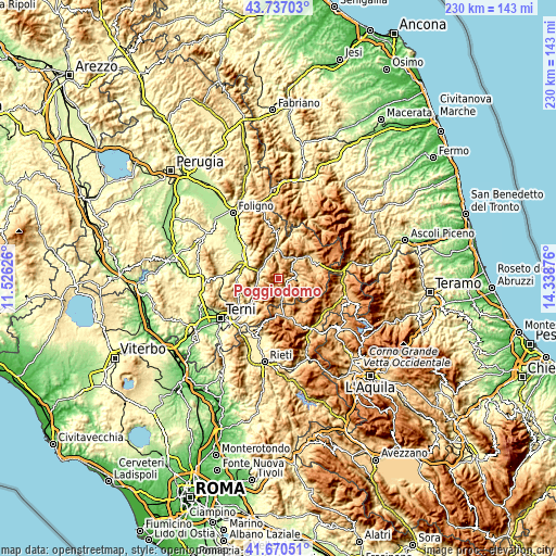
These maps also provides idea of topography and contour of this city, they are displayed at different zoom levels. More info about maps, scale and edge coordinates you can find below images.
| \ | Map #1 | Topo.Map |
| Scale [m] | 618..1655 m | × |
| Scale [ft] | 2028..5430 ft | × |
| Average | 1088.7 m = 3572 ft | × |
| Width | 7.18 km = 4.5 mi | 229.8 km = 142.8 mi |
| Height | 7.18 km = 4.5 mi | 229.8 km = 142.8 mi |
| ↑Max Latitude | 42.744651° | 43.73703° |
| Latitude at center | 42.71237° | 42.71237° |
| ↓Min Latitude | 42.680072° | 41.67051° |
| ← Min Longitude | 12.888565° | 11.52626° |
| Longitude center | 12.93251° | 12.93251° |
| →Max Longitude | 12.976455° | 14.33876° |
Nearby cities:
Cities around Poggiodomo sort by population:
• Spoleto elevation 326 m
16.1 km,  281°
281°
• Norcia 604 m
16 km,  56°
56°
• San Giacomo 250 m
17.3 km,  301°
301°
• Cascia 618 m
6.9 km,  84°
84°
• Ferentillo 247 m
15.7 km,  229°
229°
• Leonessa 953 m
16.1 km,  172°
172°
• Cerreto di Spoleto 551 m
12.2 km,  355°
355°
• Monteleone di Spoleto 944 m
7.1 km, 167°
• Scheggino 282 m
8.4 km,  270°
270°
• Sant'Anatolia di Narco 337 m
8.2 km,  286°
286°
• Polino 838 m
16 km,  206°
206°
• Meggiano 451 m
7.3 km,  310°
310°
Multilingual:
 En español:
Poggiodomo elevación 985 m.
 En France:
Poggiodomo élévation 985 m.
 Auf Deutsch:
Poggiodomo höhe über dem Meeresspiegel ist 985 m.

Sources and notes:
- [note 1] Map square and city borders are not equal. Map elevation data is calculated only from area inside that square.
- [src 1] Elevation data from geonames database provided with same terms of usage.
- [src 2] The elevation map of Poggiodomo is generated using elevation data from NASA's 3 arcsec (90m) resolution SRTM data.
- [src 3] Base (background) map © OpenStreetMap contributors tiles are generated by Geofabrik and OpenTopoMap.
Copyright & License:
This Poggiodomo Elevation Map is licensed under CC BY-SA. You may reuse any part from this page, if you give a proper credit by linking to this URL:
 More info on terms of use page.