Sava elevation
Sava (Apulia, Provincia di Taranto), Italy elevation is 111 meters and Sava elevation in feet is 364 ft above sea level [src 1]. Sava is a seat of a third-order administrative division (feature code) with elevation that is 211 meters (692 ft) smaller than average city elevation in Italy.
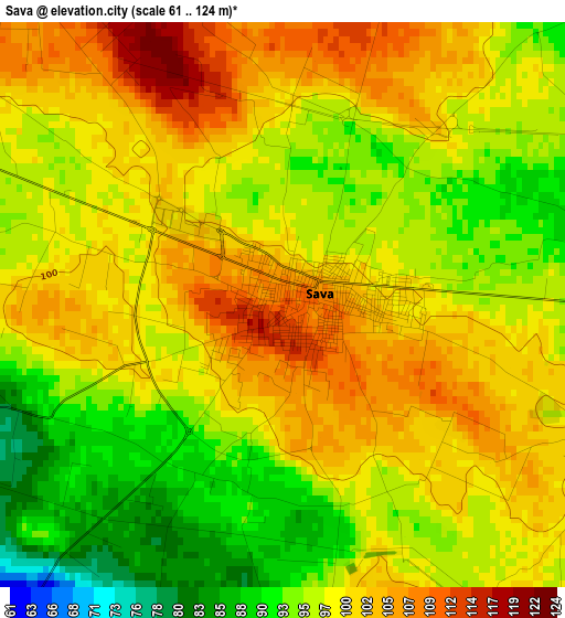
Below is the Elevation map of Sava, which displays elevation range with different colors. Scale of the first map is from 61 to 124 m (200 to 407 ft) with average elevation of 98.4 meters (=323 ft) [note 1]
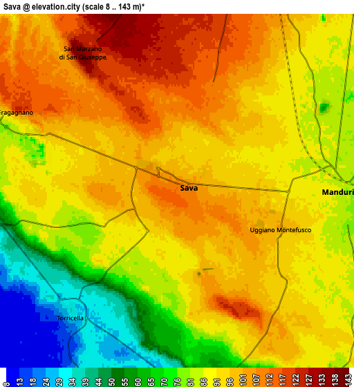
These maps also provides idea of topography and contour of this city, they are displayed at different zoom levels. More info about maps, scale and edge coordinates you can find below images.
| \ | Map #1 | Map #2 | Topo.Map |
| Scale [m] | 61..124 m | 8..143 m | × |
| Scale [ft] | 200..407 ft | 26..469 ft | × |
| Average | 98.4 m = 323 ft | 88.5 m = 290 ft | × |
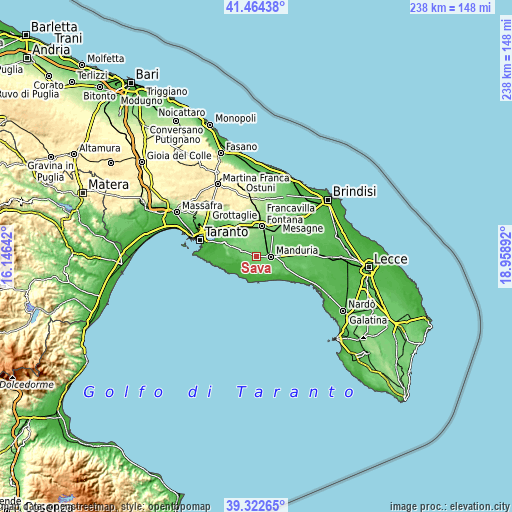
| Width | 7.44 km = 4.6 mi | 14.88 km = 9.2 mi | 238.1 km = 147.9 mi |
| Height | 7.44 km = 4.6 mi | 14.88 km = 9.2 mi | 238.1 km = 147.9 mi |
| ↑Max Latitude | 40.435487° | 40.468927° | 41.46438° |
| Latitude at center | 40.40203° | 40.40203° | 40.40203° |
| ↓Min Latitude | 40.368557° | 40.335067° | 39.32265° |
| ← Min Longitude | 17.508725° | 17.464779° | 16.14642° |
| Longitude center | 17.55267° | 17.55267° | 17.55267° |
| →Max Longitude | 17.596615° | 17.640561° | 18.95892° |
Nearby cities:
Cities around Sava sort by population:
• Francavilla Fontana elevation 146 m
14.6 km,  10°
10°
• Manduria 86 m
7.2 km,  92°
92°
• Oria 147 m
13.3 km,  34°
34°
• Lizzano 55 m
9.1 km,  263°
263°
• San Marzano di San Giuseppe 134 m
7.2 km,  324°
324°
• Fragagnano 101 m
7.2 km,  295°
295°
• Maruggio 29 m
9.2 km,  170°
170°
• Faggiano 58 m
14 km,  276°
276°
• Torricella 27 m
7 km,  221°
221°
• Monteparano 129 m
12.7 km,  291°
291°
• Roccaforzata 136 m
14.3 km, 285°
• Uggiano Montefusco 97 m
4.7 km,  111°
111°
Multilingual:
 En español:
Sava elevación 111 m.
 En France:
Sava élévation 111 m.


Sources and notes:
- [note 1] Map square and city borders are not equal. Map elevation data is calculated only from area inside that square.
- [src 1] Elevation data from geonames database provided with same terms of usage.
- [src 2] The elevation map of Sava is generated using elevation data from NASA's 3 arcsec (90m) resolution SRTM data.
- [src 3] Base (background) map © OpenStreetMap contributors tiles are generated by Geofabrik and OpenTopoMap.
Copyright & License:
This Sava Elevation Map is licensed under CC BY-SA. You may reuse any part from this page, if you give a proper credit by linking to this URL:
 More info on terms of use page.