Teano elevation
Teano (Campania, Provincia di Caserta), Italy elevation is 208 meters and Teano elevation in feet is 682 ft above sea level [src 1]. Teano is a seat of a third-order administrative division (feature code) with elevation that is 114 meters (374 ft) smaller than average city elevation in Italy.
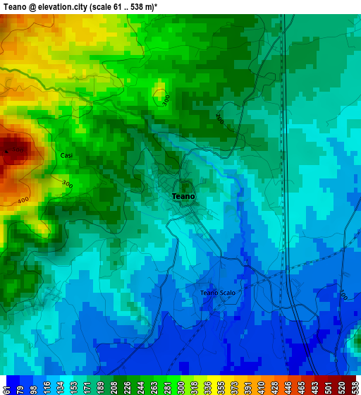
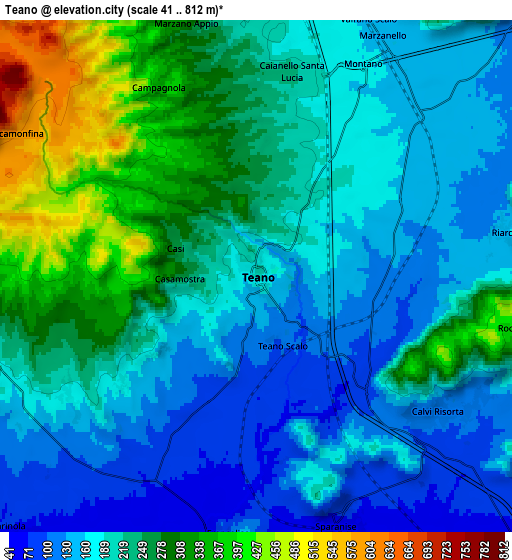
Below is the Elevation map of Teano, which displays elevation range with different colors. Scale of the first map is from 61 to 538 m (200 to 1765 ft) with average elevation of 189.2 meters (=621 ft) [note 1]
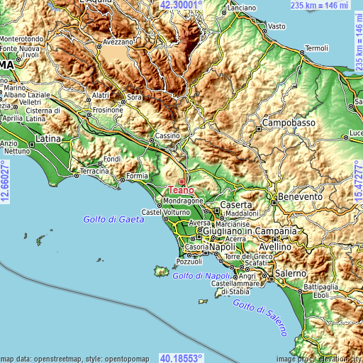
These maps also provides idea of topography and contour of this city, they are displayed at different zoom levels. More info about maps, scale and edge coordinates you can find below images.
| \ | Map #1 | Map #2 | Topo.Map |
| Scale [m] | 61..538 m | 41..812 m | × |
| Scale [ft] | 200..1765 ft | 135..2664 ft | × |
| Average | 189.2 m = 621 ft | 215.8 m = 708 ft | × |
| Width | 7.35 km = 4.6 mi | 14.69 km = 9.1 mi | 235.1 km = 146.1 mi |
| Height | 7.35 km = 4.6 mi | 14.69 km = 9.1 mi | 235.1 km = 146.1 mi |
| ↑Max Latitude | 41.284351° | 41.317365° | 42.30001° |
| Latitude at center | 41.25132° | 41.25132° | 41.25132° |
| ↓Min Latitude | 41.218272° | 41.185208° | 40.18553° |
| ← Min Longitude | 14.022575° | 13.978629° | 12.66027° |
| Longitude center | 14.06652° | 14.06652° | 14.06652° |
| →Max Longitude | 14.110465° | 14.154411° | 15.47277° |
Nearby cities:
Cities around Teano sort by population:
• Sparanise elevation 68 m
7.5 km,  160°
160°
• Zuni 118 m
6.6 km,  125°
125°
• Calvi Risorta 110 m
6.7 km, 126°
• Marzano Appio 296 m
7.6 km,  346°
346°
• Marzanello 149 m
8.2 km,  30°
30°
• Caianello 202 m
6.2 km,  14°
14°
• Riardo 136 m
7.1 km,  80°
80°
• Casale 178 m
6.4 km,  236°
236°
• Grottola 315 m
7.6 km,  343°
343°
• Santa Lucia 223 m
6 km, 10°
• Francolise 95 m
7.4 km,  186°
186°
• Rocchetta 440 m
7.8 km,  101°
101°
Multilingual:
 En español:
Teano elevación 208 m.
 En France:
Teano élévation 208 m.


Sources and notes:
- [note 1] Map square and city borders are not equal. Map elevation data is calculated only from area inside that square.
- [src 1] Elevation data from geonames database provided with same terms of usage.
- [src 2] The elevation map of Teano is generated using elevation data from NASA's 3 arcsec (90m) resolution SRTM data.
- [src 3] Base (background) map © OpenStreetMap contributors tiles are generated by Geofabrik and OpenTopoMap.
Copyright & License:
This Teano Elevation Map is licensed under CC BY-SA. You may reuse any part from this page, if you give a proper credit by linking to this URL:
 More info on terms of use page.