Zuni elevation
Zuni (Campania, Provincia di Caserta), Italy elevation is 118 meters and Zuni elevation in feet is 387 ft above sea level [src 1]. Zuni is a seat of a third-order administrative division (feature code) with elevation that is 204 meters (669 ft) smaller than average city elevation in Italy.
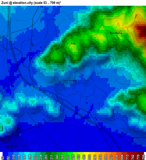
Below is the Elevation map of Zuni, which displays elevation range with different colors. Scale of the first map is from 53 to 799 m (174 to 2621 ft) with average elevation of 168.1 meters (=552 ft) [note 1]
These maps also provides idea of topography and contour of this city, they are displayed at different zoom levels. More info about maps, scale and edge coordinates you can find below images.
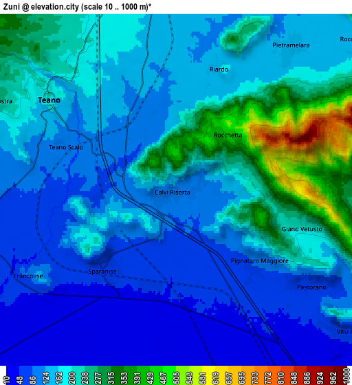
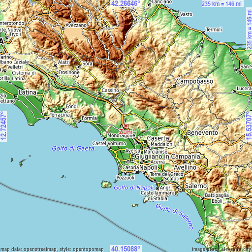
| \ | Map #1 | Map #2 | Topo.Map |
| Scale [m] | 53..799 m | 10..1000 m | × |
| Scale [ft] | 174..2621 ft | 33..3281 ft | × |
| Average | 168.1 m = 552 ft | 166.7 m = 547 ft | × |
| Width | 7.35 km = 4.6 mi | 14.7 km = 9.1 mi | 235.2 km = 146.1 mi |
| Height | 7.35 km = 4.6 mi | 14.7 km = 9.1 mi | 235.2 km = 146.1 mi |
| ↑Max Latitude | 41.250268° | 41.283299° | 42.26646° |
| Latitude at center | 41.21722° | 41.21722° | 41.21722° |
| ↓Min Latitude | 41.184155° | 41.151074° | 40.15088° |
| ← Min Longitude | 14.086875° | 14.042929° | 12.72457° |
| Longitude center | 14.13082° | 14.13082° | 14.13082° |
| →Max Longitude | 14.174765° | 14.218711° | 15.53707° |
Nearby cities:
Cities around Zuni sort by population:
• Sparanise elevation 68 m
4.4 km,  221°
221°
• Pignataro Maggiore 89 m
4.4 km,  132°
132°
• Calvi Risorta 110 m
0.1 km,  176°
176°
• Teano 208 m
6.6 km,  305°
305°
• Pietramelara 141 m
7.6 km,  38°
38°
• Pastorano 73 m
6.9 km, 125°
• Camigliano 79 m
7.7 km,  121°
121°
• Riardo 136 m
5.2 km,  18°
18°
• Giano Vetusto 203 m
5.5 km,  107°
107°
• Pozzillo 214 m
5.6 km, 105°
• Francolise 95 m
7.2 km,  239°
239°
• Rocchetta 440 m
3.2 km,  45°
45°
Multilingual:
 En español:
Zuni elevación 118 m.
 En France:
Zuni élévation 118 m.


Sources and notes:
- [note 1] Map square and city borders are not equal. Map elevation data is calculated only from area inside that square.
- [src 1] Elevation data from geonames database provided with same terms of usage.
- [src 2] The elevation map of Zuni is generated using elevation data from NASA's 3 arcsec (90m) resolution SRTM data.
- [src 3] Base (background) map © OpenStreetMap contributors tiles are generated by Geofabrik and OpenTopoMap.
Copyright & License:
This Zuni Elevation Map is licensed under CC BY-SA. You may reuse any part from this page, if you give a proper credit by linking to this URL:
 More info on terms of use page.