Torrebelvicino elevation
Torrebelvicino (Veneto, Provincia di Vicenza), Italy elevation is 245 meters and Torrebelvicino elevation in feet is 804 ft above sea level [src 1]. Torrebelvicino is a seat of a third-order administrative division (feature code) with elevation that is 77 meters (253 ft) smaller than average city elevation in Italy.
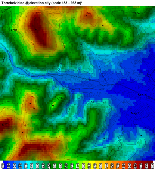
Below is the Elevation map of Torrebelvicino, which displays elevation range with different colors. Scale of the first map is from 183 to 963 m (600 to 3159 ft) with average elevation of 441.5 meters (=1448 ft) [note 1]
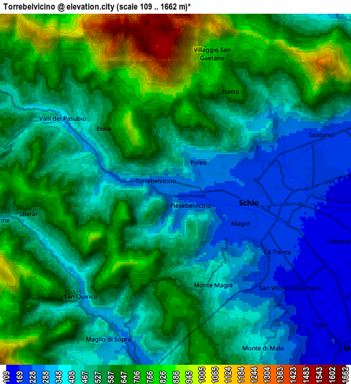
These maps also provides idea of topography and contour of this city, they are displayed at different zoom levels. More info about maps, scale and edge coordinates you can find below images.
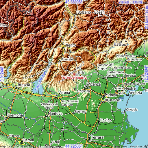
| \ | Map #1 | Map #2 | Topo.Map |
| Scale [m] | 183..963 m | 109..1662 m | × |
| Scale [ft] | 600..3159 ft | 358..5453 ft | × |
| Average | 441.5 m = 1448 ft | 535.7 m = 1758 ft | × |
| Width | 6.82 km = 4.2 mi | 13.65 km = 8.5 mi | 218.3 km = 135.6 mi |
| Height | 6.82 km = 4.2 mi | 13.65 km = 8.5 mi | 218.3 km = 135.6 mi |
| ↑Max Latitude | 45.746505° | 45.777163° | 46.68908° |
| Latitude at center | 45.71583° | 45.71583° | 45.71583° |
| ↓Min Latitude | 45.685138° | 45.65443° | 44.72533° |
| ← Min Longitude | 11.274745° | 11.230799° | 9.91244° |
| Longitude center | 11.31869° | 11.31869° | 11.31869° |
| →Max Longitude | 11.362635° | 11.406581° | 12.72494° |
Nearby cities:
Cities around Torrebelvicino sort by population:
• Schio elevation 199 m
3 km,  96°
96°
• Valdagno 269 m
8 km,  191°
191°
• Marano Vicentino 137 m
9.1 km, 104°
• Santorso 206 m
5.7 km,  69°
69°
• Recoaro Terme 456 m
7.6 km,  259°
259°
• San Vito di Leguzzano 153 m
6.4 km,  122°
122°
• Velo d'Astico 347 m
8.9 km,  25°
25°
• San Quirico 332 m
5.6 km,  219°
219°
• Giavenale 156 m
6.6 km,  105°
105°
• Valli del Pasubio 339 m
5.1 km,  302°
302°
• Monte di Malo 377 m
7 km,  151°
151°
• Velo 327 m
9 km,  24°
24°
Multilingual:
 En español:
Torrebelvicino elevación 245 m.
 En France:
Torrebelvicino élévation 245 m.
 Auf Deutsch:
Torrebelvicino höhe über dem Meeresspiegel ist 245 m.

Sources and notes:
- [note 1] Map square and city borders are not equal. Map elevation data is calculated only from area inside that square.
- [src 1] Elevation data from geonames database provided with same terms of usage.
- [src 2] The elevation map of Torrebelvicino is generated using elevation data from NASA's 3 arcsec (90m) resolution SRTM data.
- [src 3] Base (background) map © OpenStreetMap contributors tiles are generated by Geofabrik and OpenTopoMap.
Copyright & License:
This Torrebelvicino Elevation Map is licensed under CC BY-SA. You may reuse any part from this page, if you give a proper credit by linking to this URL:
 More info on terms of use page.