Treia elevation
Treia (The Marches, Provincia di Macerata), Italy elevation is 262 meters and Treia elevation in feet is 860 ft above sea level [src 1]. Treia is a seat of a third-order administrative division (feature code) with elevation that is 60 meters (197 ft) smaller than average city elevation in Italy.
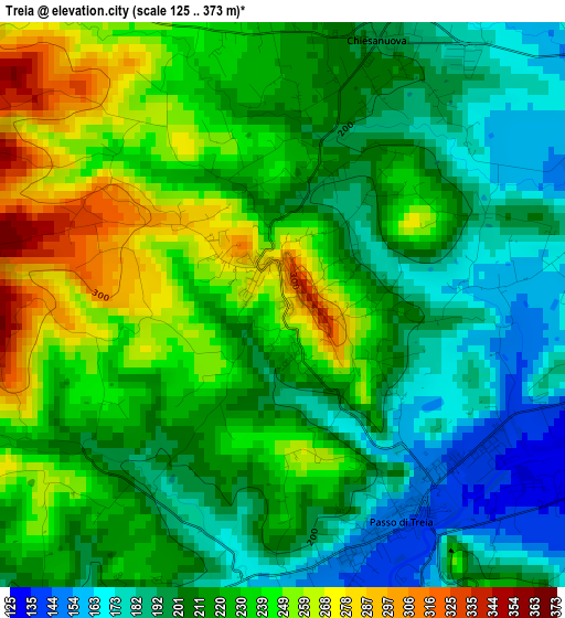
Below is the Elevation map of Treia, which displays elevation range with different colors. Scale of the first map is from 125 to 373 m (410 to 1224 ft) with average elevation of 218.4 meters (=717 ft) [note 1]
These maps also provides idea of topography and contour of this city, they are displayed at different zoom levels. More info about maps, scale and edge coordinates you can find below images.
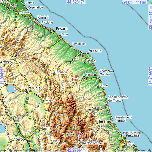
| \ | Map #1 | Topo.Map |
| Scale [m] | 125..373 m | × |
| Scale [ft] | 410..1224 ft | × |
| Average | 218.4 m = 717 ft | × |
| Width | 7.11 km = 4.4 mi | 227.6 km = 141.4 mi |
| Height | 7.11 km = 4.4 mi | 227.5 km = 141.4 mi |
| ↑Max Latitude | 43.340469° | 44.32317° |
| Latitude at center | 43.3085° | 43.3085° |
| ↓Min Latitude | 43.276514° | 42.27661° |
| ← Min Longitude | 13.266415° | 11.90411° |
| Longitude center | 13.31036° | 13.31036° |
| →Max Longitude | 13.354305° | 14.71661° |
Nearby cities:
Cities around Treia sort by population:
• Macerata elevation 276 m
11.6 km,  95°
95°
• Tolentino 231 m
11.2 km,  190°
190°
• Cingoli 593 m
11.2 km,  312°
312°
• Appignano 198 m
6.7 km,  26°
26°
• Passo di Treia 146 m
3 km,  143°
143°
• Sforzacosta 133 m
10.8 km,  122°
122°
• Montecassiano 187 m
12.2 km,  58°
58°
• Villa Potenza 94 m
9.5 km,  81°
81°
• Pollenza 339 m
5.6 km,  147°
147°
• Casette Verdini 150 m
9.8 km,  130°
130°
• Strada 307 m
12.8 km,  325°
325°
• Troviggiano 252 m
9.2 km, 328°
Multilingual:
 En español:
Treia elevación 262 m.
 En France:
Treia élévation 262 m.


Sources and notes:
- [note 1] Map square and city borders are not equal. Map elevation data is calculated only from area inside that square.
- [src 1] Elevation data from geonames database provided with same terms of usage.
- [src 2] The elevation map of Treia is generated using elevation data from NASA's 3 arcsec (90m) resolution SRTM data.
- [src 3] Base (background) map © OpenStreetMap contributors tiles are generated by Geofabrik and OpenTopoMap.
Copyright & License:
This Treia Elevation Map is licensed under CC BY-SA. You may reuse any part from this page, if you give a proper credit by linking to this URL:
 More info on terms of use page.