Trino elevation
Trino (Piedmont, Provincia di Vercelli), Italy elevation is 136 meters and Trino elevation in feet is 446 ft above sea level [src 1]. Trino is a seat of a third-order administrative division (feature code) with elevation that is 186 meters (610 ft) smaller than average city elevation in Italy.
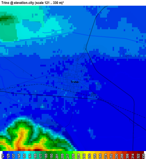
Below is the Elevation map of Trino, which displays elevation range with different colors. Scale of the first map is from 121 to 330 m (397 to 1083 ft) with average elevation of 140.7 meters (=462 ft) [note 1]
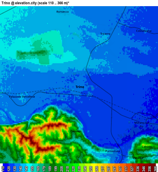
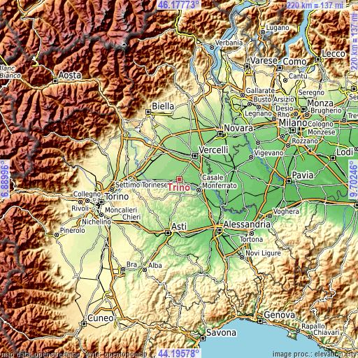
These maps also provides idea of topography and contour of this city, they are displayed at different zoom levels. More info about maps, scale and edge coordinates you can find below images.
| \ | Map #1 | Map #2 | Topo.Map |
| Scale [m] | 121..330 m | 110..366 m | × |
| Scale [ft] | 397..1083 ft | 361..1201 ft | × |
| Average | 140.7 m = 462 ft | 153 m = 502 ft | × |
| Width | 6.89 km = 4.3 mi | 13.77 km = 8.6 mi | 220.4 km = 136.9 mi |
| Height | 6.89 km = 4.3 mi | 13.77 km = 8.6 mi | 220.4 km = 136.9 mi |
| ↑Max Latitude | 45.226339° | 45.257282° | 46.17773° |
| Latitude at center | 45.19538° | 45.19538° | 45.19538° |
| ↓Min Latitude | 45.164404° | 45.133411° | 44.19578° |
| ← Min Longitude | 8.252265° | 8.208319° | 6.88996° |
| Longitude center | 8.29621° | 8.29621° | 8.29621° |
| →Max Longitude | 8.340155° | 8.384101° | 9.70246° |
Nearby cities:
Cities around Trino sort by population:
• Balzola elevation 121 m
8.5 km,  98°
98°
• Palazzolo Vercellese 141 m
5.1 km,  257°
257°
• Morano sul Po 121 m
6.4 km,  120°
120°
• Fontanetto Po 145 m
8.2 km,  269°
269°
• Pontestura 142 m
6.6 km,  153°
153°
• Costanzana 130 m
7.4 km,  50°
50°
• Tricerro 137 m
5.1 km,  28°
28°
• Ronsecco 148 m
6.6 km,  347°
347°
• Camino 221 m
4.2 km,  182°
182°
• Coniolo Bricco 226 m
7.9 km,  131°
131°
• Mombello Monferrato 262 m
7.8 km,  207°
207°
• Solonghello 182 m
7.4 km,  187°
187°
Multilingual:
 En español:
Trino elevación 136 m.
 En France:
Trino élévation 136 m.


Sources and notes:
- [note 1] Map square and city borders are not equal. Map elevation data is calculated only from area inside that square.
- [src 1] Elevation data from geonames database provided with same terms of usage.
- [src 2] The elevation map of Trino is generated using elevation data from NASA's 3 arcsec (90m) resolution SRTM data.
- [src 3] Base (background) map © OpenStreetMap contributors tiles are generated by Geofabrik and OpenTopoMap.
Copyright & License:
This Trino Elevation Map is licensed under CC BY-SA. You may reuse any part from this page, if you give a proper credit by linking to this URL:
 More info on terms of use page.