Voghera elevation
Voghera (Lombardy, Provincia di Pavia), Italy elevation is 100 meters and Voghera elevation in feet is 328 ft above sea level [src 1]. Voghera is a seat of a third-order administrative division (feature code) with elevation that is 222 meters (728 ft) smaller than average city elevation in Italy.
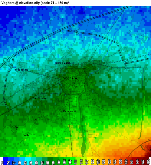
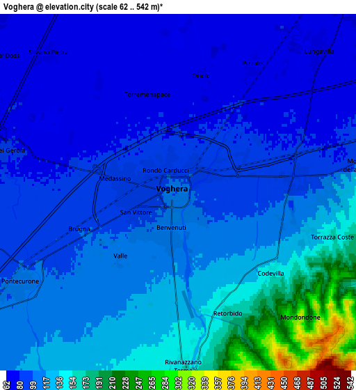
Below is the Elevation map of Voghera, which displays elevation range with different colors. Scale of the first map is from 71 to 150 m (233 to 492 ft) with average elevation of 94.6 meters (=310 ft) [note 1]
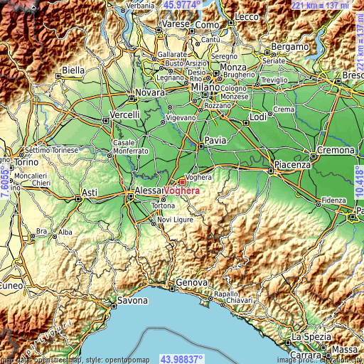
These maps also provides idea of topography and contour of this city, they are displayed at different zoom levels. More info about maps, scale and edge coordinates you can find below images.
| \ | Map #1 | Map #2 | Topo.Map |
| Scale [m] | 71..150 m | 62..542 m | × |
| Scale [ft] | 233..492 ft | 203..1778 ft | × |
| Average | 94.6 m = 310 ft | 111.6 m = 366 ft | × |
| Width | 6.91 km = 4.3 mi | 13.82 km = 8.6 mi | 221.2 km = 137.4 mi |
| Height | 6.91 km = 4.3 mi | 13.82 km = 8.6 mi | 221.1 km = 137.4 mi |
| ↑Max Latitude | 45.02258° | 45.053634° | 45.9774° |
| Latitude at center | 44.99151° | 44.99151° | 44.99151° |
| ↓Min Latitude | 44.960423° | 44.929319° | 43.98837° |
| ← Min Longitude | 8.967805° | 8.923859° | 7.6055° |
| Longitude center | 9.01175° | 9.01175° | 9.01175° |
| →Max Longitude | 9.055695° | 9.099641° | 10.418° |
Nearby cities:
Cities around Voghera sort by population:
• Rivanazzano elevation 155 m
6.9 km,  178°
178°
• Pontecurone 104 m
7.2 km,  239°
239°
• Lungavilla 71 m
7.6 km,  43°
43°
• Casei 83 m
6.9 km,  284°
284°
• Salice Terme 174 m
8.6 km,  172°
172°
• Retorbido 161 m
5 km,  156°
156°
• Montebello 121 m
7.2 km,  82°
82°
• Cervesina 72 m
7.7 km,  2°
2°
• Torrazza Coste 120 m
5.3 km,  106°
106°
• Codevilla 149 m
4.8 km,  130°
130°
• Silvano Pietra 76 m
7.4 km,  315°
315°
• Pizzale 77 m
6 km,  29°
29°
Multilingual:
 En español:
Voghera elevación 100 m.
 En France:
Voghera élévation 100 m.


Sources and notes:
- [note 1] Map square and city borders are not equal. Map elevation data is calculated only from area inside that square.
- [src 1] Elevation data from geonames database provided with same terms of usage.
- [src 2] The elevation map of Voghera is generated using elevation data from NASA's 3 arcsec (90m) resolution SRTM data.
- [src 3] Base (background) map © OpenStreetMap contributors tiles are generated by Geofabrik and OpenTopoMap.
Copyright & License:
This Voghera Elevation Map is licensed under CC BY-SA. You may reuse any part from this page, if you give a proper credit by linking to this URL:
 More info on terms of use page.