Bagaladi elevation
Bagaladi (Calabria, Provincia di Reggio Calabria), Italy elevation is 479 meters and Bagaladi elevation in feet is 1572 ft above sea level [src 1]. Bagaladi is a seat of a third-order administrative division (feature code) with elevation that is 157 meters (515 ft) bigger than average city elevation in Italy.
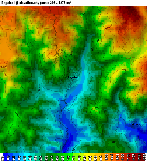
Below is the Elevation map of Bagaladi, which displays elevation range with different colors. Scale of the first map is from 266 to 1275 m (873 to 4183 ft) with average elevation of 695.5 meters (=2282 ft) [note 1]
These maps also provides idea of topography and contour of this city, they are displayed at different zoom levels. More info about maps, scale and edge coordinates you can find below images.
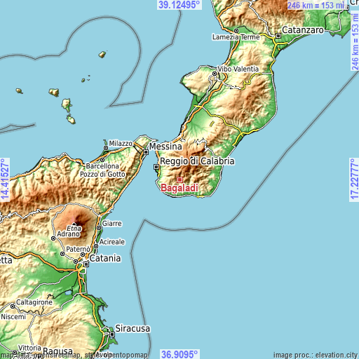
| \ | Map #1 | Topo.Map |
| Scale [m] | 266..1275 m | × |
| Scale [ft] | 873..4183 ft | × |
| Average | 695.5 m = 2282 ft | × |
| Width | 7.7 km = 4.8 mi | 246.3 km = 153 mi |
| Height | 7.7 km = 4.8 mi | 246.3 km = 153 mi |
| ↑Max Latitude | 38.060209° | 39.12495° |
| Latitude at center | 38.0256° | 38.0256° |
| ↓Min Latitude | 37.990975° | 36.9095° |
| ← Min Longitude | 15.777575° | 14.41527° |
| Longitude center | 15.82152° | 15.82152° |
| →Max Longitude | 15.865465° | 17.22777° |
Nearby cities:
Cities around Bagaladi sort by population:
• San Carlo-Condofuri Marina elevation 22 m
11.2 km,  156°
156°
• Motta San Giovanni 610 m
9.7 km,  259°
259°
• Mosorrofa 346 m
12.3 km,  308°
308°
• Pavigliana 531 m
12.6 km,  315°
315°
• Roghudi 43 m
12.2 km,  203°
203°
• Fossato Ionico-Fossatello-San Luca Marcelluzzo 565 m
5.4 km,  252°
252°
• Roccaforte del Greco 931 m
6.6 km,  68°
68°
• Cardeto 668 m
8.2 km, 323°
• San Lorenzo 789 m
2 km,  145°
145°
• Montebello Jonico 399 m
7.3 km,  229°
229°
• Bova 843 m
10.2 km,  109°
109°
• Condofuri 335 m
3.9 km,  126°
126°
Multilingual:
 En español:
Bagaladi elevación 479 m.
 En France:
Bagaladi élévation 479 m.
 Auf Deutsch:
Bagaladi höhe über dem Meeresspiegel ist 479 m.

Sources and notes:
- [note 1] Map square and city borders are not equal. Map elevation data is calculated only from area inside that square.
- [src 1] Elevation data from geonames database provided with same terms of usage.
- [src 2] The elevation map of Bagaladi is generated using elevation data from NASA's 3 arcsec (90m) resolution SRTM data.
- [src 3] Base (background) map © OpenStreetMap contributors tiles are generated by Geofabrik and OpenTopoMap.
Copyright & License:
This Bagaladi Elevation Map is licensed under CC BY-SA. You may reuse any part from this page, if you give a proper credit by linking to this URL:
 More info on terms of use page.