Pavigliana elevation
Pavigliana (Calabria, Provincia di Reggio Calabria), Italy elevation is 531 meters and Pavigliana elevation in feet is 1742 ft above sea level [src 1]. Pavigliana is a populated place (feature code) with elevation that is 209 meters (686 ft) bigger than average city elevation in Italy.
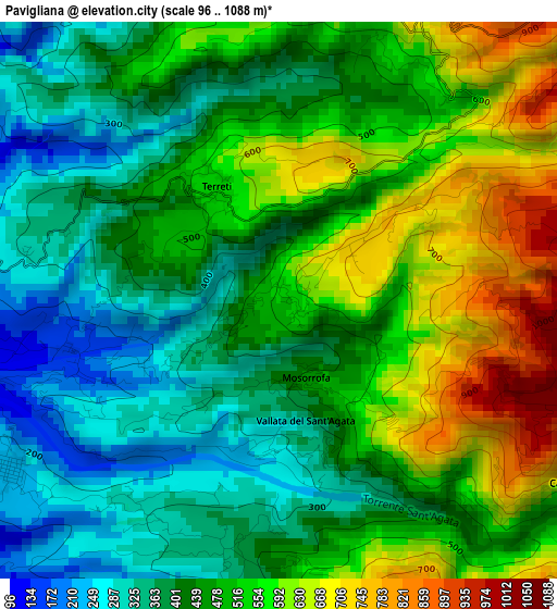
Below is the Elevation map of Pavigliana, which displays elevation range with different colors. Scale of the first map is from 96 to 1088 m (315 to 3570 ft) with average elevation of 476.1 meters (=1562 ft) [note 1]
These maps also provides idea of topography and contour of this city, they are displayed at different zoom levels. More info about maps, scale and edge coordinates you can find below images.
| \ | Map #1 | Topo.Map |
| Scale [m] | 96..1088 m | × |
| Scale [ft] | 315..3570 ft | × |
| Average | 476.1 m = 1562 ft | × |
| Width | 7.69 km = 4.8 mi | 246.1 km = 152.9 mi |
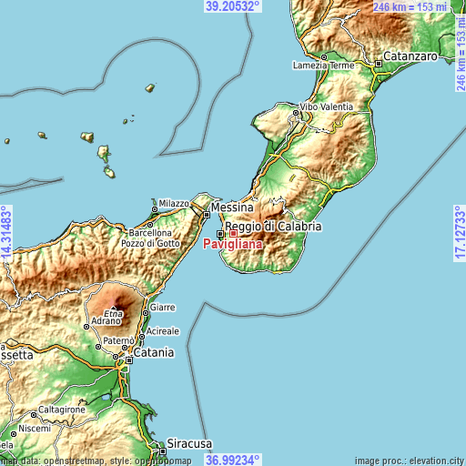
| Height | 7.69 km = 4.8 mi | 246.1 km = 152.9 mi |
| ↑Max Latitude | 38.141781° | 39.20532° |
| Latitude at center | 38.10721° | 38.10721° |
| ↓Min Latitude | 38.072623° | 36.99234° |
| ← Min Longitude | 15.677135° | 14.31483° |
| Longitude center | 15.72108° | 15.72108° |
| →Max Longitude | 15.765025° | 17.12733° |
Nearby cities:
Cities around Pavigliana sort by population:
• Reggio Calabria elevation 110 m
5.2 km,  273°
273°
• Pellaro 37 m
11.8 km,  211°
211°
• Motta San Giovanni 610 m
10.8 km,  183°
183°
• Mosorrofa 346 m
1.5 km, 208°
• Fossato Ionico-Fossatello-San Luca Marcelluzzo 565 m
11.3 km,  161°
161°
• Santo Stefano in Aspromonte 740 m
9.1 km,  41°
41°
• San Nicola 211 m
11.9 km,  348°
348°
• Cardeto 668 m
4.7 km,  122°
122°
• Sant'Alessio in Aspromonte 580 m
7.9 km,  23°
23°
• San Roberto 283 m
11.6 km,  6°
6°
• Laganadi 500 m
7.6 km, 13°
• Calanna 543 m
8.6 km,  1°
1°
Multilingual:
 En español:
Pavigliana elevación 531 m.
 En France:
Pavigliana élévation 531 m.
 Auf Deutsch:
Pavigliana höhe über dem Meeresspiegel ist 531 m.

Sources and notes:
- [note 1] Map square and city borders are not equal. Map elevation data is calculated only from area inside that square.
- [src 1] Elevation data from geonames database provided with same terms of usage.
- [src 2] The elevation map of Pavigliana is generated using elevation data from NASA's 3 arcsec (90m) resolution SRTM data.
- [src 3] Base (background) map © OpenStreetMap contributors tiles are generated by Geofabrik and OpenTopoMap.
Copyright & License:
This Pavigliana Elevation Map is licensed under CC BY-SA. You may reuse any part from this page, if you give a proper credit by linking to this URL:
 More info on terms of use page.