Caltanissetta elevation
Caltanissetta (Sicily, Provincia di Caltanissetta), Italy elevation is 579 meters and Caltanissetta elevation in feet is 1900 ft above sea level [src 1]. Caltanissetta is a seat of a second-order administrative division (feature code) with elevation that is 257 meters (843 ft) bigger than average city elevation in Italy.
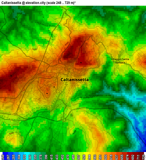
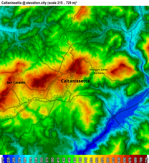
Below is the Elevation map of Caltanissetta, which displays elevation range with different colors. Scale of the first map is from 248 to 729 m (814 to 2392 ft) with average elevation of 498.5 meters (=1635 ft) [note 1]
These maps also provides idea of topography and contour of this city, they are displayed at different zoom levels. More info about maps, scale and edge coordinates you can find below images.
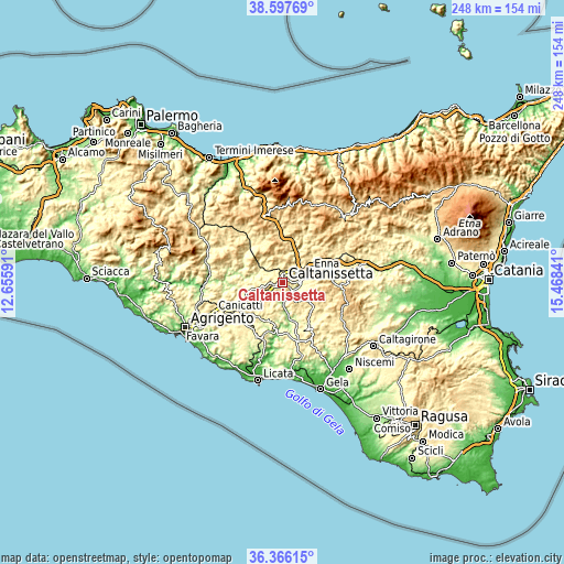
| \ | Map #1 | Map #2 | Topo.Map |
| Scale [m] | 248..729 m | 215..729 m | × |
| Scale [ft] | 814..2392 ft | 705..2392 ft | × |
| Average | 498.5 m = 1635 ft | 432.8 m = 1420 ft | × |
| Width | 7.75 km = 4.8 mi | 15.51 km = 9.6 mi | 248.1 km = 154.2 mi |
| Height | 7.75 km = 4.8 mi | 15.51 km = 9.6 mi | 248.1 km = 154.2 mi |
| ↑Max Latitude | 37.525111° | 37.559955° | 38.59769° |
| Latitude at center | 37.49025° | 37.49025° | 37.49025° |
| ↓Min Latitude | 37.455373° | 37.42048° | 36.36615° |
| ← Min Longitude | 14.018215° | 13.974269° | 12.65591° |
| Longitude center | 14.06216° | 14.06216° | 14.06216° |
| →Max Longitude | 14.106105° | 14.150051° | 15.46841° |
Nearby cities:
Cities around Caltanissetta sort by population:
• Enna elevation 935 m
20.5 km,  65°
65°
• San Cataldo 650 m
6.8 km,  264°
264°
• Barrafranca 456 m
17.6 km,  135°
135°
• Sommatino 367 m
18.2 km,  198°
198°
• Pietraperzia 467 m
10.4 km, 140°
• Serradifalco 489 m
16.5 km, 255°
• Santa Caterina Villarmosa 606 m
11.4 km,  348°
348°
• Delia 438 m
18.8 km,  218°
218°
• Villarosa 520 m
14.5 km,  41°
41°
• Calascibetta 825 m
21.6 km,  58°
58°
• Resuttano 585 m
21.1 km, 352°
• Marianopoli 692 m
17.7 km,  312°
312°
Multilingual:
 En español:
Caltanissetta elevación 579 m.
 En France:
Caltanissetta élévation 579 m.
 Auf Deutsch:
Caltanissetta höhe über dem Meeresspiegel ist 579 m.

Sources and notes:
- [note 1] Map square and city borders are not equal. Map elevation data is calculated only from area inside that square.
- [src 1] Elevation data from geonames database provided with same terms of usage.
- [src 2] The elevation map of Caltanissetta is generated using elevation data from NASA's 3 arcsec (90m) resolution SRTM data.
- [src 3] Base (background) map © OpenStreetMap contributors tiles are generated by Geofabrik and OpenTopoMap.
Copyright & License:
This Caltanissetta Elevation Map is licensed under CC BY-SA. You may reuse any part from this page, if you give a proper credit by linking to this URL:
 More info on terms of use page.