Enna elevation
Enna (Sicily), Italy elevation is 935 meters and Enna elevation in feet is 3068 ft above sea level [src 1]. Enna is a seat of a second-order administrative division (feature code) with elevation that is 613 meters (2011 ft) bigger than average city elevation in Italy.
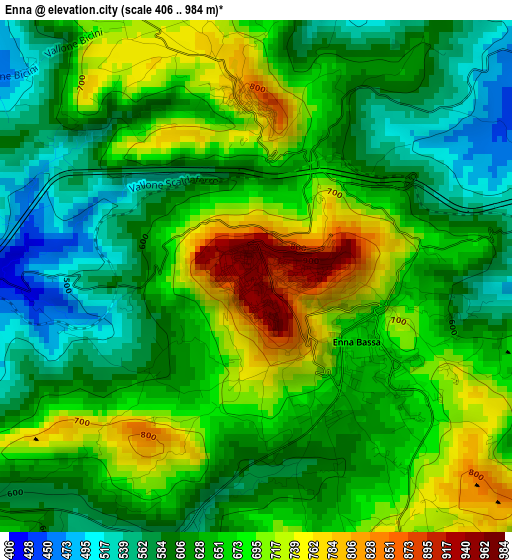
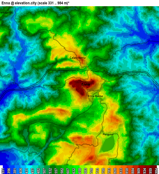
Below is the Elevation map of Enna, which displays elevation range with different colors. Scale of the first map is from 406 to 984 m (1332 to 3228 ft) with average elevation of 645.9 meters (=2119 ft) [note 1]
These maps also provides idea of topography and contour of this city, they are displayed at different zoom levels. More info about maps, scale and edge coordinates you can find below images.
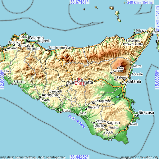
| \ | Map #1 | Map #2 | Topo.Map |
| Scale [m] | 406..984 m | 331..984 m | × |
| Scale [ft] | 1332..3228 ft | 1086..3228 ft | × |
| Average | 645.9 m = 2119 ft | 561.2 m = 1841 ft | × |
| Width | 7.75 km = 4.8 mi | 15.49 km = 9.6 mi | 247.9 km = 154 mi |
| Height | 7.75 km = 4.8 mi | 15.49 km = 9.6 mi | 247.9 km = 154 mi |
| ↑Max Latitude | 37.600325° | 37.635135° | 38.67181° |
| Latitude at center | 37.5655° | 37.5655° | 37.5655° |
| ↓Min Latitude | 37.530658° | 37.4958° | 36.44252° |
| ← Min Longitude | 14.230385° | 14.186439° | 12.86808° |
| Longitude center | 14.27433° | 14.27433° | 14.27433° |
| →Max Longitude | 14.318275° | 14.362221° | 15.68058° |
Nearby cities:
Cities around Enna sort by population:
• Caltanissetta elevation 579 m
20.5 km,  245°
245°
• Piazza Armerina 703 m
21.8 km,  157°
157°
• Leonforte 630 m
13.8 km,  51°
51°
• Barrafranca 456 m
21.7 km,  196°
196°
• Valguarnera Caropepe 593 m
12.9 km,  127°
127°
• Pietraperzia 467 m
20.3 km,  216°
216°
• Santa Caterina Villarmosa 606 m
21.2 km,  277°
277°
• Villarosa 520 m
9.4 km,  285°
285°
• Assoro 706 m
14.1 km,  63°
63°
• Calascibetta 825 m
2.8 km,  355°
355°
• Nissoria 678 m
18.2 km, 57°
• Alimena 752 m
20 km,  315°
315°
Multilingual:
 En español:
Enna elevación 935 m.
 En France:
Enna élévation 935 m.


Sources and notes:
- [note 1] Map square and city borders are not equal. Map elevation data is calculated only from area inside that square.
- [src 1] Elevation data from geonames database provided with same terms of usage.
- [src 2] The elevation map of Enna is generated using elevation data from NASA's 3 arcsec (90m) resolution SRTM data.
- [src 3] Base (background) map © OpenStreetMap contributors tiles are generated by Geofabrik and OpenTopoMap.
Copyright & License:
This Enna Elevation Map is licensed under CC BY-SA. You may reuse any part from this page, if you give a proper credit by linking to this URL:
 More info on terms of use page.