Resuttano elevation
Resuttano (Sicily, Provincia di Caltanissetta), Italy elevation is 585 meters and Resuttano elevation in feet is 1919 ft above sea level [src 1]. Resuttano is a seat of a third-order administrative division (feature code) with elevation that is 263 meters (863 ft) bigger than average city elevation in Italy.
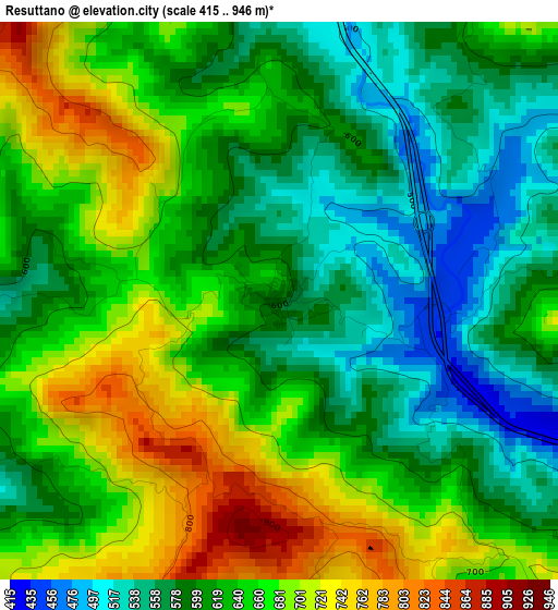
Below is the Elevation map of Resuttano, which displays elevation range with different colors. Scale of the first map is from 415 to 946 m (1362 to 3104 ft) with average elevation of 631.3 meters (=2071 ft) [note 1]
These maps also provides idea of topography and contour of this city, they are displayed at different zoom levels. More info about maps, scale and edge coordinates you can find below images.
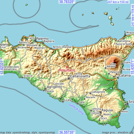
| \ | Map #1 | Topo.Map |
| Scale [m] | 415..946 m | × |
| Scale [ft] | 1362..3104 ft | × |
| Average | 631.3 m = 2071 ft | × |
| Width | 7.73 km = 4.8 mi | 247.5 km = 153.8 mi |
| Height | 7.73 km = 4.8 mi | 247.5 km = 153.8 mi |
| ↑Max Latitude | 37.713422° | 38.78325° |
| Latitude at center | 37.67865° | 37.67865° |
| ↓Min Latitude | 37.643861° | 36.55735° |
| ← Min Longitude | 13.985515° | 12.62321° |
| Longitude center | 14.02946° | 14.02946° |
| →Max Longitude | 14.073405° | 15.43571° |
Nearby cities:
Cities around Resuttano sort by population:
• Santa Caterina Villarmosa elevation 606 m
9.8 km,  176°
176°
• Villarosa 520 m
16.1 km,  129°
129°
• Vallelunga Pratameno 486 m
17.4 km,  271°
271°
• Polizzi Generosa 918 m
15 km,  350°
350°
• Castellana Sicula 775 m
12.1 km,  4°
4°
• Petralia Sottana 965 m
15.6 km,  21°
21°
• Alimena 752 m
7.6 km,  77°
77°
• Marianopoli 692 m
13.4 km,  228°
228°
• Villalba 600 m
16.5 km,  260°
260°
• Bompietro 725 m
9.3 km,  38°
38°
• Petralia Soprana 1121 m
15.2 km,  27°
27°
• Blufi 697 m
9 km, 25°
Multilingual:
 En español:
Resuttano elevación 585 m.
 En France:
Resuttano élévation 585 m.
 Auf Deutsch:
Resuttano höhe über dem Meeresspiegel ist 585 m.

Sources and notes:
- [note 1] Map square and city borders are not equal. Map elevation data is calculated only from area inside that square.
- [src 1] Elevation data from geonames database provided with same terms of usage.
- [src 2] The elevation map of Resuttano is generated using elevation data from NASA's 3 arcsec (90m) resolution SRTM data.
- [src 3] Base (background) map © OpenStreetMap contributors tiles are generated by Geofabrik and OpenTopoMap.
Copyright & License:
This Resuttano Elevation Map is licensed under CC BY-SA. You may reuse any part from this page, if you give a proper credit by linking to this URL:
 More info on terms of use page.