Zābol elevation
Zābol (Sistan and Baluchestan), Iran elevation is 483 meters and Zābol elevation in feet is 1585 ft above sea level [src 1]. Zābol is a seat of a second-order administrative division (feature code) with elevation that is 561 meters (1841 ft) smaller than average city elevation in Iran.
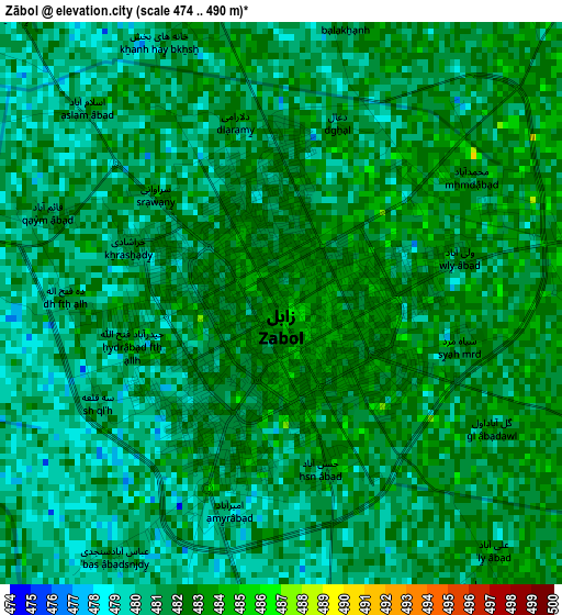
Below is the Elevation map of Zābol, which displays elevation range with different colors. Scale of the first map is from 474 to 490 m (1555 to 1608 ft) with average elevation of 481.1 meters (=1578 ft) [note 1]
These maps also provides idea of topography and contour of this city, they are displayed at different zoom levels. More info about maps, scale and edge coordinates you can find below images.
| \ | Map #1 | Map #2 | Topo.Map |
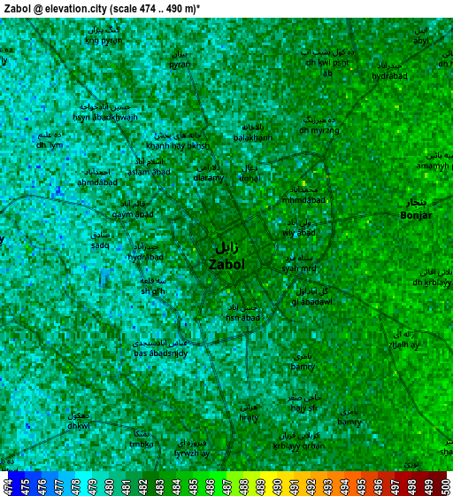
| Scale [m] | 474..490 m | 474..490 m | × |
| Scale [ft] | 1555..1608 ft | 1555..1608 ft | × |
| Average | 481.1 m = 1578 ft | 481.2 m = 1579 ft | × |
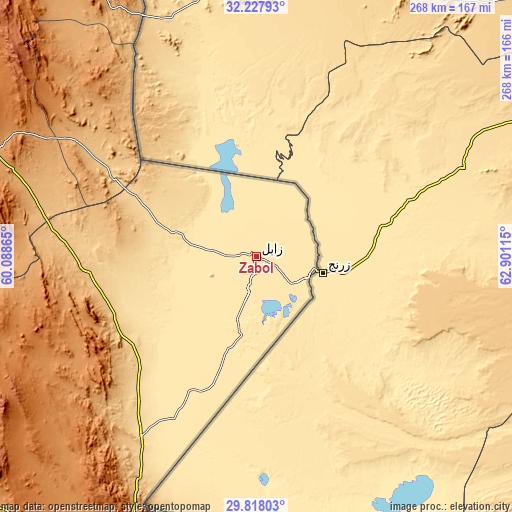
| Width | 8.37 km = 5.2 mi | 16.75 km = 10.4 mi | 268 km = 166.5 mi |
| Height | 8.37 km = 5.2 mi | 16.75 km = 10.4 mi | 268 km = 166.5 mi |
| ↑Max Latitude | 31.068249° | 31.105883° | 32.22793° |
| Latitude at center | 31.0306° | 31.0306° | 31.0306° |
| ↓Min Latitude | 30.992936° | 30.955257° | 29.81803° |
| ← Min Longitude | 61.450955° | 61.407009° | 60.08865° |
| Longitude center | 61.4949° | 61.4949° | 61.4949° |
| →Max Longitude | 61.538845° | 61.582791° | 62.90115° |
Nearby cities:
Cities around Zābol sort by population:
• Zahedan elevation 1380 m
181.1 km,  199°
199°
• Bīrjand 1459 m
296.1 km,  313°
313°
• Khāsh 1413 m
313.6 km,  184°
184°
• Noşratābād 1112 m
191.8 km,  229°
229°
• Moḩammadābād 602 m
351.4 km,  221°
221°
• Fahraj 680 m
341.6 km, 227°
• Ḩājjīābād 1038 m
319.1 km,  333°
333°
• Asadīyeh 2170 m
270.6 km,  321°
321°
• Sarbīsheh 1824 m
235 km, 316°
• Nehbandān 1187 m
149.8 km,  292°
292°
• Dūst Moḩammad Khān 483 m
31 km,  65°
65°
• Zehak 496 m
23.3 km,  130°
130°
Multilingual:
 En español:
Zābol elevación 483 m.
 En France:
Zābol élévation 483 m.


Sources and notes:
- [note 1] Map square and city borders are not equal. Map elevation data is calculated only from area inside that square.
- [src 1] Elevation data from geonames database provided with same terms of usage.
- [src 2] The elevation map of Zābol is generated using elevation data from NASA's 3 arcsec (90m) resolution SRTM data.
- [src 3] Base (background) map © OpenStreetMap contributors tiles are generated by Geofabrik and OpenTopoMap.
Copyright & License:
This Zābol Elevation Map is licensed under CC BY-SA. You may reuse any part from this page, if you give a proper credit by linking to this URL:
 More info on terms of use page.