Darreh Shahr elevation
Darreh Shahr (Ilam Province), Iran elevation is 660 meters and Darreh Shahr elevation in feet is 2165 ft above sea level [src 1]. Darreh Shahr is a seat of a second-order administrative division (feature code) with elevation that is 384 meters (1260 ft) smaller than average city elevation in Iran.
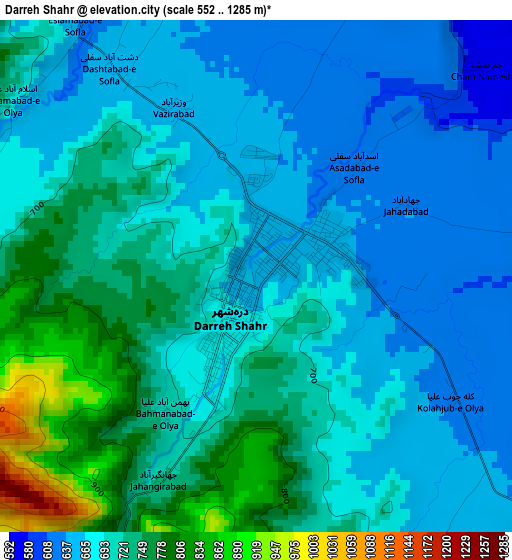
Below is the Elevation map of Darreh Shahr, which displays elevation range with different colors. Scale of the first map is from 552 to 1285 m (1811 to 4216 ft) with average elevation of 700.7 meters (=2299 ft) [note 1]
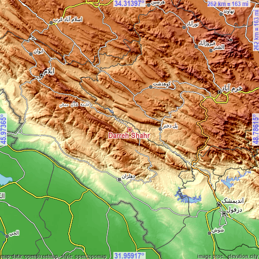
These maps also provides idea of topography and contour of this city, they are displayed at different zoom levels. More info about maps, scale and edge coordinates you can find below images.
| \ | Map #1 | Map #2 | Topo.Map |
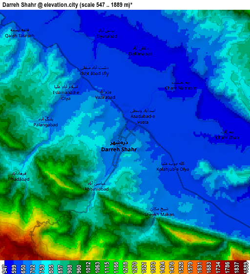
| Scale [m] | 552..1285 m | 547..1889 m | × |
| Scale [ft] | 1811..4216 ft | 1795..6198 ft | × |
| Average | 700.7 m = 2299 ft | 794.1 m = 2605 ft | × |
| Width | 8.18 km = 5.1 mi | 16.37 km = 10.2 mi | 261.8 km = 162.7 mi |
| Height | 8.18 km = 5.1 mi | 16.36 km = 10.2 mi | 261.8 km = 162.7 mi |
| ↑Max Latitude | 33.181257° | 33.218029° | 34.31397° |
| Latitude at center | 33.14447° | 33.14447° | 33.14447° |
| ↓Min Latitude | 33.107667° | 33.070849° | 31.95917° |
| ← Min Longitude | 47.335955° | 47.292009° | 45.97365° |
| Longitude center | 47.3799° | 47.3799° | 47.3799° |
| →Max Longitude | 47.423845° | 47.467791° | 48.78615° |
Nearby cities:
Cities around Darreh Shahr sort by population:
• Khorramabad elevation 1182 m
98.4 km,  67°
67°
• Īlām 1403 m
104.4 km,  301°
301°
• Kūhdasht 1190 m
48.2 km,  26°
26°
• Dehlorān 224 m
51.2 km,  191°
191°
• Aleshtar 1614 m
114.5 km,  45°
45°
• Ābdānān 889 m
17.3 km,  167°
167°
• Mehrān 150 m
113.2 km,  268°
268°
• Vasīān 991 m
73.1 km,  58°
58°
• Sarābleh 1027 m
102.5 km,  312°
312°
• Arakvāz-e Malekshāhī 1326 m
77.3 km,  290°
290°
• Sarāb-e Dūreh 1114 m
75.7 km, 51°
• Poldokhtar 663 m
30.8 km,  88°
88°
Multilingual:
 En español:
Darreh Shahr elevación 660 m.
 En France:
Darreh Shahr élévation 660 m.
 Auf Deutsch:
Darreh Shahr höhe über dem Meeresspiegel ist 660 m.

Sources and notes:
- [note 1] Map square and city borders are not equal. Map elevation data is calculated only from area inside that square.
- [src 1] Elevation data from geonames database provided with same terms of usage.
- [src 2] The elevation map of Darreh Shahr is generated using elevation data from NASA's 3 arcsec (90m) resolution SRTM data.
- [src 3] Base (background) map © OpenStreetMap contributors tiles are generated by Geofabrik and OpenTopoMap.
Copyright & License:
This Darreh Shahr Elevation Map is licensed under CC BY-SA. You may reuse any part from this page, if you give a proper credit by linking to this URL:
 More info on terms of use page.