Ahmadpur elevation
Ahmadpur (Maharashtra, Latur), India elevation is 526 meters and Ahmadpur elevation in feet is 1726 ft above sea level [src 1]. Ahmadpur is a populated place (feature code) with elevation that is 233 meters (764 ft) bigger than average city elevation in India.
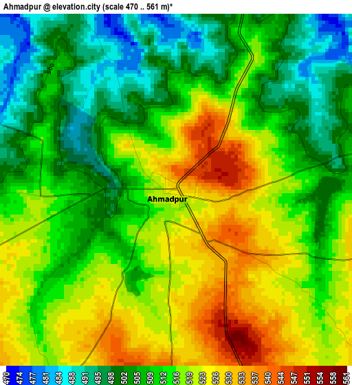
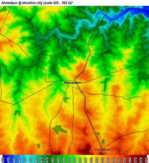
Below is the Elevation map of Ahmadpur, which displays elevation range with different colors. Scale of the first map is from 470 to 561 m (1542 to 1841 ft) with average elevation of 512.6 meters (=1682 ft) [note 1]
These maps also provides idea of topography and contour of this city, they are displayed at different zoom levels. More info about maps, scale and edge coordinates you can find below images.
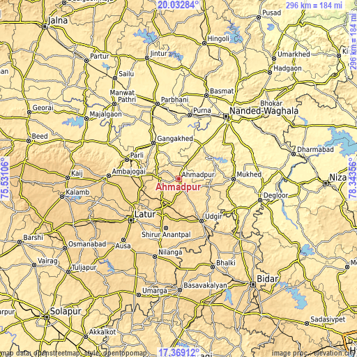
| \ | Map #1 | Map #2 | Topo.Map |
| Scale [m] | 470..561 m | 429..582 m | × |
| Scale [ft] | 1542..1841 ft | 1407..1909 ft | × |
| Average | 512.6 m = 1682 ft | 511.9 m = 1679 ft | × |
| Width | 9.26 km = 5.8 mi | 18.51 km = 11.5 mi | 296.2 km = 184 mi |
| Height | 9.26 km = 5.8 mi | 18.51 km = 11.5 mi | 296.2 km = 184 mi |
| ↑Max Latitude | 18.747839° | 18.789447° | 20.03284° |
| Latitude at center | 18.70622° | 18.70622° | 18.70622° |
| ↓Min Latitude | 18.664591° | 18.622952° | 17.36912° |
| ← Min Longitude | 76.893365° | 76.849419° | 75.53106° |
| Longitude center | 76.93731° | 76.93731° | 76.93731° |
| →Max Longitude | 76.981255° | 77.025201° | 78.34356° |
Nearby cities:
Cities around Ahmadpur sort by population:
• Nanded elevation 363 m
64.2 km,  38°
38°
• Latur 638 m
51.9 km,  228°
228°
• Parbhani 421 m
64.9 km,  344°
344°
• Udgīr 643 m
39.7 km,  151°
151°
• Parli Vaijnāth 463 m
45.6 km,  290°
290°
• Ambājogāi 633 m
58.1 km,  272°
272°
• Dīglūr 383 m
69.6 km,  104°
104°
• Gangākher 382 m
35.3 km,  325°
325°
• Pūrna 381 m
53.7 km,  9°
9°
• Nilanga 607 m
68.4 km,  196°
196°
• Ausa 637 m
68.8 km,  222°
222°
• Mukher 404 m
45.4 km,  89°
89°
Multilingual:
 En español:
Ahmadpur elevación 526 m.
 En France:
Ahmadpur élévation 526 m.
 Auf Deutsch:
Ahmadpur höhe über dem Meeresspiegel ist 526 m.

Sources and notes:
- [note 1] Map square and city borders are not equal. Map elevation data is calculated only from area inside that square.
- [src 1] Elevation data from geonames database provided with same terms of usage.
- [src 2] The elevation map of Ahmadpur is generated using elevation data from NASA's 3 arcsec (90m) resolution SRTM data.
- [src 3] Base (background) map © OpenStreetMap contributors tiles are generated by Geofabrik and OpenTopoMap.
Copyright & License:
This Ahmadpur Elevation Map is licensed under CC BY-SA. You may reuse any part from this page, if you give a proper credit by linking to this URL:
 More info on terms of use page.