Gangākher elevation
Gangākher (Maharashtra, Parbhani), India elevation is 382 meters and Gangākher elevation in feet is 1253 ft above sea level [src 1]. Gangākher is a populated place (feature code) with elevation that is 89 meters (292 ft) bigger than average city elevation in India.
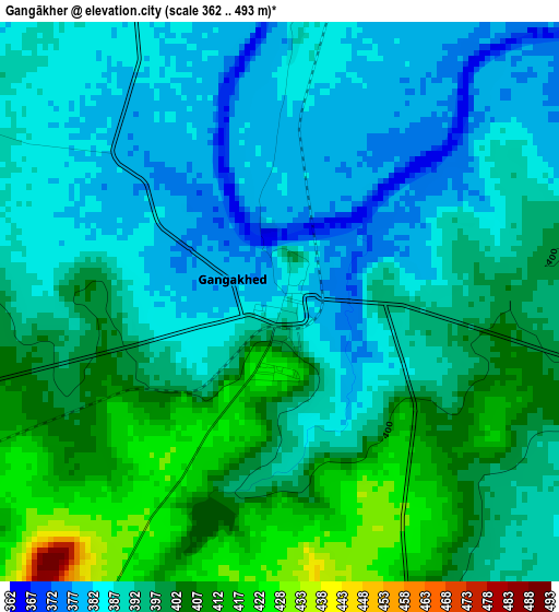
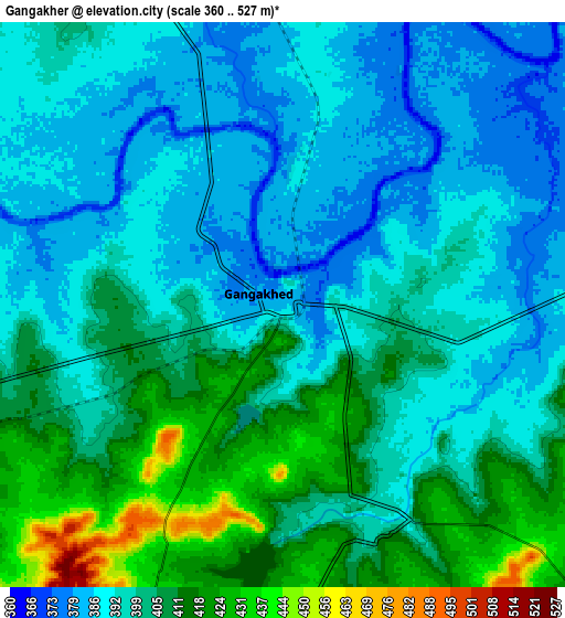
Below is the Elevation map of Gangākher, which displays elevation range with different colors. Scale of the first map is from 362 to 493 m (1188 to 1617 ft) with average elevation of 394.9 meters (=1296 ft) [note 1]
These maps also provides idea of topography and contour of this city, they are displayed at different zoom levels. More info about maps, scale and edge coordinates you can find below images.
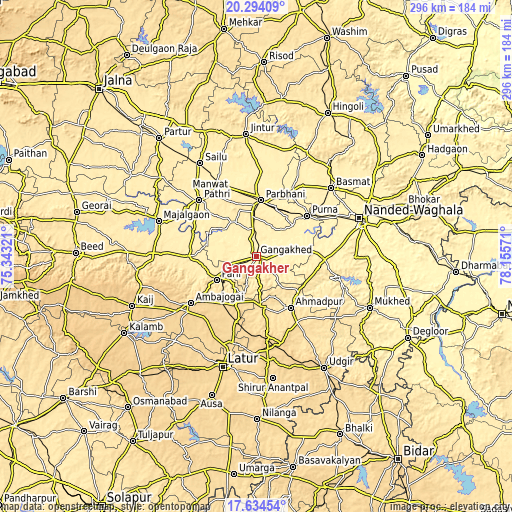
| \ | Map #1 | Map #2 | Topo.Map |
| Scale [m] | 362..493 m | 360..527 m | × |
| Scale [ft] | 1188..1617 ft | 1181..1729 ft | × |
| Average | 394.9 m = 1296 ft | 399.2 m = 1310 ft | × |
| Width | 9.24 km = 5.7 mi | 18.48 km = 11.5 mi | 295.7 km = 183.7 mi |
| Height | 9.24 km = 5.7 mi | 18.48 km = 11.5 mi | 295.7 km = 183.7 mi |
| ↑Max Latitude | 19.011174° | 19.052717° | 20.29409° |
| Latitude at center | 18.96962° | 18.96962° | 18.96962° |
| ↓Min Latitude | 18.928056° | 18.886482° | 17.63454° |
| ← Min Longitude | 76.705515° | 76.661569° | 75.34321° |
| Longitude center | 76.74946° | 76.74946° | 76.74946° |
| →Max Longitude | 76.793405° | 76.837351° | 78.15571° |
Nearby cities:
Cities around Gangākher sort by population:
• Nanded elevation 363 m
63.1 km,  70°
70°
• Latur 638 m
66.5 km,  196°
196°
• Parbhani 421 m
33.3 km,  3°
3°
• Parli Vaijnāth 463 m
26.5 km,  239°
239°
• Ambājogāi 633 m
46.4 km, 235°
• Basmat 397 m
58.6 km,  47°
47°
• Mājalgaon 435 m
60.7 km,  290°
290°
• Selu 424 m
63 km,  329°
329°
• Ahmadpur 526 m
35.3 km,  145°
145°
• Pāthri 432 m
46.2 km,  314°
314°
• Pūrna 381 m
37.4 km, 50°
• Mānwat 440 m
45.4 km,  324°
324°
Multilingual:
 En español:
Gangākher elevación 382 m.
 En France:
Gangākher élévation 382 m.
 Auf Deutsch:
Gangākher höhe über dem Meeresspiegel ist 382 m.

Sources and notes:
- [note 1] Map square and city borders are not equal. Map elevation data is calculated only from area inside that square.
- [src 1] Elevation data from geonames database provided with same terms of usage.
- [src 2] The elevation map of Gangākher is generated using elevation data from NASA's 3 arcsec (90m) resolution SRTM data.
- [src 3] Base (background) map © OpenStreetMap contributors tiles are generated by Geofabrik and OpenTopoMap.
Copyright & License:
This Gangākher Elevation Map is licensed under CC BY-SA. You may reuse any part from this page, if you give a proper credit by linking to this URL:
 More info on terms of use page.