Amroha elevation
Amroha (Uttar Pradesh, Jyotiba Phule Nagar), India elevation is 218 meters and Amroha elevation in feet is 715 ft above sea level [src 1]. Amroha is a populated place (feature code) with elevation that is 75 meters (246 ft) smaller than average city elevation in India.
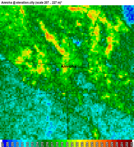
Below is the Elevation map of Amroha, which displays elevation range with different colors. Scale of the first map is from 207 to 227 m (679 to 745 ft) with average elevation of 215.6 meters (=707 ft) [note 1]
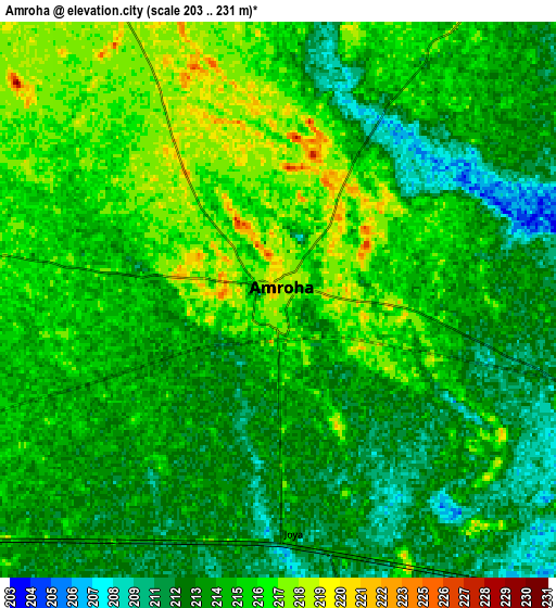
These maps also provides idea of topography and contour of this city, they are displayed at different zoom levels. More info about maps, scale and edge coordinates you can find below images.
| \ | Map #1 | Map #2 | Topo.Map |
| Scale [m] | 207..227 m | 203..231 m | × |
| Scale [ft] | 679..745 ft | 666..758 ft | × |
| Average | 215.6 m = 707 ft | 214.1 m = 702 ft | × |
| Width | 8.56 km = 5.3 mi | 17.11 km = 10.6 mi | 273.8 km = 170.1 mi |
| Height | 8.56 km = 5.3 mi | 17.11 km = 10.6 mi | 273.8 km = 170.1 mi |
| ↑Max Latitude | 28.941604° | 28.980054° | 30.12686° |
| Latitude at center | 28.90314° | 28.90314° | 28.90314° |
| ↓Min Latitude | 28.864661° | 28.826169° | 27.66482° |
| ← Min Longitude | 78.425895° | 78.381949° | 77.06359° |
| Longitude center | 78.46984° | 78.46984° | 78.46984° |
| →Max Longitude | 78.513785° | 78.557731° | 79.87609° |
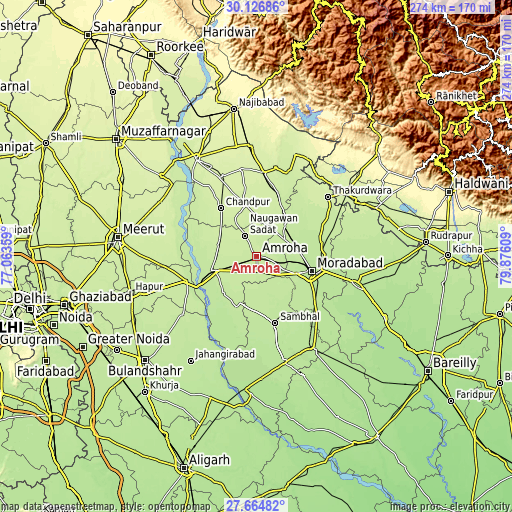
Nearby cities:
Cities around Amroha sort by population:
• Morādābād elevation 205 m
30.7 km,  103°
103°
• Chāndpur 231 m
32.2 km,  323°
323°
• Hasanpur 211 m
27 km,  221°
221°
• Gajraula 213 m
23.3 km,  254°
254°
• Seohāra 232 m
35.9 km,  18°
18°
• Nūrpur 231 m
28 km,  347°
347°
• Bachhraon 216 m
23.1 km,  276°
276°
• Dhanaura 224 m
21.7 km,  286°
286°
• Kānth 219 m
23.3 km,  41°
41°
• Sahaspur 224 m
28.4 km,  31°
31°
• Sirsi 202 m
33.9 km,  150°
150°
• Tājpur 227 m
28.9 km,  2°
2°
Multilingual:
 En español:
Amroha elevación 218 m.
 En France:
Amroha élévation 218 m.


Sources and notes:
- [note 1] Map square and city borders are not equal. Map elevation data is calculated only from area inside that square.
- [src 1] Elevation data from geonames database provided with same terms of usage.
- [src 2] The elevation map of Amroha is generated using elevation data from NASA's 3 arcsec (90m) resolution SRTM data.
- [src 3] Base (background) map © OpenStreetMap contributors tiles are generated by Geofabrik and OpenTopoMap.
Copyright & License:
This Amroha Elevation Map is licensed under CC BY-SA. You may reuse any part from this page, if you give a proper credit by linking to this URL:
 More info on terms of use page.