Kānth elevation
Kānth (Uttar Pradesh, Morādābād), India elevation is 219 meters and Kānth elevation in feet is 719 ft above sea level [src 1]. Kānth is a populated place (feature code) with elevation that is 74 meters (243 ft) smaller than average city elevation in India.
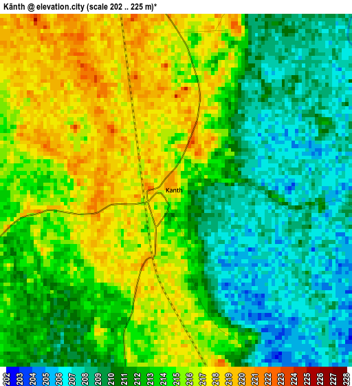
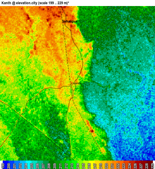
Below is the Elevation map of Kānth, which displays elevation range with different colors. Scale of the first map is from 202 to 225 m (663 to 738 ft) with average elevation of 212.6 meters (=698 ft) [note 1]
These maps also provides idea of topography and contour of this city, they are displayed at different zoom levels. More info about maps, scale and edge coordinates you can find below images.
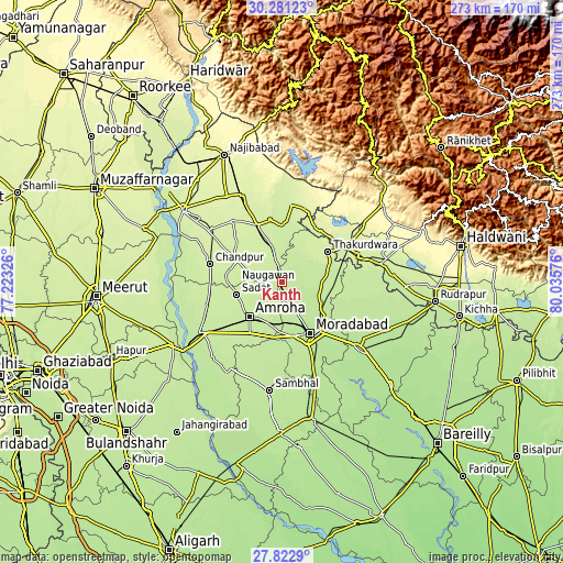
| \ | Map #1 | Map #2 | Topo.Map |
| Scale [m] | 202..225 m | 199..229 m | × |
| Scale [ft] | 663..738 ft | 653..751 ft | × |
| Average | 212.6 m = 698 ft | 211.6 m = 694 ft | × |
| Width | 8.54 km = 5.3 mi | 17.08 km = 10.6 mi | 273.3 km = 169.8 mi |
| Height | 8.54 km = 5.3 mi | 17.08 km = 10.6 mi | 273.3 km = 169.8 mi |
| ↑Max Latitude | 29.097796° | 29.136188° | 30.28123° |
| Latitude at center | 29.05939° | 29.05939° | 29.05939° |
| ↓Min Latitude | 29.02097° | 28.982535° | 27.8229° |
| ← Min Longitude | 78.585565° | 78.541619° | 77.22326° |
| Longitude center | 78.62951° | 78.62951° | 78.62951° |
| →Max Longitude | 78.673455° | 78.717401° | 80.03576° |
Nearby cities:
Cities around Kānth sort by population:
• Morādābād elevation 205 m
28.4 km,  149°
149°
• Amroha 218 m
23.3 km,  221°
221°
• Chāndpur 231 m
35.7 km,  283°
283°
• Sherkot 236 m
30.2 km,  349°
349°
• Dhāmpur 241 m
30 km,  337°
337°
• Seohāra 232 m
17.1 km, 346°
• Tānda 208 m
31.7 km,  106°
106°
• Jaspur 245 m
31.1 km,  38°
38°
• Thakurdwara 229 m
26.9 km,  56°
56°
• Nūrpur 231 m
23.7 km,  295°
295°
• Sahaspur 224 m
6.9 km, 354°
• Tājpur 227 m
18.2 km,  309°
309°
Multilingual:
 En español:
Kānth elevación 219 m.
 En France:
Kānth élévation 219 m.


Sources and notes:
- [note 1] Map square and city borders are not equal. Map elevation data is calculated only from area inside that square.
- [src 1] Elevation data from geonames database provided with same terms of usage.
- [src 2] The elevation map of Kānth is generated using elevation data from NASA's 3 arcsec (90m) resolution SRTM data.
- [src 3] Base (background) map © OpenStreetMap contributors tiles are generated by Geofabrik and OpenTopoMap.
Copyright & License:
This Kānth Elevation Map is licensed under CC BY-SA. You may reuse any part from this page, if you give a proper credit by linking to this URL:
 More info on terms of use page.