Badnāwar elevation
Badnāwar (Madhya Pradesh, Dhār), India elevation is 515 meters and Badnāwar elevation in feet is 1690 ft above sea level [src 1]. Badnāwar is a populated place (feature code) with elevation that is 222 meters (728 ft) bigger than average city elevation in India.
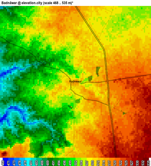
Below is the Elevation map of Badnāwar, which displays elevation range with different colors. Scale of the first map is from 468 to 535 m (1535 to 1755 ft) with average elevation of 506.5 meters (=1662 ft) [note 1]
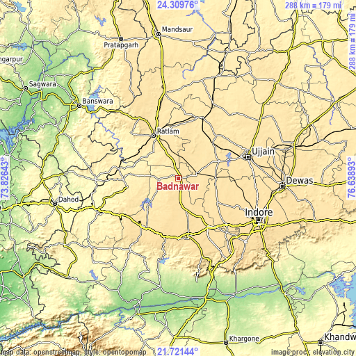
These maps also provides idea of topography and contour of this city, they are displayed at different zoom levels. More info about maps, scale and edge coordinates you can find below images.
| \ | Map #1 | Map #2 | Topo.Map |
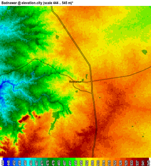
| Scale [m] | 468..535 m | 444..545 m | × |
| Scale [ft] | 1535..1755 ft | 1457..1788 ft | × |
| Average | 506.5 m = 1662 ft | 505.3 m = 1658 ft | × |
| Width | 8.99 km = 5.6 mi | 17.99 km = 11.2 mi | 287.8 km = 178.8 mi |
| Height | 8.99 km = 5.6 mi | 17.99 km = 11.2 mi | 287.8 km = 178.8 mi |
| ↑Max Latitude | 23.062249° | 23.102676° | 24.30976° |
| Latitude at center | 23.02181° | 23.02181° | 23.02181° |
| ↓Min Latitude | 22.981359° | 22.940895° | 21.72144° |
| ← Min Longitude | 75.188735° | 75.144789° | 73.82643° |
| Longitude center | 75.23268° | 75.23268° | 75.23268° |
| →Max Longitude | 75.276625° | 75.320571° | 76.63893° |
Nearby cities:
Cities around Badnāwar sort by population:
• Ratlām elevation 486 m
39.5 km,  330°
330°
• Nagda 470 m
52.1 km,  21°
21°
• Dhār 559 m
48.1 km,  172°
172°
• Khāchrod 493 m
44.9 km,  6°
6°
• Rājgarh 518 m
48.3 km,  217°
217°
• Depālpur 537 m
37 km,  120°
120°
• Unhel 485 m
48.5 km,  43°
43°
• Gautampura 502 m
29.6 km,  97°
97°
• Petlāwad 398 m
44.5 km,  268°
268°
• Namli 494 m
51.9 km,  340°
340°
• Bamna 395 m
48.9 km,  279°
279°
• Piploda 469 m
41.9 km,  29°
29°
Multilingual:
 En español:
Badnāwar elevación 515 m.
 En France:
Badnāwar élévation 515 m.
 Auf Deutsch:
Badnāwar höhe über dem Meeresspiegel ist 515 m.

Sources and notes:
- [note 1] Map square and city borders are not equal. Map elevation data is calculated only from area inside that square.
- [src 1] Elevation data from geonames database provided with same terms of usage.
- [src 2] The elevation map of Badnāwar is generated using elevation data from NASA's 3 arcsec (90m) resolution SRTM data.
- [src 3] Base (background) map © OpenStreetMap contributors tiles are generated by Geofabrik and OpenTopoMap.
Copyright & License:
This Badnāwar Elevation Map is licensed under CC BY-SA. You may reuse any part from this page, if you give a proper credit by linking to this URL:
 More info on terms of use page.