Barjora elevation
Barjora (West Bengal, Bānkurā), India elevation is 81 meters and Barjora elevation in feet is 266 ft above sea level [src 1]. Barjora is a populated place (feature code) with elevation that is 212 meters (696 ft) smaller than average city elevation in India.
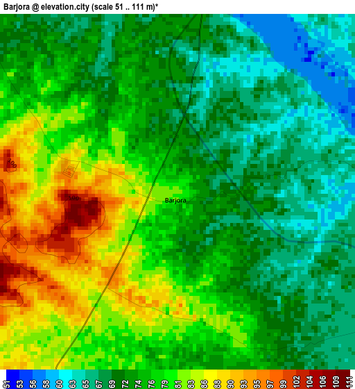
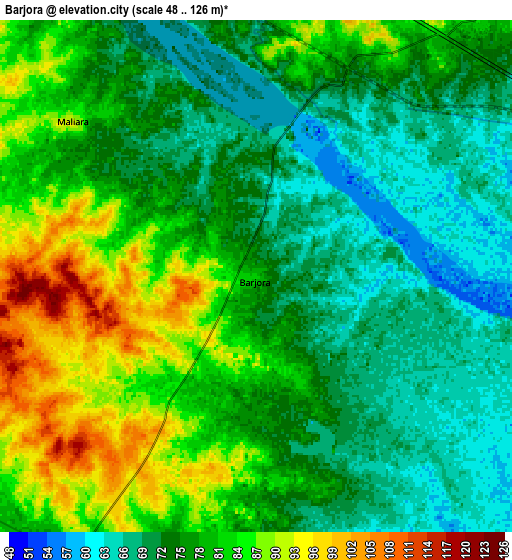
Below is the Elevation map of Barjora, which displays elevation range with different colors. Scale of the first map is from 51 to 111 m (167 to 364 ft) with average elevation of 75.4 meters (=247 ft) [note 1]
These maps also provides idea of topography and contour of this city, they are displayed at different zoom levels. More info about maps, scale and edge coordinates you can find below images.
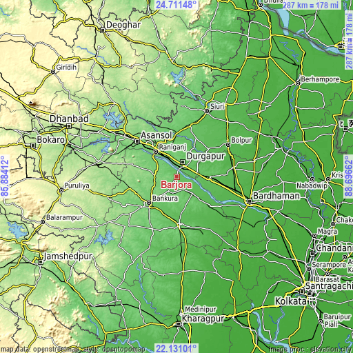
| \ | Map #1 | Map #2 | Topo.Map |
| Scale [m] | 51..111 m | 48..126 m | × |
| Scale [ft] | 167..364 ft | 157..413 ft | × |
| Average | 75.4 m = 247 ft | 77.2 m = 253 ft | × |
| Width | 8.97 km = 5.6 mi | 17.93 km = 11.1 mi | 286.9 km = 178.3 mi |
| Height | 8.97 km = 5.6 mi | 17.93 km = 11.1 mi | 286.9 km = 178.3 mi |
| ↑Max Latitude | 23.467856° | 23.508161° | 24.71148° |
| Latitude at center | 23.42754° | 23.42754° | 23.42754° |
| ↓Min Latitude | 23.387211° | 23.34687° | 22.13101° |
| ← Min Longitude | 87.246425° | 87.202479° | 85.88412° |
| Longitude center | 87.29037° | 87.29037° | 87.29037° |
| →Max Longitude | 87.334315° | 87.378261° | 88.69662° |
Nearby cities:
Cities around Barjora sort by population:
• Durgapur elevation 100 m
10 km,  10°
10°
• Āsansol 119 m
42.3 km,  312°
312°
• Jāmuria 132 m
37.6 km,  325°
325°
• Bānkura 94 m
31.1 km,  225°
225°
• Rānīganj 103 m
26.6 km,  322°
322°
• Bishnupur 73 m
39.4 km,  175°
175°
• Dubrājpur 100 m
41.3 km, 12°
• Guskhara 41 m
45.9 km,  80°
80°
• Sonāmukhi 66 m
18.5 km,  137°
137°
• Bahula 102 m
28 km, 332°
• Pātrasāer 58 m
35.7 km, 135°
• Beliātor 87 m
13.9 km,  210°
210°
Multilingual:
 En español:
Barjora elevación 81 m.
 En France:
Barjora élévation 81 m.


Sources and notes:
- [note 1] Map square and city borders are not equal. Map elevation data is calculated only from area inside that square.
- [src 1] Elevation data from geonames database provided with same terms of usage.
- [src 2] The elevation map of Barjora is generated using elevation data from NASA's 3 arcsec (90m) resolution SRTM data.
- [src 3] Base (background) map © OpenStreetMap contributors tiles are generated by Geofabrik and OpenTopoMap.
Copyright & License:
This Barjora Elevation Map is licensed under CC BY-SA. You may reuse any part from this page, if you give a proper credit by linking to this URL:
 More info on terms of use page.